
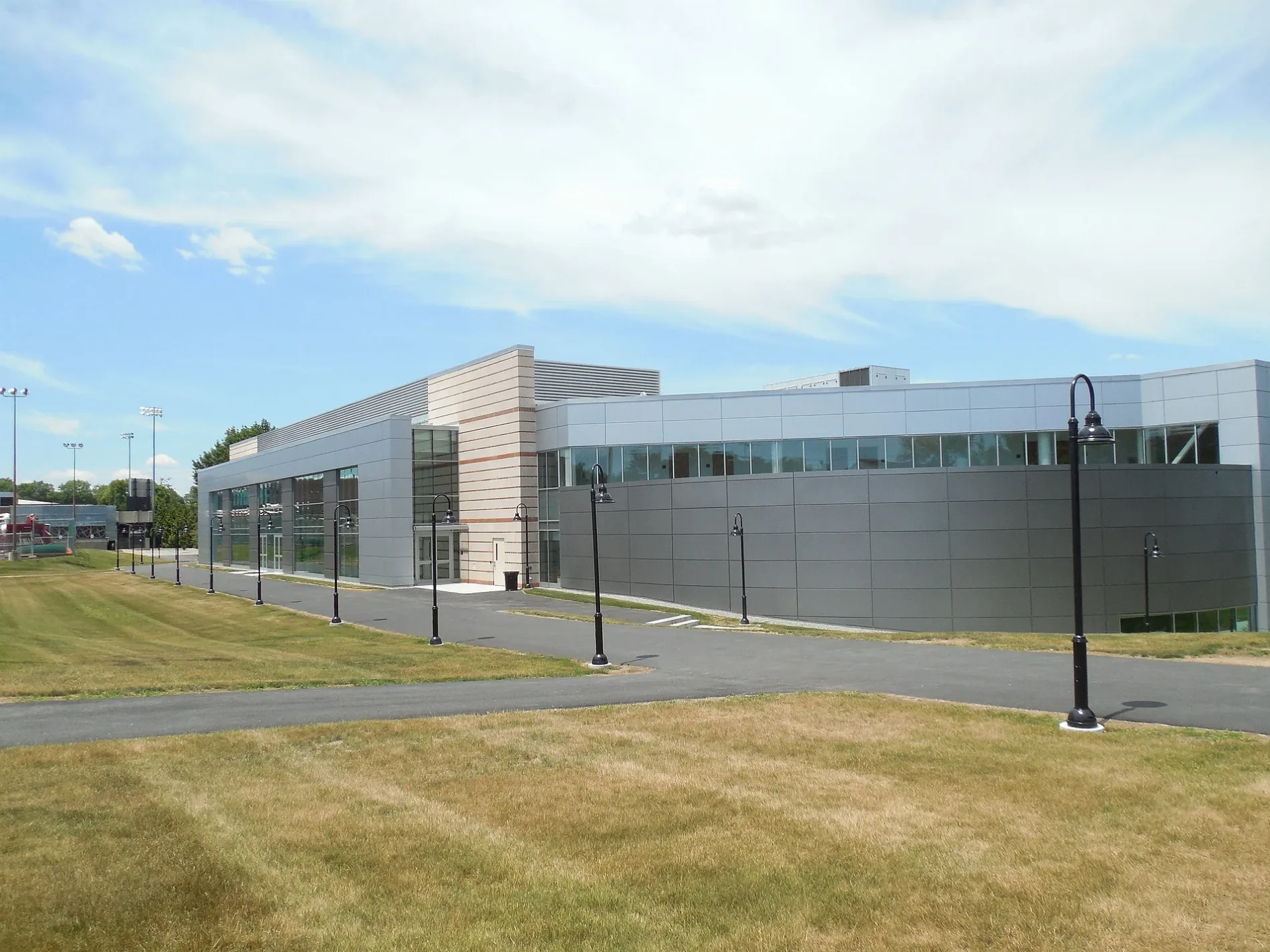
Schneider Arena in Providence, Rhode Island
Schneider Arena in Providence is a stadium. Schneider Arena is located near Grape Street. Ⓦ.
- Building Type
- building
- Leisure
- stadium
Image
Tourist information centers
Mail depots
Viewpoints
Bus stops
Artworks
Pharmacies
Public clocks
Places of worship
Streets nearby
Italy Street500 ft
Eva Street500 ft
Loveday Street550 ft
Huxley AvenueProvidence College (Huxley Gate)
0.1 mi
Ventura Street0.1 mi
Addeo Street0.1 mi
Dante Street0.1 mi
Trent Street0.1 mi
Loveday0.2 mi
Veazie Street0.2 mi
Grape Street0.2 mi
Admiral StreetCVS Pharmacy, Admiral before Grape, Admiral before Dante, Emmanuel Seventh-day Adventist Church, LaSalle Bakery, Welcome to Providence College, Admiral before Wanskuck, Admiral before Huxley, Admiral before Devonshire, Admiral after Devonshire, Admiral before Zella, Admiral before Crandall, Admiral opposite Kentland, Admiral opposite Winona, Admiral after Winona, Admiral opposite Wanskuck, Admiral before River, Admiral before Seamans, Admiral before Phebe, Admiral after Sharon, Admiral opposite Huxley, Admiral before Hawkins, Admiral before Filmore, Admiral opposite Newcomb, Admiral after Newcomb, 270 Admiral, Admiral before Berkshire, Admiral opposite Tappan, Opposite 318 Admiral, Admiral before Suffolk, Admiral & Chad Brown (before Pumgansett), Admiral & Chad Brown (opposite Fillmore)
0.2 mi
Corina Street0.2 mi
Ceres Street0.2 mi
Damon Street0.2 mi
Veto Street0.2 mi
Fernando Street0.2 mi
Alicant Street0.2 mi
Douglas AvenueAlpha and Omega Deaf Church, Douglas after Sherwood, Douglas before Admiral, Douglas opposite Coggeshall, Douglas opposite Sherwood, Douglas after Berkshire, Douglas before Mowry, Douglas before Lancashire, Douglas after Damon, Douglas opposite Berkshire, Douglas after Corina, Opposite 623 Douglas, Douglas & Eaton (opposite Suffolk), Douglas after Chad Brown, Douglas opposite Crimea, Douglas opposite Mansfield, Douglas before Ainsworth, Douglas opposite Seamans, Douglas before Atlas, Douglas after River, Douglas & Veazie, Douglas before River, Douglas before Chalkstone, Sons of Jacob Synagogue, Rhode Island Jewish Museum, Douglas opposite Goddard, Douglas before Orms, Douglas before Bernon, Douglas & Eaton, Ladder 133
0.2 mi
Mowry Street0.3 mi
Appian StreetMr Lemon
0.3 mi
Columbus Street0.3 mi
Messina Street0.3 mi
Lancashire Street0.3 mi
Fiore Street0.3 mi
Virginia Lane0.3 mi
Coggeshall StreetWalgreens
0.3 mi
Forsyth Street0.3 mi
Clym Street0.3 mi
August Street0.4 mi
Arts centers nearby
Smith Center for the Arts0.3 mi
Buildings nearby
Bedford Hall0.2 mi
LaundryMat0.2 mi
Dormitories nearby
Davis Hall0.2 mi
Drugstores nearby
Walgreens0.3 mi
Fire stations nearby
Providence Fire Department0.1 mi
Police stations nearby
Providence College Office of Safety & Security0.1 mi
Restaurants nearby
Raymond Hall0.1 mi
Sports fields nearby
Tennis Courts400 ft
Chapey Field450 ft
Lennon Family Field500 ft
Stadiums nearby
Glay Field0.3 mi
Technical colleges nearby
Ryan Center0.2 mi
Accino Hall0.2 mi
Dore Hall0.2 mi
St. Joseph Hall0.2 mi
Hunt-Cavanagh Hall0.2 mi
Suites Hall0.3 mi
Fennel Hall0.3 mi
| Year built | 1973 |
|---|---|
| Official opening | 1973 |
| Operator | Providence Friars |
| Owned by | Providence College |
| Located in | Rhode Island |
| Country | United States |
| Location | Providence |
 Public transit map Providence Legend
| Railway | |
| Bus | |
| Streetcar |
 Bicycle map Providence Legend
| Bike path | |
| Bike lane on roadway | |
| Cycling allowed on bus lane | |
| Bicycle street | |
| Open to cyclists | |
| Open to cyclists, good path | |
| Cycling prohibited | |
| Cobblestone |
| Long-distance bike route | (depending on scale) | |
| Long-distance bike route |
 Pedestrian map Providence Legend
| Path |
| Long-distance hiking trail | (depending on scale) | |
| Long-distance hiking trail | ||
| Pedestrians prohibited |