
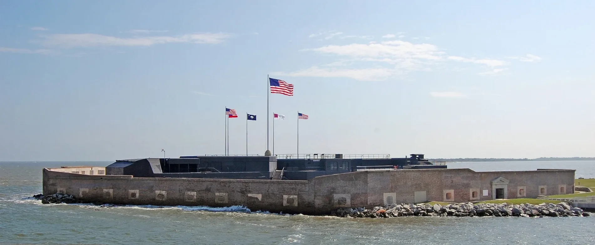
Fort Sumter in Charleston County, South Carolina
Fort Sumter in Charleston County is a park. Fort Sumter is also known as Fort Sumter National Monument. Fort Sumter is located near Middle Street. Ⓦ.
- Leisure
- park
- Nature
- coastline
Image
Streets nearby
Middle StreetMex 1 Coastal Cantina, The Obstinate Daughter, Beardcat's Sweet Shop, The Co-Op Frose & Eatery, Beachkrew, The Longboard, High Thyme Cuisine, Body Garden, Sandpiper Gallery, A Maker's Post, Sunrise Children's School
1.1 mi
Station 10 Street1.1 mi
Station 11 Street1.1 mi
Station 121.1 mi
Station 9 1/2 Street1.1 mi
Station 9 Street1.1 mi
Osceola Avenue1.2 mi
Sea Breeze Lane1.2 mi
Station 12 Street1.2 mi
Star of the West Street1.2 mi
Conquest Avenue1.2 mi
Palmetto Street1.2 mi
Poe AvenueSullivan's Island Historic District
1.2 mi
Station 13 Street1.3 mi
Station 131.3 mi
Station 14 Street1.3 mi
Fort Johnson Road1.4 mi
Cove Avenue1.4 mi
Pitt Street Bridge1.4 mi
Station 14 1/2 Street1.4 mi
Hennessy Street1.4 mi
Station 15 Street1.4 mi
Station 16 Street South1.5 mi
Thompson AvenueSullivan's Island Town Hall
1.5 mi
Pickett Bridge Recreation Area1.5 mi
Station 16 Street1.5 mi
Pitt StreetOld Village Post House, Village Bakery, Pitt Street Pharmacy
1.8 mi
Beaches nearby
Grice Beach0.7 mi
Buildings nearby
Powder Magazine1.2 mi
Fort Sumter NM Admin Offices1.2 mi
Harbor Entrance Control Post / Harbor Defense Post1.2 mi
Fort Moultrie Generator Building1.3 mi
Poweder Magazine1.3 mi
Battery Jasper1.3 mi
Grice Marine Laboratory1.3 mi
MUSC President's House (former)1.3 mi
Mugdock Castle1.3 mi
Fort Moultrie Spawars Building1.4 mi
SCDNR Marine Resources Research Institute1.4 mi
Marshlands House1.4 mi
SCDNR Outdoor Classroom1.4 mi
Commercial areas nearby
Marine Resources Center1.4 mi
Covered areas nearby
Water Well building1.3 mi
Museums nearby
Fort Sumter History Museum400 ft
Parks nearby
Fort Moultrie1.4 mi
Pitt Street Bridge Park1.5 mi
Places of worship nearby
Stella Maris Catholic Church1.2 mi
Rivers nearby
Ashley River0.5 mi
Tourist information centers nearby
Fort Moultrie Visitor Center1.2 mi
| Named after | Thomas Sumter |
|---|---|
| Year built | 1811 |
| Heritage designation | National Register of Historic Places contributing property |
| Protected area | Fort Sumter and Fort Moultrie National Historical Park |
| Located in | Charleston |
| Country | United States |
| Body of water | Charleston Harbor |
| Website | https://www.nps.gov/fosu/ |
| Native name | Fort Sumter |
| Described by | The Nuttall Encyclopædia, FortWiki, Meyers Konversations-Lexikon, 4th edition (1885–1890), Starforts, The New Student's Reference Work, The American Cyclopædia |
| Has part | Battery Huger |
| Part of | Fort Sumter and Fort Moultrie National Historical Park |
 Public transit map Charleston County Legend
| Railway | |
| Bus | |
| Streetcar |
 Bicycle map Charleston County Legend
| Bike path | |
| Bike lane on roadway | |
| Cycling allowed on bus lane | |
| Bicycle street | |
| Open to cyclists | |
| Open to cyclists, good path | |
| Cycling prohibited | |
| Cobblestone |
| Long-distance bike route | (depending on scale) | |
| Long-distance bike route |
 Pedestrian map Charleston County Legend
| Path |
| Long-distance hiking trail | (depending on scale) | |
| Long-distance hiking trail | ||
| Pedestrians prohibited |