
Mississippi River in Blytheville, AR 72315
Mississippi River in Blytheville, AR 72315 (Lauderdale County) is a river. Mississippi River is also known as The Mississippi. Mississippi River also exists in Dyer County and Lake County. Ⓦ.
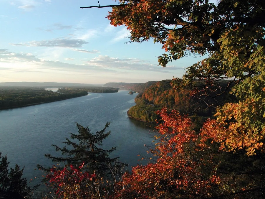
- Waterway Type
- river
Streets nearby
J D Smith Spur Road1.3 mi
J D Smith Road1.4 mi
Barr RoadNew Mitchell Grove Church, Barr
2.4 mi
Hales Point Barr RoadHales Point
2.6 mi
East County Road 1743.0 mi
North County Road 10633.0 mi
Boat Ramp Road3.1 mi
Watkins Road3.3 mi
Hales Point Grainery Road3.5 mi
Obion R3.8 mi
North County Road 1015Hickman
3.8 mi
East County Road 2363.9 mi
Brushy Ridge Road4.1 mi
East County Road 1424.1 mi
Levee Road4.3 mi
North County Road 9554.5 mi
Farm Road4.5 mi
North County Road 9674.6 mi
East County Road 1644.6 mi
Moss Island Road4.7 mi
East County Road 3944.9 mi
Chic RoadChic, Midway
4.9 mi
County Road 9674.9 mi
Morris Road5.1 mi
East County Road 1025.3 mi
County Road 4305.3 mi
East County Road 430Tomato
5.6 mi
Abandoned railways nearby
Jonesboro, Lake City, & Eastern5.1 mi
Cemeteries nearby
Walker Cemetery2.8 mi
Buckner Cemetery4.1 mi
Ditches nearby
Ditch No. 383.0 mi
Ditch No. 474.5 mi
Ditch No. 494.7 mi
Ditch No. 395.2 mi
Drains nearby
Ditch No. 425.0 mi
Industrial areas nearby
Kinder Morgan3.7 mi
Tenaris Hickman4.2 mi
Atlas Tube4.3 mi
Nucor-Yamato Steel4.8 mi
Paco Steel4.8 mi
Friedman Industries4.9 mi
Linde5.2 mi
Prospect Steel5.2 mi
Nucor Skyline Armorel5.2 mi
Nucor Coatings5.5 mi
Railways nearby
Armorel Branch4.6 mi
Rivers nearby
Forked Deer River3.1 mi
Obion River4.2 mi
Other nearby
Hickman South Substation4.7 mi
| Length | 3766 |
|---|---|
| Located in | United States |
| Country | United States |
| Source | Lake Itasca |
| Mouth | Gulf of Mexico |
| Tributary | Black River, Arkansas River, Ohio River, Saint Croix River, Wisconsin River, Rock River, Illinois River, Kaskaskia River, Minnesota River, Des Moines River, White River, Apple River, Big Muddy River, St. Francis River, Yazoo River, Big Black River, Maquoketa River, Wolf River, Rice Creek, Iowa River, Turkey River, Loosahatchie River, Meramec River, Wapsipinicon River, Chippewa River, River des Peres, Bayou Pierre, Catfish Creek, Crow River, Duck Creek, Hatchie River, Henderson Creek, Little Maquoketa River, Marys River, Obion River, Prairie River, Rum River, Rush River, Salt River, Schoolcraft River, Skunk River, Swan River, Trempealeau River, Turtle River, Upper Iowa River, Vermillion River, Wind River, Yellow River, Village Creek, Brazeau Creek, Cinque Hommes Creek, Nokasippi River, Apple Creek, Coles Creek, River aux Vases, Minnehaha Creek, Fox River, Bassett Creek, Sucker Creek, Missouri River |
| Native name | Mississippi River |
| Described by | Sytin Military Encyclopedia, Small Brockhaus and Efron Encyclopedic Dictionary, Brockhaus and Efron Encyclopedic Dictionary, Jewish Encyclopedia of Brockhaus and Efron, The Nuttall Encyclopædia, Great Soviet Encyclopedia (1926–1947), The Encyclopedia Americana, The American Cyclopædia, Encyclopædia Britannica 11th edition, Collier's New Encyclopedia, 1921, The New Student's Reference Work, New International Encyclopedia, Meyer’s Universum, Fünfzehnter Band, Meyer’s Universum, Siebzehnter Band, Meyer’s Universum, Achtzehnter Band, Granat Encyclopedic Dictionary |
Public transit map Lauderdale County Legend
| Railway | |
| Bus | |
| Streetcar |
Bicycle map Lauderdale County Legend
| Bike path | |
| Bike lane on roadway | |
| Cycling allowed on bus lane | |
| Bicycle street | |
| Open to cyclists | |
| Open to cyclists, good path | |
| Cycling prohibited | |
| Cobblestone |
| Long-distance bike route | (depending on scale) | |
| Long-distance bike route |
Pedestrian map Lauderdale County Legend
| Path |
| Long-distance hiking trail | (depending on scale) | |
| Long-distance hiking trail | ||
| Pedestrians prohibited |