
North Houston Avenue in Bryan, Texas
North Houston Avenue in Bryan is a residential street. It runs in a north-south direction starting from Military Drive and crosses East 15th Street, East 17th Street, East 18th Street, East Martin Luther King Junior Street, East Pruitt Street, East 21st Street, East 22nd Street, East 23rd Street and East 24th Street and ends at East William J Bryan Parkway. North Houston Avenue also exists in Harris County, Brazoria County, Grayson County, Dawson County and Red River County.
- Road Type
- residential street
- Postal Code
- 77803
- Route
- north-south
Image
Bars
Artworks
Fast food restaurants
Museums
Cafes
Marketplaces
Schools
Stations
- bus lines 04/09
Tobacco shops
Restaurants
Theaters
Pharmacies
Art galleries
Picnic areas
Streets nearby
North Preston AvenueWashington School
350 ft
East 23rd Street500 ft
East 21st Street0.2 mi
North Washington Avenue0.2 mi
East Pruitt Street0.2 mi
East Martin Luther King Junior Street0.2 mi
Texas Avenue North0.2 mi
East 22nd StreetTavo Coffee Co
0.2 mi
East 24th Street0.2 mi
East 26th Street0.3 mi
East William J Bryan ParkwayHaswell Pond and Fountain, Haswell Park Picnic #2, Haswell Park Picnic #3, Haswell Park Picnic #4, Bryan
0.3 mi
West 23rd Street0.3 mi
South Preston Avenue0.3 mi
North Main StreetThe Chocolate Gallery, Catalina Hatters, Subway, Good Time Charley's, Caffe Capri, Brookshire Brothers Pharmacy, The Proudest Monkey, The Grand Stafford Theater, Harvest Coffee Bar, Murphy's Law, Bavarian Brauhaus
0.3 mi
North Bryan AvenueThe Frame Gallery
0.3 mi
West 22nd Street0.3 mi
East 27th Street0.3 mi
Texas Avenue SouthOMG Seafood, Zand's Persian Kebabs, Carter's Burgers, Zan's Persian Kebabs, Hometown Chinese Restaurant, What's The Buzz, Yesterdays Bar & Grill
0.4 mi
Regent AvenueBryan Terminal, Children's Museum of Brazos Valley
0.4 mi
South Tabor Avenue0.4 mi
West William J Bryan ParkwaySquare One Art Gallery, The Corner of Time
0.4 mi
Carnegie AlleyRevolution Cafe & Bar, Velvet Leaf Cigar Lounge
0.4 mi
West 26th StreetThe Village Cafe, Downtown Uncorked, Mr. G's Italian Pizzeria, Downtown Bryan Association, Art 979 Art Gallery
0.4 mi
Banks nearby
Truist0.3 mi
Bars nearby
The 1010.3 mi
Buildings nearby
Moore House0.2 mi
Brazos County Health Department0.2 mi
Varisco Building0.3 mi
Black Water Draw Brewing Company0.3 mi
Legal Monkeys0.3 mi
Rick Davis & Associates0.3 mi
Brazos County Administrative Building0.4 mi
Commercial buildings nearby
BCS Modern0.2 mi
Courthouses nearby
Brazos County Courthouse0.3 mi
Fast food restaurants nearby
Church's Chicken350 ft
DQ Grill & Chill0.2 mi
Gas stations nearby
Shell0.2 mi
Hotels nearby
The Lasalle Hotel, Bryan College Station, A Tribute Portfolio Hotel0.4 mi
Libraries nearby
Clara B. Mounce Public Library0.3 mi
Carnegie History Center0.4 mi
Movie theaters nearby
The Queen Theater0.4 mi
Museums nearby
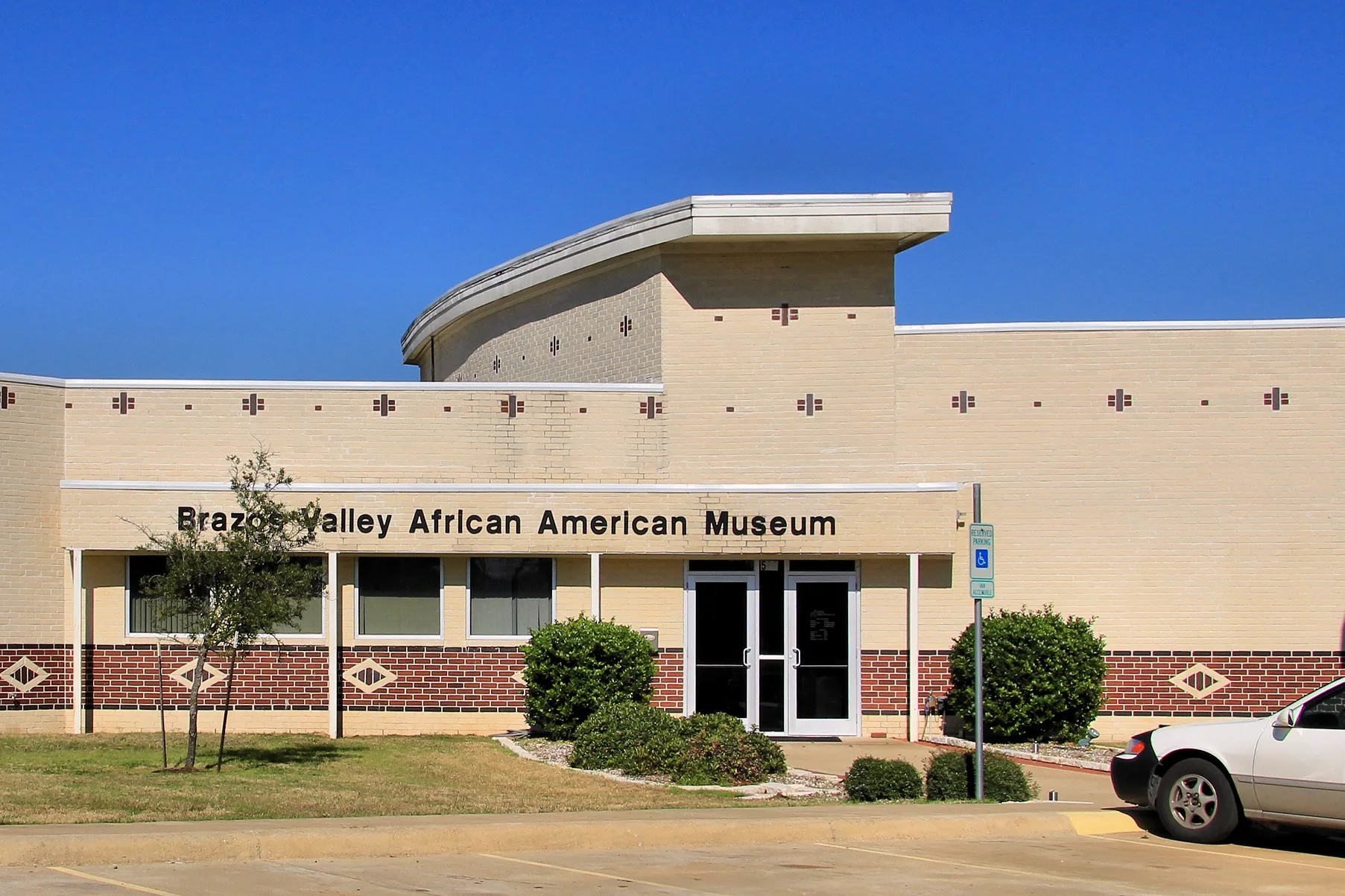
Brazos Valley African American Museum0.1 mi
Parking lots nearby
Roy Kelly Parking Garage0.3 mi
Pawn shops nearby
Cash America Pawn300 ft
Places of worship nearby
Allen Chapel AME Church150 ft
Cross Central Church0.1 mi
Railways nearby
UP Bryan Subdivision0.2 mi
Restaurants nearby
Hot Dogs Etc.0.1 mi
Theaters nearby
The Palace Theatre0.4 mi
 Public transit map Bryan Legend
| Railway | |
| Bus | |
| Streetcar |
 Bicycle map Bryan Legend
| Bike path | |
| Bike lane on roadway | |
| Cycling allowed on bus lane | |
| Bicycle street | |
| Open to cyclists | |
| Open to cyclists, good path | |
| Cycling prohibited | |
| Cobblestone |
| Long-distance bike route | (depending on scale) | |
| Long-distance bike route |
 Pedestrian map Bryan Legend
| Path |
| Long-distance hiking trail | (depending on scale) | |
| Long-distance hiking trail | ||
| Pedestrians prohibited |