
8th & Corinth in Dallas
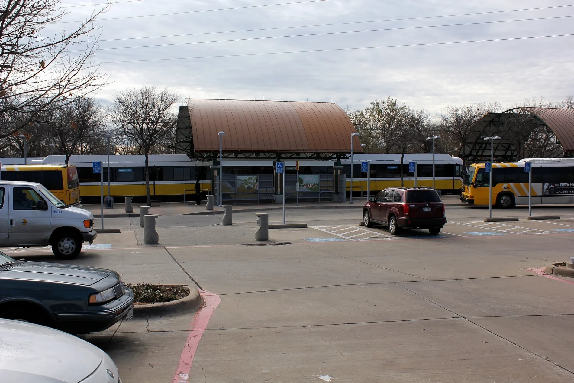
8th & Corinth in Dallas is a station (DART). 8th & Corinth is also known as 8th & Corinth station. 8th & Corinth is located near North Corinth Street Road. Ⓦ.
- Land Use
- railway area
- Operator
- DART
Image
Streets nearby
Corinth DART Station8th & Corinth, 1, 2, 3
250 ft
South Corinth Street RoadCorinth @ Illinois - N - NS, Corinth @ Louisiana - N - NS, Corinth @ Morrell - N - MB, Corinth @ High Hill - N - NS, Corinth @ Berwick - N - NS, Corinth @ High Hill - S - MB, Corinth @ Illinois - S - FS, Corinth @ Danube - N - NS, Corinth @ Danube - S - NS, Liberty Baptist Church, Corinth @ 11th - S - NS, Corinth @ Louisiana - S - NS, Corinth @ Georgia - S - NS, Corinth @ Essex - S - FS, Corinth @ Essex - N - NS, Corinth @ Berwick - S - NS, Corinth @ High Hill - S - NS, Corinth @ Stella - S - NS, Corinth @ Stella - S - MB, Corinth @ Padgitt - S - NS, Corinth @ Woodbine - S - FS, Corinth @ Padgitt - N - NS, Corinth @ Woodbine - N - FS, Corinth @ Ave B - N - NS, Corinth @ 11th - N - NS, Corinth @ Morrell - S - NS, Corinth @ Morrell - N - FS
300 ft
North Corinth Street Road450 ft
Santa Fe Avenue550 ft
Avenue C550 ft
East 8th Street7-Eleven, Ger's Brake Service
0.1 mi
Avenue D0.1 mi
Fran WayFiji Senior Sign, Fran Way @ 11 St - S - FS, Fiji Sign
0.1 mi
East 11th Street0.1 mi
Atwood Street0.1 mi
Corinth Street Viaduct0.2 mi
Avenue BAve B @ Corinth - E - NS
0.2 mi
Canyon Street0.2 mi
Viaduct Street0.2 mi
Faulk Street0.2 mi
Crete Street0.2 mi
Monaghan Court0.2 mi
Albright Street0.2 mi
Sicily Street0.2 mi
Ventura Drive0.2 mi
Bobbie Street0.2 mi
Sphinx Street0.3 mi
Rockefeller Boulevard0.3 mi
Avenue E0.3 mi
Pecan Drive0.3 mi
Avenue A0.3 mi
Hart Street0.3 mi
South Moore StreetMorrell
0.3 mi
Trinity Skyline Trail0.3 mi
Tonga Street0.3 mi
Avenue F0.3 mi
North Moore Street0.3 mi
Plum Street0.3 mi
East 10th StreetTenth Street Historic District
0.3 mi
East 9th Street0.3 mi
East Clarendon DriveDallas Zoo
0.3 mi
Church Street0.3 mi
Hutchins Avenue0.4 mi
Santa Fe Trestle Trail0.4 mi
Abandoned railways nearby
TER Oak Cliff Viaduct (Abaodoned)0.2 mi
Light rail lines nearby
DART Light Rail50 ft
DART0.1 mi
Parks nearby
Moore Park0.2 mi
Fiji Park0.2 mi
Fiji Community Park0.2 mi
Tama Park0.3 mi
Razed railways nearby
ATSF0.2 mi
Texas Electric Railway0.3 mi
Streams nearby
Cedar Creek0.2 mi
| Year built | 1996 |
|---|---|
| Official opening | 1996 |
| Located in | Dallas |
| Country | United States |
| Transport network | DART Light Rail |
| Connecting line | Red Line, Blue Line |
| Connecting service | Red Line, Blue Line |
 Public transit map Dallas Legend
| Railway | |
| Bus | |
| Streetcar |
 Bicycle map Dallas Legend
| Bike path | |
| Bike lane on roadway | |
| Cycling allowed on bus lane | |
| Bicycle street | |
| Open to cyclists | |
| Open to cyclists, good path | |
| Cycling prohibited | |
| Cobblestone |
| Long-distance bike route | (depending on scale) | |
| Long-distance bike route |
 Pedestrian map Dallas Legend
| Path |
| Long-distance hiking trail | (depending on scale) | |
| Long-distance hiking trail | ||
| Pedestrians prohibited |