
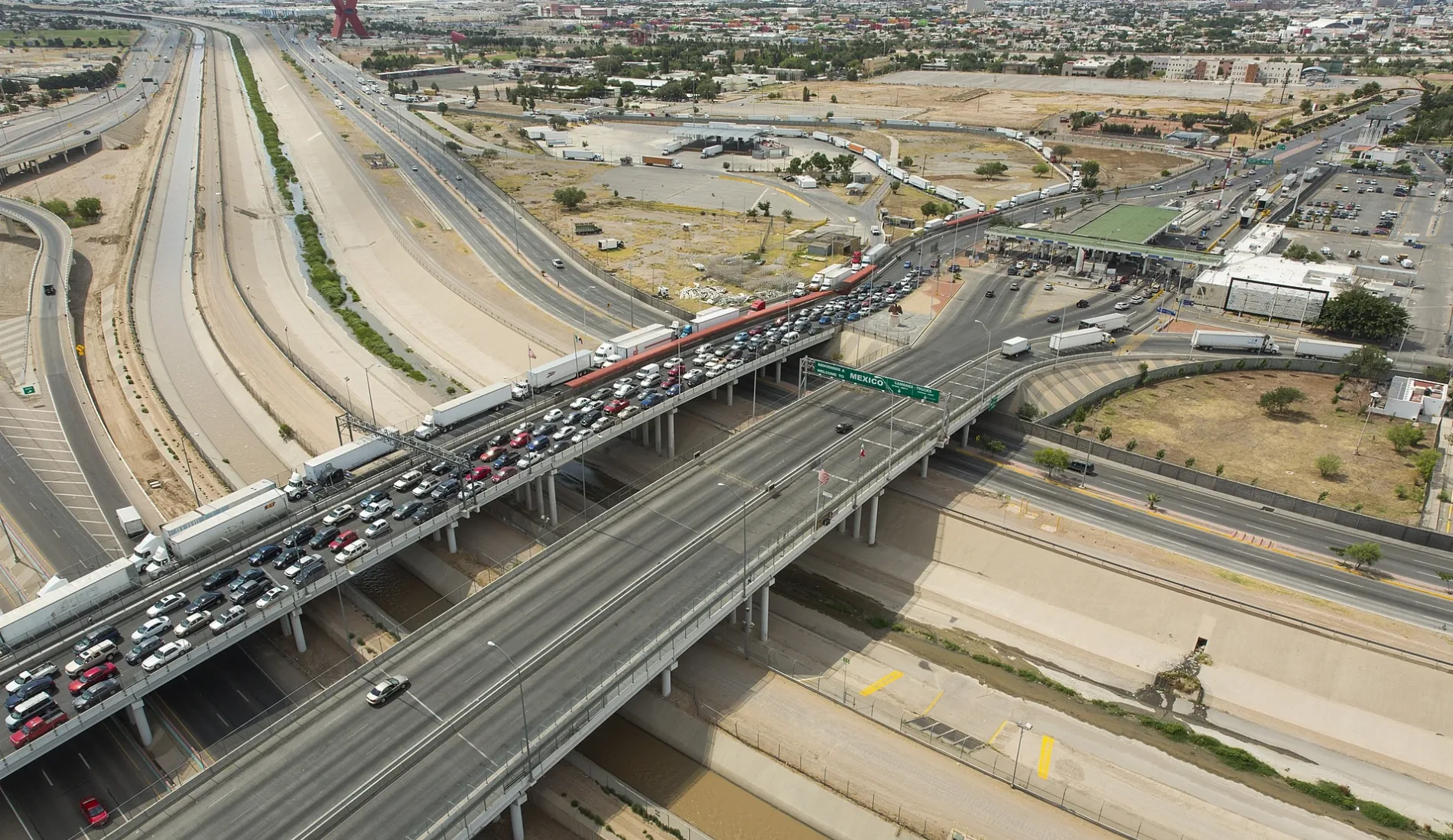
Cordova International Bridge in El Paso, Texas
Cordova International Bridge in El Paso is a four-lane, asphalted highway (also known as Cordova Bridge). It runs as a one-way street in a north-south direction and ends in a cul-de-sac. Cordova International Bridge is also known as Cordova Bridge. This street is part of the highway "110". Ⓦ.
- Alternate Name
- Cordova Bridge
- Road Type
- highway
- Lanes
- 4
- Route
- north-south
Image
Streets nearby
Bridge of the Americas (Trucks)Cordova Port of Entry, CBP Inspection Station, CBP Inspection Station (Trucks)
150 ft
Cordova International Bridge500 ft
César Chávez Border Highway0.2 mi
Customs Drive0.2 mi
East Paisano DriveCentro de la Tecnología, La Valentina Cafe
0.3 mi
Delta Drive0.3 mi
South Latta Street0.3 mi
Gateway South BoulevardSpeedway
0.3 mi
Patriot Freeway0.3 mi
Gateway North BoulevardMattress Firm, Speedway, Starbucks, Capones Barbershop, Dirty Boot Liquor, Cash America Pawn, Case de Torta
0.3 mi
Linea de CamionesAduanas e Inmigracion Mexicano, Cd. Juárez
0.3 mi
South Luna Street0.4 mi
Copia StreetEl Paso Holiness Church, Alon, KFC
0.4 mi
Avenida Rafael Pérez SernaHP Enterprise Services
0.4 mi
South Cebada Street0.4 mi
South Grama Street0.4 mi
Findley Avenue0.4 mi
East San Antonio AvenueChamizal Express Library, San Jacinto School
0.4 mi
South San Marcial Street0.4 mi
South Stevens Street0.4 mi
Avenida de las AméricasPemex E01185
0.4 mi
Prieto Way0.4 mi
Webber Place0.4 mi
Martinez0.4 mi
Laredo Avenue0.4 mi
Rivera Avenue0.4 mi
South Estrella Street0.5 mi
Central Avenue0.5 mi
Great Bear Court0.5 mi
South Raynor Street0.5 mi
Cypress Avenue0.5 mi
Calle E0.6 mi
Calle Carlos PellicerCruz Atreal, Monumento a Baden-Powell BP fundador Scout
0.6 mi
South Piedras StreetRam / Super Stop
0.6 mi
Calle F0.6 mi
Canals nearby
Franklin Canal0.4 mi
Covered areas nearby
Cordova Port of Entry450 ft
Aduana0.2 mi
Fast food restaurants nearby
McDonald's0.6 mi
Gas stations nearby
Payan's Fuel Center0.6 mi
Museums nearby
Museo de Arqueologìa del Chamizal0.6 mi
Parks nearby
Chamizal National Memorial150 ft
Banderas del Chamizal0.4 mi
Places of worship nearby
St. Francis Xavier Catholic Church & Parish0.3 mi
Tourist information centers nearby
Chamizal National Memorial Visitor Center0.2 mi
Centro de Informacion Turistica El Chamizal0.4 mi
Trails nearby
Pista de patinar La Laguna0.4 mi
University buildings nearby
Z0.6 mi
Y0.6 mi
Other nearby
Explanada del Museo de Arqueología del Chamizal0.6 mi
| Official opening | 1996 |
|---|---|
| Located in | Texas, Chihuahua |
| Country | United States, Mexico |
| Crosses | Rio Grande |
| Part of | Mexico–United States border |
 Public transit map El Paso Legend
| Railway | |
| Bus | |
| Streetcar |
 Bicycle map El Paso Legend
| Bike path | |
| Bike lane on roadway | |
| Cycling allowed on bus lane | |
| Bicycle street | |
| Open to cyclists | |
| Open to cyclists, good path | |
| Cycling prohibited | |
| Cobblestone |
| Long-distance bike route | (depending on scale) | |
| Long-distance bike route |
 Pedestrian map El Paso Legend
| Path |
| Long-distance hiking trail | (depending on scale) | |
| Long-distance hiking trail | ||
| Pedestrians prohibited |