
East 12th Street in Houston
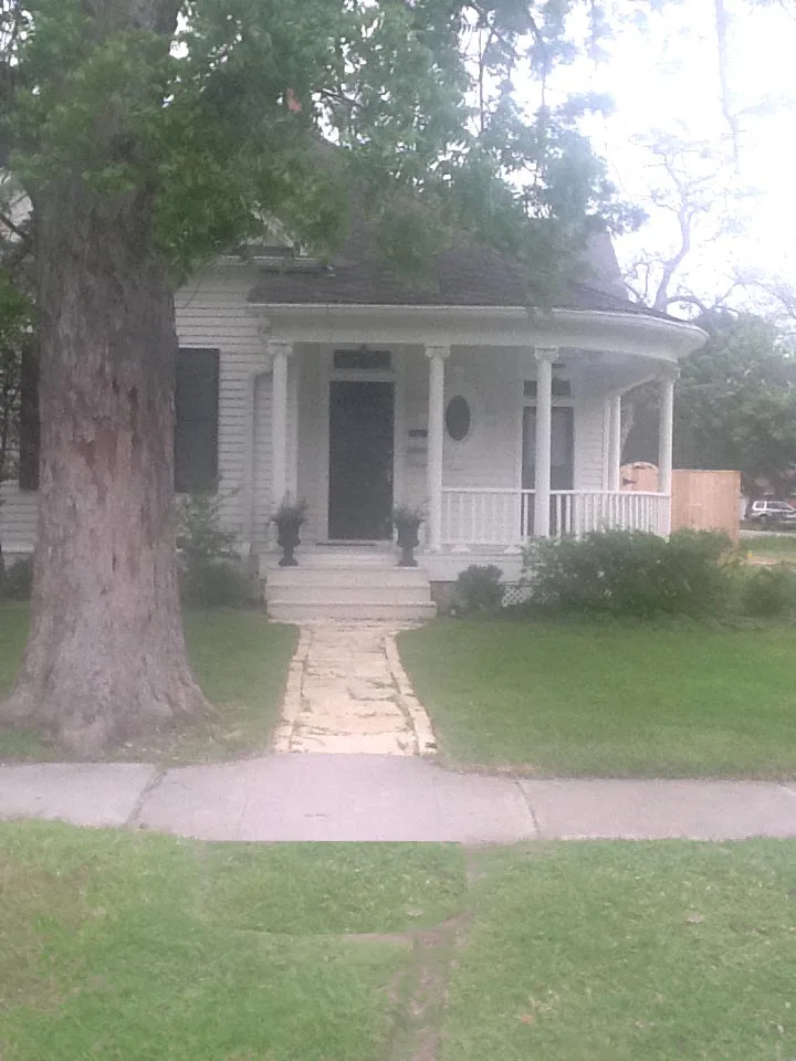
East 12th Street in Houston is a two-lane, asphalted residential street. The street has sidewalks. It runs in an east-west direction starting from West 12th Street and crosses Heights Boulevard, Harvard Street, Cortlandt Street, Arlington Street, Columbia Street, Oxford Street and Beverly Street and ends at Studewood Street. East 12th Street also exists in Deer Park.
- Road Type
- residential street
- Lanes
- 2
- Route
- east-west
Image
Tourist information centers
Cafes
Liquor stores
Bakeries
Cosmetics stores
Restaurants
Garden centers
Banks
Bike shops
Places of worship
Fast food restaurants
Theaters
Convenience stores
Dentist offices
Event venues
Streets nearby
Cortlandt StreetBudget, Shell
0.1 mi
East 13th StreetHeights High School Theatre, Heights High School
0.1 mi
East 11th StreetMetro Mart, Frost Bank, Buchanan's Native Plants, Starbucks, Three Dog Bakery
0.1 mi
West 12th Street0.2 mi
West 11th StreetDish Society, Mattress Firm, West Eleventh Church of God, CBD American Shaman, Revolucion Coffee + Juice, I Know The Owner
0.2 mi
East 14th StreetHoward Locksmith Heights, Latina Mission Presbyterian Church
0.3 mi
West 13th StreetSeven Crown Food Store
0.3 mi
East 11½ StreetThe Studewood Cantine
0.3 mi
East 13½ Street0.3 mi
East 10th StreetShokku Ramen, Maison Pucha Bistro
0.3 mi
Harvard StreetBonjour, Metro by T-Mobile, Star Pizza, First Baptist Church Heights
0.3 mi
Beverly StreetHeights Liquor
0.3 mi
Paul Carr Jogging TrailLombard Lamp
0.3 mi
Heights BoulevardThe Boardroom, Salata, Clear Smiles, Barnaby's Cafe, Ideal Image, Heights Christian Church, The Houston Saengenbund, Arcadia, 3rd Generation Ink, Retreat Massage, The Monk's Kitchen, Water Tree, TJ's Smoke Shop, Subway
0.3 mi
Arlington StreetMemorial Hermann Urgent Care
0.3 mi
Oxford StreetJenni's Noodle House
0.3 mi
East 12½ Street0.3 mi
Algregg Street0.4 mi
Yale StreetSaint Albans Catholic Church, Blue Line Bike Lab, Area 52, Lola, Jimmy John's, Crumbl Cookies, Wingstop, Premier Fine Wine & Spirits, Great Clips, Aqua Cleaners, Total Nutrition, Smashburger, BLVD Dentistry, Luna Pizzeria, Massage Heights, GNC, Nail Time, Noon Mediterranean, Subway, Texas Children's Pedatrics, Lovejoy's, Heights Antiques on Yale, Dentist Tree of The Heights, Replay Games, Bank of America, Kim Liquor, Wild Boar Barbershop, CVS Pharmacy, Airline Medical Clinic, Taqueria No Toques Mi Taco, Corner Bakery, Doctors Express Urgent Care, Verizon, Flash Dental, Starbucks, Mattress Firm, Kendra Scott, Lemon Laine, The Impeccable Pig, Pressed, Shipley Do-Nuts, Yale Store, Valero
0.4 mi
East 15th Street0.4 mi
Studewood StreetHelen in the Heights, Huntington Learning Center, Studewood Barber Shop, Adonia Dentistry, Heights Nutrition
0.4 mi
Hall Place0.4 mi
West 15th StreetHouston Heights, CubeSmart, Flying Squid Tattoo
0.4 mi
Peddie Street0.5 mi
Le Green Street0.5 mi
East 16th Street0.5 mi
Ralfallen Street0.5 mi
Columbia Street0.5 mi
Antique stores nearby
14th Street Trading Post0.3 mi
Bars nearby
The Shiloh Club0.4 mi
Buildings nearby
Moses A Clanton House0.2 mi
Hope & Causey0.2 mi
Sharespace Heights0.3 mi
Miller House0.3 mi
Lula J Doughty House0.3 mi
Houston Finance Co0.4 mi
Cafes nearby
EQ Heights0.2 mi
Commercial buildings nearby
Front Room Hair Studio0.3 mi
Event venues nearby
Heights Fire Station0.3 mi
Fast food restaurants nearby
Someburger0.4 mi
Fire stations nearby
Heights Fire Department0.3 mi
Libraries nearby
Heights Neighborhood Library0.2 mi
Music stores nearby
Fleming's Instrument Repair0.4 mi
Parks nearby
Milroy Park0.3 mi
Pubs nearby
Heights & Co0.4 mi
Religious areas nearby
All Saints Catholic Church0.2 mi
Restaurants nearby
1891 American Eatery and Bar0.3 mi
School buildings nearby
All Saints School0.2 mi
Social facilities nearby
Village of the Heights0.4 mi
 Public transit map Houston Legend
| Railway | |
| Bus | |
| Streetcar |
 Bicycle map Houston Legend
| Bike path | |
| Bike lane on roadway | |
| Cycling allowed on bus lane | |
| Bicycle street | |
| Open to cyclists | |
| Open to cyclists, good path | |
| Cycling prohibited | |
| Cobblestone |
| Long-distance bike route | (depending on scale) | |
| Long-distance bike route |
 Pedestrian map Houston Legend
| Path |
| Long-distance hiking trail | (depending on scale) | |
| Long-distance hiking trail | ||
| Pedestrians prohibited |