
Bayou Trail in Houston
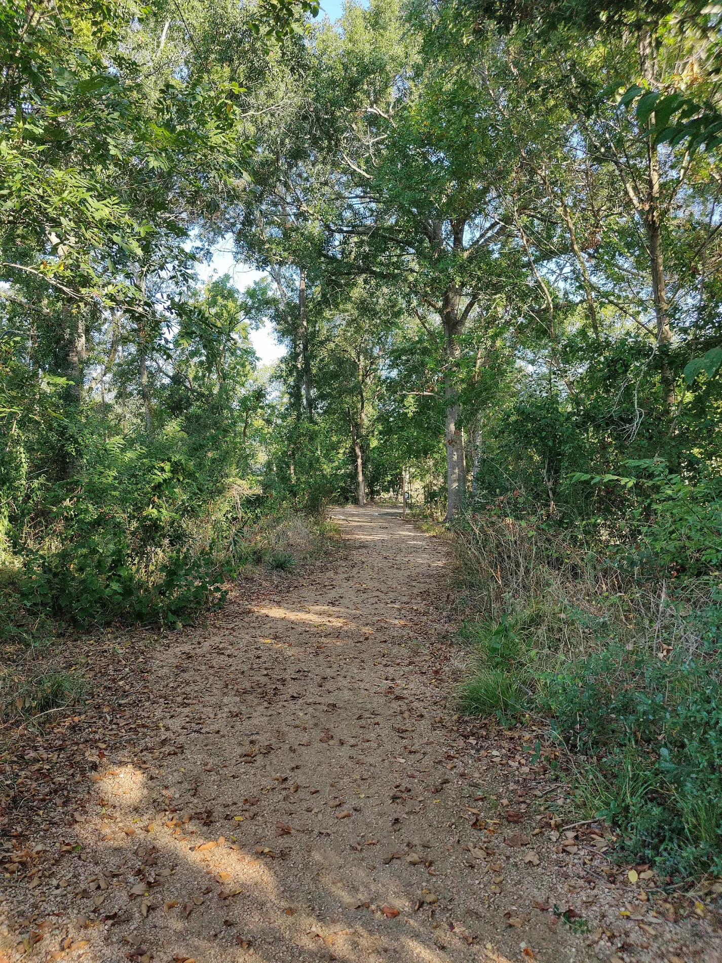
Bayou Trail in Houston is a fine-gravel footpath (also known as Scout Trail). It runs in a southeast-northwest direction and ends in a cul-de-sac. Bayou Trail is also known as Scout Trail.
- Alternate Name
- Scout Trail
- Road Type
- footpath
- Operator
- Willow Waterhole Greenspace Conservancy
- Route
- southeast-northwest
Image
Restaurants
Fast food restaurants
Secondhand stores
Nightclubs
Pharmacies
Public bookcases
Cell phone stores
Liquor stores
Bakeries
Vending machines
Artworks
Tourist information centers
Furniture stores
Auto repair shops
Ice cream shops
Streets nearby
Brown Foundation TrailWillow Waterhole
550 ft
Arboretum Trail0.1 mi
Gaymoor Drive0.1 mi
Menninger Clinic Trail0.1 mi
Ricecrest Street0.1 mi
John M. O'Quinn Foundation Trail0.1 mi
Warm Springs Road0.1 mi
Spellman Road0.1 mi
Benning Drive0.2 mi
Mc Knight Street0.2 mi
Sanford RoadHouston Police Department - Fondren Patrol
0.2 mi
South Willow DriveLo Nuevo De Jalisco
0.2 mi
New Street0.2 mi
Arboles Drive0.2 mi
Endicott LaneMassage Envy, Firehouse Subs
0.3 mi
Chimney Rock RoadCVS Pharmacy, Domino's, Metro by T-Mobile, Lo Price Liquor & Tobacco, Dr. Philip A. Matorin MD, Pilgrim Lutheran Church, Line 32, Church's Chicken, Chipotle, Natural Pawz, Bird's Eye View Optometry, Line 49, Uptown Shears, Rich Cleaners, Kolache Factory, Burganic Hub, Lauren’s Fragrances, Asian Cafe, The Hat Store, THS Ranch, TitleMax, French Riviera Bakery & Cafe, Massage Heaven
0.3 mi
Gasmer Drive0.3 mi
Kinder Foundation Trail0.3 mi
Neighborhood Trail0.3 mi
Audubon TrailGreat Blue Heron
0.3 mi
Kingfisher DriveLittle Free Library
0.3 mi
Fonda Street0.3 mi
Starkridge Drive0.3 mi
Clematis Lane0.4 mi
Hummingbird Street0.4 mi
West Bellfort StreetStella, Meyerland, Westbury, The Samaritan Furniture, Braes Resale, Bakery Inka Havana, Fannin South Transit Center, Fannin South, Solid Rock Baptist Church, McDonald's, United Sisters, Grace Episcopal Church
0.4 mi
Animal boardings nearby
You Lucky Dog Pet Resort0.3 mi
Banks nearby
Chase0.4 mi
Buildings nearby
The Gathering Place200 ft
Southwestern Bell0.1 mi
Clinics nearby
Caring Foot & Ankle Specialists0.2 mi
Door stores nearby
ABC Doors0.4 mi
Gardens nearby
Native Prairie Plant Garden0.1 mi
Industrial areas nearby
Chimney Rock Elks Club0.1 mi
Waukesha-Pearce Industries0.3 mi
Monasteries nearby
Tu Viện Thánh Catarina0.3 mi
Office buildings nearby
Westbury Professional Building0.3 mi
Genesis Plaza0.3 mi
Pavilions nearby
Dabney Kennedy Scout Pavilion350 ft
Picnic areas nearby
Edith Smith Outdoor Classroom0.2 mi
Places of worship nearby
Sharon Fellowship Church0.3 mi
Iglesia Evangelica Nuevo Amanecer0.4 mi
Residential areas nearby
Villa Rosa Apartments0.4 mi
Retail areas nearby
Westbury Triangle0.3 mi
Rivers nearby
Willow Waterhole Bayou0.3 mi
Self storages nearby
Store Space0.2 mi
Sports centers nearby
Westbury Baseball0.3 mi
Waters nearby
Scout Lake300 ft
Heron Lake0.2 mi
| Located in | Houston |
|---|---|
| Country | United States |
| Body of water | Scout Lake |
| Part of | Willow Waterhole Greenway |
 Public transit map Houston Legend
| Railway | |
| Bus | |
| Streetcar |
 Bicycle map Houston Legend
| Bike path | |
| Bike lane on roadway | |
| Cycling allowed on bus lane | |
| Bicycle street | |
| Open to cyclists | |
| Open to cyclists, good path | |
| Cycling prohibited | |
| Cobblestone |
| Long-distance bike route | (depending on scale) | |
| Long-distance bike route |
 Pedestrian map Houston Legend
| Path |
| Long-distance hiking trail | (depending on scale) | |
| Long-distance hiking trail | ||
| Pedestrians prohibited |