
Image
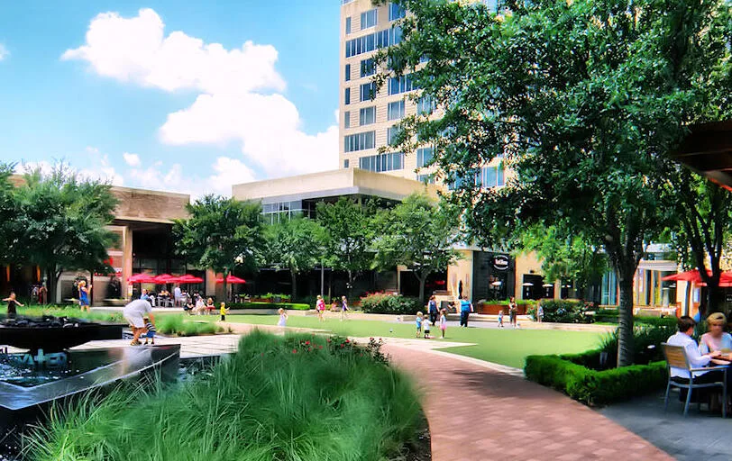
Thrift stores
Cafes
Opticians
Furniture stores
Hotels
Charging stations
Restaurants
Clothing stores
Fast food restaurants
Movie theaters
Theaters
Bars
Banks
Car sharing stations
Streets nearby
Town and Country StreetAntony's Deli, Goodwill Select
400 ft
Town and Country WayTown & Country / CityCentre
400 ft
Town & Country Lane0.1 mi
Plaza Way0.1 mi
Sorella Courtecurie25 Supercar Club, Grimaldi’s, The Moran CITYCENTRE Hotel, Capital Grille, Seasons 52
0.2 mi
Rocky Meadow Drive0.2 mi
West Sam Houston Tollway NorthEZTAG
0.2 mi
Queensbury LaneAT&T, Queensbury Theatre, Houston, TX - Queensbury Lane Tesla Supercharger
0.2 mi
Citycentre WayYard House, RA Sushi, Cyclone Anaya’s Mexican Grill, Salata, Chipotle, Grubb Burger, Urban Outfitters
0.2 mi
Kingsride LaneZalat Pizza, Wells Fargo, Liberty Taco, Flying Biscuit Cafe
0.3 mi
Trail Hollow Drive0.3 mi
Barryknoll LaneNottingham West
0.3 mi
Katy TollwayEnergy Corridor
0.3 mi
Attingham Drive0.3 mi
Katy FreewayNorthwest Transit Center
0.3 mi
Town and Country BoulevardBurlap Barrel, Brio, Eddie V’s, Warby Parker, Lululemon, LoveSac, ComedySportz Houston, Studio Movie Grille, Texas De Brazil, Starbucks
0.3 mi
West Sam Houston Parkway NorthEverything But Water, Amegy Bank, Murphy's Deli, Starbucks, Laredo Taco Company, 7-Eleven, EZTAG, Builders FirstSource, Spark, Einstein Bros. Bagels, Verizon, Frost Bank
0.4 mi
Katy Freeway Frontage RoadWe Love Houston, Blink, Star Stop, Jack in the Box, Katy Medical Supplies, Laredo Taco Company, Clear Dermatology, Le Peep, Nails Beautiful, Snap Kitchen, Green Bank, Wells Fargo, Masraff's, Verizon, Passport Health Houston Travel Clinic, Red Robin, CubeSmart, Bahama Buck's Original Shaved Ice, Talespin Pizza, Skin 101, Brazilian Salon, Peters Dominican Barbershop, Her Velvet Hand, Mattres Outlet, Rock N Roll It, Pizza Hut, Guadalajara Hacienda, Car Audio Zone, Atomic Monkey Comics, Pizaro's Pizza, Rooms To Go, The Egg & I, GNC, Jimmy John's, Five Guys, Denny's, Mattress Firm, Marble Slab Creamery, Panda Express, Which Wich?, European Wax Center, Massage Envy, MOD Pizza, Leslie's Pool Supplies, Chuy's, The Vitamin Shoppe, Subway, Common Bond, Jason's Deli, Velvet Taco, Pincho, Line 39, PNC Bank
0.4 mi
Hallie Drive0.4 mi
Britoak LaneAutumn Oaks
0.5 mi
Kimberley Lane0.5 mi
Autumn Oaks Drive0.5 mi
Cherrybark Lane0.5 mi
Diamond Leaf Lane0.5 mi
Buildings nearby
Main Building0.3 mi
59 Diner0.3 mi
Book Store0.4 mi
The Commons0.4 mi
Fitness centers nearby
Life Time550 ft
Hotels nearby
Candlewood Suites0.2 mi
Holiday Inn Express & Suites0.3 mi
Kiosks nearby
SBMSA Concessions0.4 mi
Liquor stores nearby
Spec's Liqours0.4 mi
Parks nearby
Harris County Pocket Park0.2 mi
Bendwood Park0.4 mi
Post offices nearby
United States Post Office - Memorial Park Station0.1 mi
Residential areas nearby
Autumn Oaks0.4 mi
Fonn Villas0.5 mi
Restaurants nearby
bellagreen0.1 mi
Taste of Texas0.2 mi
Fuddruckers0.2 mi
Pappadeaux0.2 mi
Pappasito's0.3 mi
Fadi's Mediterranean Grill0.3 mi
Niko Niko's0.3 mi
Retail areas nearby
Town & Country North0.4 mi
Schools nearby
Wildcat Way School0.3 mi
Streams nearby
Rummel Creek0.4 mi
University buildings nearby
Texas A&M University - Mays Business School CityCentre0.2 mi
| Year built | 1983 |
|---|---|
| Located in | Houston |
| Country | United States |
| Website | http://www.citycentrehouston.com |
 Public transit map Houston Legend
| Railway | |
| Bus | |
| Streetcar |
 Bicycle map Houston Legend
| Bike path | |
| Bike lane on roadway | |
| Cycling allowed on bus lane | |
| Bicycle street | |
| Open to cyclists | |
| Open to cyclists, good path | |
| Cycling prohibited | |
| Cobblestone |
| Long-distance bike route | (depending on scale) | |
| Long-distance bike route |
 Pedestrian map Houston Legend
| Path |
| Long-distance hiking trail | (depending on scale) | |
| Long-distance hiking trail | ||
| Pedestrians prohibited |