
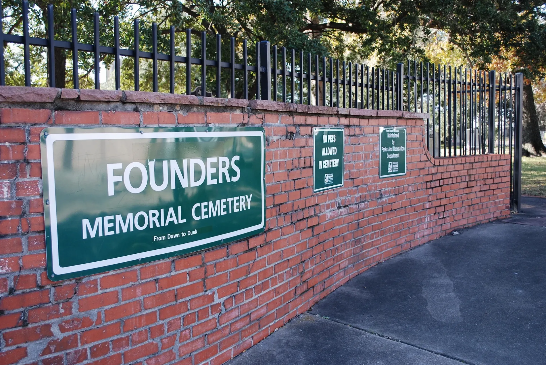
Founders Memorial Cemetery in Houston
Founders Memorial Cemetery in Houston is a cemetery. Founders Memorial Cemetery is also known as Founders Memorial Park. Ⓦ.
- Alternate Name
- Founders Memorial Park
- Land Use
- cemetery
Image
Restaurants
Cafes
Fast food restaurants
Artworks
Places of worship
Bars
Bike shops
Convenience stores
Streets nearby
Nash Street250 ft
Saulnier StreetFourth Ward
500 ft
Lamb Street500 ft
Skyline Trail0.1 mi
Andrews Street0.1 mi
Valentine StreetRose of Sharon Missionary Baptist Church
0.1 mi
Park Trail Run0.1 mi
Robin Street0.1 mi
West Dallas StreetThe Kennedy Houston, Katami, Texaco
0.1 mi
Buckner Street0.1 mi
Arthur Street0.2 mi
Valentine Way0.2 mi
Crosby Street0.2 mi
Bluebonnet Place Circle0.2 mi
Skyline Vista0.2 mi
Matthews Street0.2 mi
Cushing StreetBibleway Missionary Baptist church
0.2 mi
Ruthven Street0.2 mi
Park Trail Way0.2 mi
Park Vista Drive0.2 mi
Park Trail Vista0.2 mi
Heiner Street0.2 mi
Wilson StreetSaint James United Methodist Church, Macedonia Missionary Baptist Church
0.2 mi
Allen ParkwayPAUSE sign, Shady Grove, Dogs
0.2 mi
Bayou Oaks Vista Drive0.2 mi
Bailey Street0.3 mi
Cleveland Street0.3 mi
Gillette StreetNew Zion Temple Church of the World Wide Fellowship
0.3 mi
Genesee Street0.3 mi
Robita Street0.3 mi
Memorial DriveMemorial Drive United Methodist Church, Large Spindle Piece, The Grand on Memorial Apartments, Urban American Kitchen, Amazing Cleaners, Snip-its Haircuts for Kids, Food Mart, Pizza Inn, Piada Italian Street Food, Pollo Bravo, Fajita Pete’s, Starbucks, Smoothie King, Kolache Factory, The UPS Store, Scott Gertner's Rhythm Room, Entrust Immediate Care, Domino's, Harmony Thai Massage Houston, The Refuge, Wilchester West, Chez Kobayashi Pastries, Mrs. Donuts, Three Quarter Time, Kary King, CS Mini Salon Suites, Baskin-Robbins, Walgreens, Nothing Bundt Cakes, Blush Nail Spa, MOD Pizza
0.4 mi
Rhode Place0.4 mi
Buildings nearby
Cubesmart Self Storage100 ft
Isabelle Simms House0.2 mi
Rev. Ned Pullum House0.2 mi
J. Vance Lewis House0.2 mi
Cemeteries nearby
Beth Israel Cemetery350 ft
Hotels nearby
Best Western Plus Downtown Inn & Suites0.1 mi
Institutional grounds nearby
Federal Reserve Bank of Dallas0.3 mi
Libraries nearby
African American History Research Center0.3 mi
Museums nearby
Rutherford B. H. Yates Museum0.2 mi
Parks nearby
Sabine-to-Bagby Promenade0.2 mi
Eleanor Tinsley Park0.3 mi
Places of worship nearby
Temple Beth Israel300 ft
Restaurants nearby
Seaside Lounge0.2 mi
Retail buildings nearby
Mama's Got It Grocery and Grill0.2 mi
Shelters nearby
Nau Family Pavilion0.3 mi
Sports fields nearby
Eleanor Tinsley Park Volleyball Court0.2 mi
Other nearby
Fourth Ward0.3 mi
| Year built | 1836 |
|---|---|
| Located in | Houston |
| Country | United States |
 Public transit map Houston Legend
| Railway | |
| Bus | |
| Streetcar |
 Bicycle map Houston Legend
| Bike path | |
| Bike lane on roadway | |
| Cycling allowed on bus lane | |
| Bicycle street | |
| Open to cyclists | |
| Open to cyclists, good path | |
| Cycling prohibited | |
| Cobblestone |
| Long-distance bike route | (depending on scale) | |
| Long-distance bike route |
 Pedestrian map Houston Legend
| Path |
| Long-distance hiking trail | (depending on scale) | |
| Long-distance hiking trail | ||
| Pedestrians prohibited |