
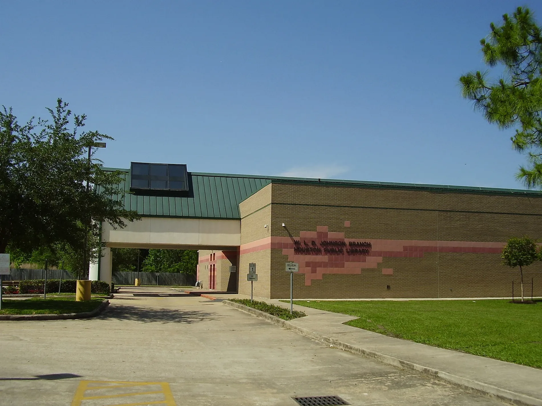
Johnson Neighborhood Library in Houston
Johnson Neighborhood Library in Houston is a library (Houston Public Library), Reed Road 3517 (77051). Johnson Neighborhood Library is also known as W.L.D. Johnson Neighborhood Library. Ⓦ.
- House Number
- 3517
- Postal Code
- 77051
- Street
- Reed Road
- Amenity
- library
- Building Type
- public building
- Operator
- Houston Public Library
Image
Places of worship
Streets nearby
Mallory Street300 ft
Martell Street350 ft
Tangerine StreetParadise Missionary Baptist Church
0.2 mi
Reed RoadApostolic Faith Church, City of Houston Fire Station 24, Spiritual Enlightenment Baptist Church, New Hope Missionary Baptist Church, New Saint Elizabeth Baptist Church
0.2 mi
Tangerine0.2 mi
Culver Street0.2 mi
Scott StreetSunny Side Missionary Baptist Church, Elgin/Third Ward, JB Wig, Jolla Bella, L.A. Central Nails, OST Dry Cleaners, Star Braiding, Sun Liquor, U.S. Nails, Washateria, Zen Fashion Accessories, OST Food Store, Boost Mobile, Loan Express, Princess Beauty Supply, The Medicine Shoppe, TSU/UH Athletics District, Quik Stop Market, The T-Shirt Spot, Popeyes, True Faith Church, Leeland/Third Ward, Sunnyside
0.2 mi
Maggie Avenue0.2 mi
Wilmington StreetBethesda Missionary Baptist Church, New Beginning Church of God in Christ
0.2 mi
Chesterfield DriveBlueridge Baptist Church
0.3 mi
Ashville DriveSaint Lukes African Methodist Episcopal Church
0.3 mi
Rockingham Street0.3 mi
Heno Street0.3 mi
Rosehaven Drive0.3 mi
Dawson LaneBethel New Star Baptist Church
0.4 mi
Phlox StreetMount Ararat Baptist Church
0.4 mi
Mallow StreetGolden Gate Baptist Church, First Elizabeth Baptist Church, Ship of Zion Baptist Church
0.4 mi
Alvin StreetFellowship Missionary Baptist Saint Church, True Doctrine Missionary Baptist Church
0.4 mi
Larkspur StreetGreater Union Baptist Church, Progressive Baptist Church
0.4 mi
Grassmere Street0.4 mi
Maggie Street0.4 mi
Kewanee StreetFirst Pentecostal Church, Tabernacle of Faith Church
0.4 mi
Comal StreetBible Way Holiness Church
0.4 mi
Sierra Drive0.5 mi
Cathedral Drive0.5 mi
Sparrow StreetGreater Hope Baptist Church, New Faith Missionary Baptist Church, New Star Bethel Mission Baptist Church
0.5 mi
Fairland Drive0.5 mi
Knoxville StreetGreater Lighthouse Church of God in Christ, Second Church of Christ
0.5 mi
Edgar Street0.5 mi
Barberry DriveLord Jesus Christ Holiness Church, Galilee Baptist Church
0.5 mi
Brandon StreetMaranatha Church of God in Christ, Galilee Missionary Baptist Church, New Jerusalem Missionary Baptist Church
0.5 mi
Galesburg StreetGideon Missionary Baptist Church
0.6 mi
Davenport StreetTrue Vine Church of God in Christ, East Macedonia American Baptist Church
0.6 mi
Ferdinand Street0.6 mi
Fasco0.6 mi
Southview Street0.6 mi
Aledo StreetOrange Grove Baptist Church, Pisidia Missionary Baptist Church
0.6 mi
Woodward0.7 mi
Bellfort StreetSaint James Baptist Church, Foster Place Baptist Church, Pizza Hut, Buzzy Bee, Alcott Elementary School, Jack in the Box, Bellfort Church of Christ, Trinity Fellowship Church, Iglesia de Cristo Pentecostal Hispana Church
0.8 mi
Duane StreetHouston Fire Station Number 55
0.8 mi
Brinkley StreetFaith Missionary Baptist Church, Macedonia Baptist Church, Christian Faith Baptist Church
0.8 mi
Buildings under construction nearby
Sunnyside Health and Multi-Service Center0.6 mi
Community centers nearby
Sunnyside Community Center0.7 mi
Gardens nearby
St. Francis Xavier Prayer Garden0.7 mi
Sunnyside Urban Garden0.7 mi
Parks nearby
Sunnyside Park0.5 mi
Wilmington Greenspace0.7 mi
Places of worship nearby
El Bethel Baptist Church0.4 mi
Police stations nearby
Houston Police Department - Sunnyside300 ft
| Located in | Houston |
|---|---|
| Country | United States |
 Public transit map Houston Legend
| Railway | |
| Bus | |
| Streetcar |
 Bicycle map Houston Legend
| Bike path | |
| Bike lane on roadway | |
| Cycling allowed on bus lane | |
| Bicycle street | |
| Open to cyclists | |
| Open to cyclists, good path | |
| Cycling prohibited | |
| Cobblestone |
| Long-distance bike route | (depending on scale) | |
| Long-distance bike route |
 Pedestrian map Houston Legend
| Path |
| Long-distance hiking trail | (depending on scale) | |
| Long-distance hiking trail | ||
| Pedestrians prohibited |