
Reliant Astrodome in Houston
Reliant Astrodome in Houston is a stadium. Reliant Astrodome is also known as Astrodome. Reliant Astrodome is located near NRG Parkway. Ⓦ.
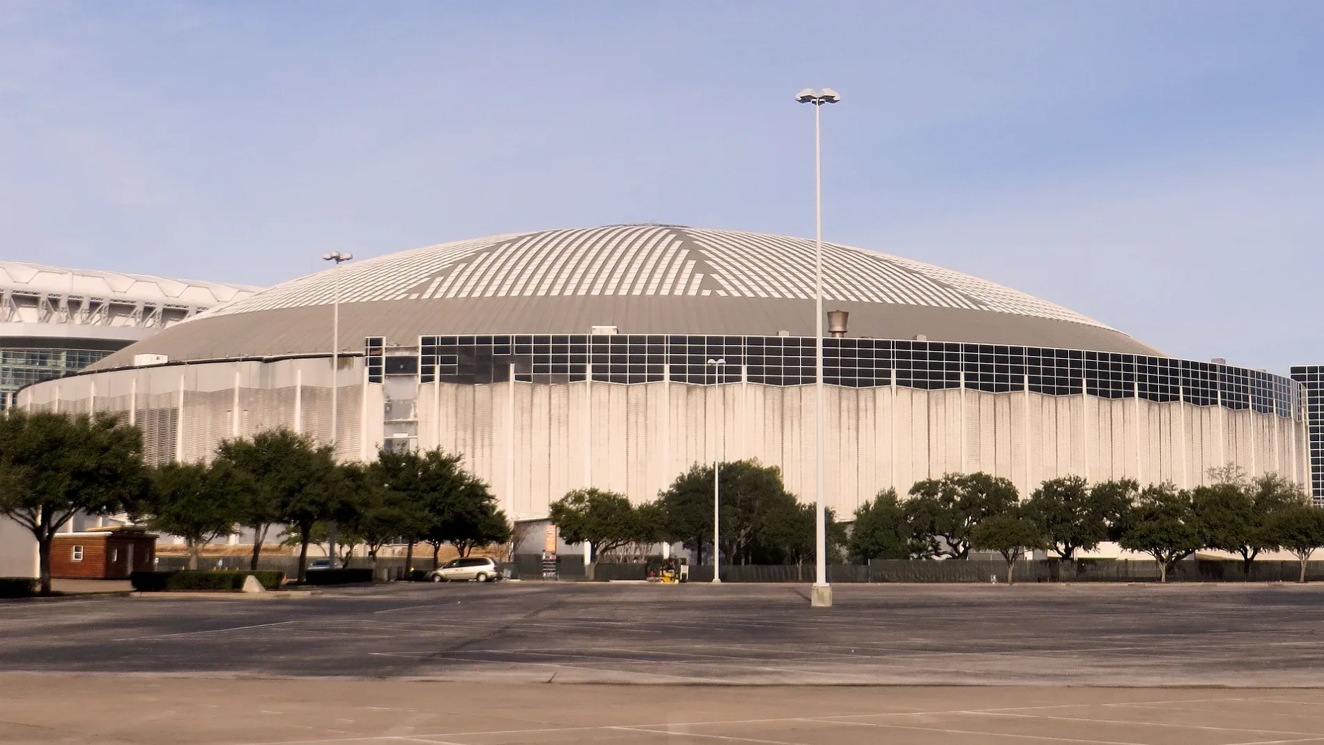
- Alternate Name
- Astrodome
- Building Type
- building
- Leisure
- stadium
Streets nearby
NRG Parkway450 ft
Holly Hall StreetSH 288
0.3 mi
Greenbriar DriveMaxim Hair Restoration, Urbach Pediatric Dentistry, Houstonian Dental, Smith Lands, Freds Italian, Shell, Japanese Ramen Gachi, Rice Village Animal Hospital, Tuesday Morning, Freebirds, Amy's Ice Creams, Bricks & Minifigs, Common Bond Bistro & Bakery
0.4 mi
Kirby DriveStone Mill Bakers, Avalon Place, Texas Children's Pediatrics, Baylor Family Practice, Texan Dental, P.A., Angelo'z, Pizza Hut, Viet's Express, Akashi Asian Sushi Cuisine & Wine Bar, The Teahouse, Sarpino's Pizzeria, Morningside Thai Restaurant, Snap Kitchen, Dimassi's Mediterranean Buffet, Russo's New York Pizza, Subway, Asahi Sushi, Sushi King, Flixbus Houston Uptown - Upper Kirby
0.4 mi
Westridge Street0.4 mi
Murworth DrivePristine Dental, Hertz, Quick Clips Hair Salon, Calliope's
0.4 mi
La Concha Lane0.4 mi
Knight RoadAvis, Circle K
0.5 mi
South Loop WestWest Loop Transit Center
0.5 mi
South Loop West Frontage RoadBurger King, Chacho's Grill, Arby's, West Loop Transit Center, McDonald's, timewise, Mobil, Brake Check, Concentra Urgent Care, License Me Driving School, UnIted Christian School
0.5 mi
Fannin StreetTexas Medical Center Transit Center, Club Quarters Hotel, Houston, Downtown, Nationwide Nail Supply Inc., Midtown, Dominion Montessori School, Fannin South, Hermann Park/Rice U, McCormick & Schmick's, The University of Texas Health Science Center, Museum District, Museum District (southbound), Stadium Park/Astrodome, Memorial Hermann Hospital/Houston Zoo, Chick-fil-A, Dryden/TMC, Wheeler Station Transit Center, Salata, Walgreens, CVS Pharmacy, Starbucks, MOD Pizza, Winner's Corner, Bleezys Smoke Shop
0.5 mi
McNee Road0.5 mi
Sarah Avenue0.5 mi
Lantern Point Drive0.6 mi
Naomi StreetAble Auto Glass
0.6 mi
North Stadium Drive0.6 mi
West RoadAirline United Methodist Church
0.6 mi
Old Spanish TrailCity G.E.A.R., Walgreens, CVS Pharmacy, Ray's BBQ Shack, OST Liquor, T&C Beauty Supply, Mane & Minks Vet Spa, Modish Ladies Apparel, Sweet Lips Cigar Lounge, On The Rocks Bar & Lounge, Vapes & Vibes, Essentials Pharmacy, Motherland Brading, Custom Loans, Clipper Barber Shop, Domino's, Metro by T-Mobile, Subway, MacGregor Park/Martin Luther King, Jr., Chipotle, Royal Nails & Spa, Five Guys, Panda Express, Louisiana Fried Chicken & Seafood, Glazed the Doughnut Cafe, Infinite Smiles Family Dentistry, The UPS Store, Liberty Taco, The Gyro Guys, The Baker's Son By Valerio's, Antonio's Grill
0.6 mi
David M. Underwood Boulevard0.7 mi
Areas nearby
NRG Park0.4 mi
Banks nearby
Capital One0.7 mi
Buildings nearby
NRG Park Warehouse0.3 mi
The Blood Center Annex0.4 mi
Conference centers nearby
NRG Center0.2 mi
Drugstores nearby
Walgreens0.7 mi
Fast food restaurants nearby
McDonald's0.6 mi
Smoothie King0.7 mi
Gas stations nearby
Circle K0.4 mi
Hotels nearby
Extended Stay America - Houston - Med. Ctr. - NRG Park - Fannin0.4 mi
Holiday Inn Houston - NRG/Medical Center Area0.4 mi
Extended Stay America - Houston - Med. Ctr. - NRG Park - Kirby0.5 mi
SpringHill Suites Houston Medical Center/NRG Park0.5 mi
Heritage Center0.5 mi
Gulf Coast Building 40.6 mi
Parks nearby
Carruth Plaza550 ft
Residential areas nearby
Revl Med Center0.4 mi
Residences at the MED0.5 mi
8181 Med Center0.5 mi
City Plaza0.5 mi
Scotland Yard0.6 mi
Algeria II0.6 mi
Briargreen Condominiums0.6 mi
Restaurants nearby
Catfish Station0.5 mi
Olive GardenTide Cleaners, Supercuts, Smallcakes Cupcakery, Tropical Smoothie Cafe, FedEx Office, European Wax Center, Wynn Nails Spa, Matsu Sushi Bar, Pho Basil Vietnamese Restaurant, Starbucks
0.6 mi
Sports centers nearby
NRG Arena0.4 mi
Houston Methodist Training Center0.5 mi
Stadiums nearby
Reliant Stadium0.3 mi
Other nearby
Stadium Substation250 ft
Fannin Substation0.3 mi
| Named after | astrodome |
|---|---|
| Year built | 1965 |
| Official opening | 1965 |
| Owned by | Harris County |
| Heritage designation | National Register of Historic Places listed place, America's Most Endangered Historic Places, Recorded Texas Historic Landmark, National Treasure, State Antiquities Landmark |
| Located in | Houston |
| Address | 8400 Kirby Drive |
| Country | United States |
| Part of | NRG Park |
Public transit map Houston Legend
| Railway | |
| Bus | |
| Streetcar |
Bicycle map Houston Legend
| Bike path | |
| Bike lane on roadway | |
| Cycling allowed on bus lane | |
| Bicycle street | |
| Open to cyclists | |
| Open to cyclists, good path | |
| Cycling prohibited | |
| Cobblestone |
| Long-distance bike route | (depending on scale) | |
| Long-distance bike route |
Pedestrian map Houston Legend
| Path |
| Long-distance hiking trail | (depending on scale) | |
| Long-distance hiking trail | ||
| Pedestrians prohibited |