
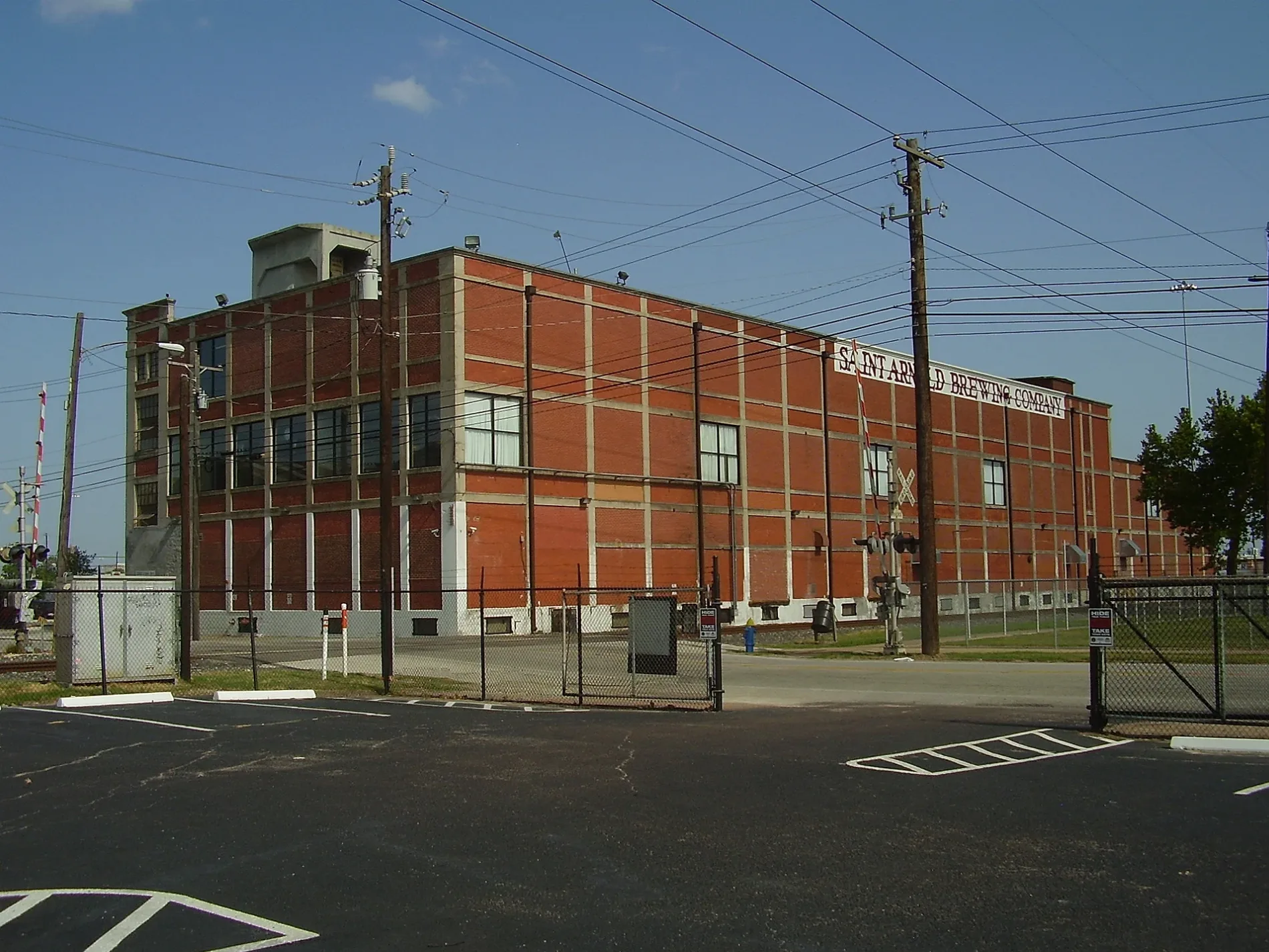
Saint Arnold Brewing Company in Houston
Saint Arnold Brewing Company in Houston ist ein Gebäude, Lyons Avenue 2000 (77020). Ⓦ.
- House Number
- 2000
- Postal Code
- 77020
- Street
- Lyons Avenue
- Building Type
- manufacture
- Website
- https://www.saintarnold.com/
Image
Schools
Bars
Stations
Places of worship
Police stations
Galleries
- Meow Wolf Houston (WLAN, Meow Wolf, opening hours: Sun–Wed 10–21; Thu–Sat 10–23, Web) at Lyons Avenue 2103 (77020) – approx. 550 ft.
Light rail stops
Bus stops
Streets nearby
Semmes StreetMeow Wolf Houston
250 ft
Maury Street450 ft
East Freeway450 ft
Lyons AvenueFirst Shiloh Baptist Church, Chase, Church of Christ, Domino's, Kim's Store, Jefferson Dental Clinic, Carrera Dental & Braces, Metro by T-Mobile, Boost Mobile, Lyons Discount Cleaners, AutoZone, Fifth Ward, Olivet Baptist Church, Toke & Poke, Little Caesars
0.2 mi
McKee Street0.3 mi
Hardy Toll Road0.3 mi
Nance StreetGoodwill Missionary Baptist Church
0.3 mi
Mc Call0.3 mi
Charles StreetSwift, Boost Mobile, Uz's Donuts, Frenchy's Chicken
0.3 mi
Chapman Street0.3 mi
Jensen DriveNew Fellowship Missionary Baptist Church, North Houston Church of Christ, Fuel Depot, Cricket Wireless, McDonald's, Greater Jerusalem Baptist Church, New Bethlehem Missionary Baptist Church, Houston Police Department - Jensen Street
0.3 mi
Sterrett StreetBisong Art Gallery
0.3 mi
Rothwell Street0.3 mi
William Street0.3 mi
Leona Street0.4 mi
Hill Road0.4 mi
West Street0.4 mi
East Freeway Frontage RoadCVS Pharmacy, Taco Cabana, Blue Bayou Cafe, Dimassi's Mediterranean Buffet, Express Fuel, Chevron, NTB-National Tire & Battery, Wells Fargo, East Side Surgery Center, Centrum Health, Sleep Center, American Health imaging, Dorsey Dental Services, Ojos Locos Sports Cantina, Motel 7, Family Thrift Center
0.4 mi
Richey Street0.4 mi
Maffitt Street0.4 mi
Clark Street0.4 mi
Providence Street0.4 mi
Grayson Street0.4 mi
Winter Street0.4 mi
Conti StreetMcCardell Academy
0.4 mi
Harrington StreetBrooks Street Junction
0.4 mi
Opelousas Street0.4 mi
Burnett StreetBad Astronaut Brewing company
0.4 mi
New Orleans StreetCarr Street Junction, Houston Fire Department Station 19, Miracle Revival Fellowship of Deliverance Church
0.4 mi
Eastex Freeway Frontage RoadCrown Inn, Palace Inn, Cart’air, Hollywood Inn, Bank of America, Harris County Sheriff's Office - DARE Program, New Sunrise Baptist Church, Regency Inn & Suites
0.4 mi
Chase Street0.5 mi
Common StreetAnawim thrift store
0.5 mi
Brooks Street0.5 mi
Elysian StreetBethany Missionary Baptist Church
0.5 mi
Hardy Street0.5 mi
Lorraine StreetChurch of God in Christ
0.5 mi
Mary Street0.5 mi
Mills Street0.5 mi
Buildings nearby
Dakota Lofts0.4 mi
Commercial buildings nearby
CenturyLink Communications0.1 mi
Parks nearby
Hennessy Park400 ft
Burnett Street Park0.4 mi
Places of worship nearby
Mount Vernon United Methodist Church0.5 mi
Pubs nearby
Gristworkz0.4 mi
Railways nearby
UP Houston West Belt Subdivision0.3 mi
Union Pacific Railroad0.4 mi
Residential areas nearby
Hardy Yards Apartment Homes0.3 mi
Hardy Yards0.3 mi
Restaurants nearby
Last Concert Cafe0.3 mi
| Year built | 1994 |
|---|---|
| Country | United States |
 Public transit map Houston Legend
| Railway | |
| Bus | |
| Streetcar |
 Bicycle map Houston Legend
| Bike path | |
| Bike lane on roadway | |
| Cycling allowed on bus lane | |
| Bicycle street | |
| Open to cyclists | |
| Open to cyclists, good path | |
| Cycling prohibited | |
| Cobblestone |
| Long-distance bike route | (depending on scale) | |
| Long-distance bike route |
 Pedestrian map Houston Legend
| Path |
| Long-distance hiking trail | (depending on scale) | |
| Long-distance hiking trail | ||
| Pedestrians prohibited |