
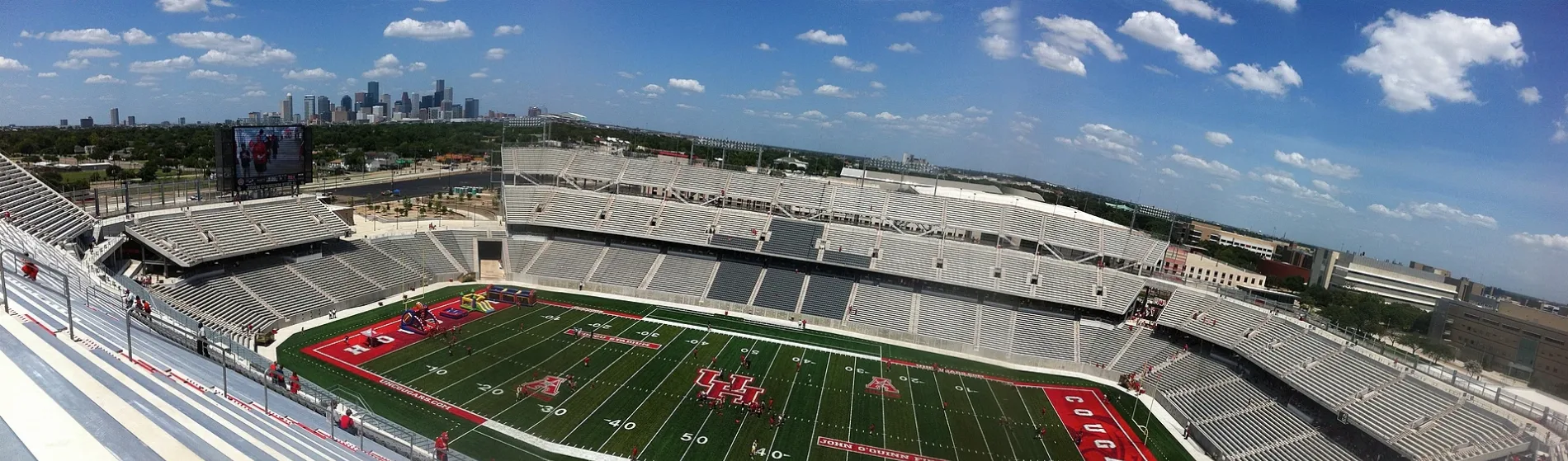
TDECU Stadium in Houston
TDECU Stadium in Houston is a stadium (American Football), Holman Street 3847 (77204) 🌐. TDECU Stadium is also known as John O'Quinn Field at TDECU Stadium. Ⓦ.
- House Number
- 3847
- Postal Code
- 77204
- Street
- Holman Street
- Leisure
- stadium
- Website
- https://uhcougars.com/
Image
Light rail stops
Restaurants
Fire stations
Clothing stores
Artworks
Fast food restaurants
Stations
Convenience stores
Streets nearby
Adair StreetSubway, Wingstop
0.1 mi
Scott StreetTSU/UH Athletics District, Sunny Side Missionary Baptist Church, Elgin/Third Ward, JB Wig, Jolla Bella, L.A. Central Nails, OST Dry Cleaners, Star Braiding, Sun Liquor, U.S. Nails, Washateria, Zen Fashion Accessories, OST Food Store, Boost Mobile, Loan Express, Princess Beauty Supply, The Medicine Shoppe, Quik Stop Market, The T-Shirt Spot, Popeyes, True Faith Church, Leeland/Third Ward, Sunnyside
0.1 mi
East Alabama Avenue0.1 mi
Holman StreetCougar, Project Row Houses
0.1 mi
Cougar PlaceUntitled, Jonah and the Whale
0.2 mi
Eagle StreetCollege Oaks, Washington Terrace
0.2 mi
Napoleon StreetBurger King
0.2 mi
SB Cullen @ Hyne Build0.2 mi
Cullen BoulevardLaredo Taco Company, EZ Backyard Bar B Q, Evangelistic Restoration Church, Houston Fire Department Station 55, Cullen Blvd @ Elgin St, Saint Francis Xavier Church, KFC, McDonald's, Popeyes, Cullen Baptist Church, Fiesta Missionary Baptist Church, Berean Missionary Baptist Church, Euphonia, Ary Stillman Collection, Mount Pilgrim Baptist Church, Minnetex, The Four Horsemen and Soho Saint
0.2 mi
Reeves StreetDomino's
0.2 mi
Canfield Street0.2 mi
Cleburne StreetCity Wide Baptist Brotherhood Church
0.2 mi
Attucks Street0.3 mi
Sampson StreetPrimetime, Southwood Oaks
0.3 mi
Sanders Street0.4 mi
Truxillo Street0.4 mi
Cobb Street0.4 mi
Rosewood StreetHouston Fire Department Station 25, Gigglin' Marlin Dive & Swim
0.4 mi
Alabama0.4 mi
Susan Ann Court0.4 mi
Tierwester StreetLiberty Baptist Church, Papa John's
0.4 mi
Wheeler StreetEvocacio Oriental, UH South/University Oaks, Shine AutoSpa Midtown, Wheeler Avenue @ Chartres Street, Circle of Peace, green seed vegan
0.4 mi
Buildings nearby
Memorial Hermann Football Operations Center100 ft
Football Indoor Practice Facility0.1 mi
Bert F. Winston Band Complex0.2 mi
Melcher Life Sciences0.2 mi
Sunrise Inn0.3 mi
Jesse H. Jones Business Building0.3 mi
Thurgood Marshall Law School Building0.4 mi
Public Affairs Building0.4 mi
Commercial areas nearby
Wallipp Preparatory Academy0.4 mi
Convenience stores nearby
BMB Food Store0.3 mi
Twee's Corner Food Store0.3 mi
Fast food restaurants nearby
Wendy's0.1 mi
Shipley Do-Nuts0.1 mi
Burger King0.1 mi
Taco Bell0.2 mi
Libraries nearby
Smith Neighborhood Library450 ft
Parking lots nearby
Cleburne Garage at Sampson0.4 mi
Places of worship nearby
Wheeler Avenue Baptist Church0.3 mi
TSU Catholic Newman Center0.3 mi
Police stations nearby
Department of Public Safety0.2 mi
Religious areas nearby
Holman Street Baptist Church0.3 mi
Residential areas nearby
Urban Academic Village0.4 mi
Restaurants nearby
Bobbie Q's Rib Shack400 ft
Lions Den Kitchen0.1 mi
Navy Seafood0.1 mi
Sports fields nearby
John O'Quinn Field350 ft
Practice Football Field0.2 mi
| Named after | Texas Dow Employees Credit Union |
|---|---|
| Located in | Houston |
| Country | United States |
 Public transit map Houston Legend
| Railway | |
| Bus | |
| Streetcar |
 Bicycle map Houston Legend
| Bike path | |
| Bike lane on roadway | |
| Cycling allowed on bus lane | |
| Bicycle street | |
| Open to cyclists | |
| Open to cyclists, good path | |
| Cycling prohibited | |
| Cobblestone |
| Long-distance bike route | (depending on scale) | |
| Long-distance bike route |
 Pedestrian map Houston Legend
| Path |
| Long-distance hiking trail | (depending on scale) | |
| Long-distance hiking trail | ||
| Pedestrians prohibited |