
West 17th Street in Georgetown, Texas
West 17th Street in Georgetown is a two-lane, asphalted local road. It runs in an east-west direction starting from Scenic Drive and crosses Bridge Street, East 17th Street, South Main Street, South Austin Avenue, South Forest Street, Hart Street, Candee Street, Leander Street and Railroad Avenue. Nearby there is a community center. West 17th Street also exists in Travis County, Harris County, Moore County, Parmer County and Bailey County.
- Road Type
- local road
- Lanes
- 2
- Speed Limit
- 30 mph
- Route
- east-west
Image
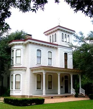
Community centers
Streets nearby
Candee Street400 ft
Stone Ciircle450 ft
South Forest StreetSynergy Holistic Esthetics LLC
0.1 mi
West 16th Street0.1 mi
Hart StreetStonehaven Senior Center
0.2 mi
West 15th Street0.2 mi
West 14th Street0.2 mi
Timber StreetJimmy Vega's Smokehouse
0.2 mi
West 13th Street0.2 mi
Scenic DriveO'Reilly Auto Parts, Domino's
0.2 mi
South Main StreetRough and Ready Antiques, The Framer's Gallery, Laurie's Cafe, All Things Kids, Ken'z Guitars & Accessories, Hydrate Juice Bar, The Escape - Fine Crafts and Gifts, Georgetown Winery and Vineyard, Kork Wine Bar, Lamppost Coffee, Razmataz Salon, Thundercloud Subs, U Wash M Laundromat
0.3 mi
West 18th Street0.3 mi
Bank Drive ThruAustin Telco Federal Credit Union
0.3 mi
Martin Luther King StreetSt Paul United Methodist Church
0.3 mi
Cyrus Avenue0.3 mi
East 16th Street0.3 mi
East 17th Street0.3 mi
Railroad AvenueThe UPS Store, Texell Credit Union
0.3 mi
Eubank Street0.3 mi
West University AvenueCAVA, Jack in the Box, Timeless Imports Furniture & Decor, Connie's Car Wash, Mattress Firm, Five Guys, Central Texas Oral Surgery & Dental Implants, Eden's Corner, Jersey Mike's Subs, Nothing Bundt Cakes, MOD Pizza, Jimmy John's, NT Hair Salon, Extra Space Storage
0.3 mi
George Street0.3 mi
West StreetSt. Paul's Chapel, First Baptist Church
0.3 mi
South Austin AvenueBrazos Market Boutique, Wildfire, Artisans Connect Gallery, The Williamson Museum, 18 Carrot Bakery, Mad Hatters Brim Shop And Shave Parlor, Fuego Latino Gastropub, Barons Creek Wine Room, Mesquite Creek Outfitters, Monument Cafe, Statue of Robert McAlpin Williamson (Three-Legged Willie), All Things New - Florals & Design by Debra, Sugar Mommy's, Wells Fargo, CVS Pharmacy, Mr T's Automotive and Inspection, Austin Avenue Animal Hospital, Lulu's Pie Shoppe, Georgetown Palace Theatre, Legacy Pools and Spas, Pro Glass
0.4 mi
West 11th StreetN4H Research, Skin Boutique by Angelique, The Glowhouse, Marisol’s Mexican Grill
0.4 mi
East University AvenueLittle Caesars, Smile Haus Modern Family Dentistry and Orthodontics, The Knitting Cup, Old Town Veterinary Hospital
0.4 mi
West 10th StreetTexas Car Title and Payday Loan, Rush Beauty Bar, Machtv
0.4 mi
South Myrtle StreetGeorgetown Outdoor Power, Western Blonde Salon
0.4 mi
Auto parts stores nearby
AutoZone0.2 mi
Auto repair shops nearby
Georgetown Oil Exchange0.4 mi
Banks nearby
Wells Fargo0.4 mi
First Texas Bank0.4 mi
Commercial buildings nearby
Main Street Baptist Church Youth Annex0.4 mi
Convenience stores nearby
Valero0.3 mi
Exxon Snack Max 20.3 mi
Fast food restaurants nearby
Golden Chick0.4 mi
Gas stations nearby
Exxon0.3 mi
Houses nearby
Secret Siren Photography0.2 mi
Motels nearby
Budget Inn0.2 mi
Parks nearby
Kelly Park550 ft
Old Town Park0.2 mi
Pawn shops nearby
National Pawn and Jewelry0.3 mi
Places of worship nearby
Iglesia El Buen Pastor (EBP)300 ft
Friendly Will Missionary Baptist0.2 mi
Residential areas nearby
The Rail at Georgetown500 ft
Georgian Apartments0.2 mi
Restaurants nearby
Dos Salsas0.4 mi
Tony And Luigi's Ristorante0.4 mi
Retail buildings nearby
Flooring Warehouse0.3 mi
Tire dealers nearby
Whitestone Tire Center0.4 mi
 Public transit map Georgetown Legend
| Railway | |
| Bus | |
| Streetcar |
 Bicycle map Georgetown Legend
| Bike path | |
| Bike lane on roadway | |
| Cycling allowed on bus lane | |
| Bicycle street | |
| Open to cyclists | |
| Open to cyclists, good path | |
| Cycling prohibited | |
| Cobblestone |
| Long-distance bike route | (depending on scale) | |
| Long-distance bike route |
 Pedestrian map Georgetown Legend
| Path |
| Long-distance hiking trail | (depending on scale) | |
| Long-distance hiking trail | ||
| Pedestrians prohibited |