
Myrtle Avenue in Salt Lake City
Myrtle Avenue in Salt Lake City is a service road and runs in an east-west direction starting from Main Street and ends at East Avenue.
- Road Type
- service road
- Route
- east-west
Image
Streets nearby
Prospect Avenue300 ft
Maple Avenue350 ft
Cascade Avenue400 ft
Cypress Avenue500 ft
East Avenue0.1 mi
Main Street0.1 mi
West Avenue0.1 mi
Acacia Avenue0.1 mi
600 South0.1 mi
500 South500 South / VA Hospital (WB), 500 South / VA Hospital (EB)
0.2 mi
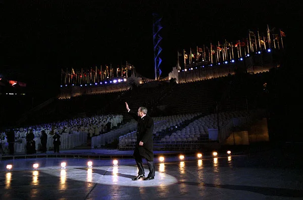
Olympic and Paralympic Cauldron Plaza0.2 mi
1400 East0.2 mi
Masonic Avenue0.2 mi
1300 East1300 East @ 544 South, 1300 East @ 698 South, First Baptist Child Development Center, 1300 East @ 794 South, 1300 East @ 401 South, 1300 East @ 480 South, 1300 East @ 525 South, B&D Burger, McInnes Dry Cleaning, Rio Grande Cafe, Indochine Vietnamese Bistro, Yellow Rose, 1300 East @ 673 South
0.2 mi
Colonial Place0.2 mi
Guardsman WayGuardsman Way / 600 South (NB), Guardsman, Guardsman Way / 500 South (SB), Guardsman Way / 600 South (SB), Guardsman Way / 700 South (NB), Guardsman Way / Sunnyside Avenue (SB)
0.3 mi
700 South0.3 mi
1580 East0.3 mi
South Campus DriveHuntsman Basketball Facility, U South Campus Station (WB), U Social Work Building (EB), University South Campus, Swoop, U South Campus Station (EB), The Meldrum Theatre, Directory - South Canpus, U Museum of Fine Arts (EB), U Museum of Fine Arts (WB), U Social Work Building (WB)
0.3 mi
University StreetStadium, U Presidents' Circle (SB Stop A), U Presidents' Circle (NB Stop B), Stadium Station (SB), College of Law, U President's Circle (NB Stop D), FedEx Office, Publik Ed's, U President's Circle (SB Stop C), Stadium Station (NB), 300 South
0.3 mi
1500 EastUTECH, Starbucks, Canyon View Credit Union, Block U
0.3 mi
1530 East0.3 mi
400 South400 South / 900 East (EB), 400 South / 900 East (WB), 400 South / 700 East (WB), Chipotle, Chuck-a-Rama, The Fault Line Cafe, 900 East
0.3 mi
Apartment buildings nearby
Friendship Manor0.2 mi
The Summit0.3 mi
Buildings nearby
Transformer Building0.2 mi
Stadium Substation0.3 mi
Cemeteries nearby
Mount Olivet Cemetery0.2 mi
Gardens nearby
Nuh Eevaat Garden0.4 mi
Light rail lines nearby
Red Line0.3 mi
Places of worship nearby
First Unitarian Church of Salt Lake City0.2 mi
Playgrounds nearby
Dog Run0.2 mi
Residential buildings nearby
The Bungalow0.2 mi
Service buildings nearby
University Substation0.2 mi
Sports centers nearby
Dee Glen Smith Athletic Center0.2 mi
Spencer Eccles Field House0.2 mi
George S. Eccles Tennis Center0.2 mi
Sports fields nearby
Rice Eccles Football Field0.2 mi
Stadiums nearby
Rice-Eccles Stadium0.3 mi
Ticket offices nearby
University of Utah Ticket Office0.1 mi
University buildings nearby
S J Quinney College of Law0.3 mi
Einar Nielsen Fieldhouse0.3 mi
Thatcher Chemistry Building0.3 mi
Social Work0.4 mi
Social & Behavioral Science Lecture Hall0.4 mi
Building 720.4 mi
Warehouses nearby
Plumbing Shop Building0.3 mi
Library Storage0.3 mi
Waters nearby
Mount Olivet Reservoir0.2 mi
Public transit map Salt Lake City Legend
| Railway | |
| Bus | |
| Streetcar |
Bicycle map Salt Lake City Legend
| Bike path | |
| Bike lane on roadway | |
| Cycling allowed on bus lane | |
| Bicycle street | |
| Open to cyclists | |
| Open to cyclists, good path | |
| Cycling prohibited | |
| Cobblestone |
| Long-distance bike route | (depending on scale) | |
| Long-distance bike route |
Pedestrian map Salt Lake City Legend
| Path |
| Long-distance hiking trail | (depending on scale) | |
| Long-distance hiking trail | ||
| Pedestrians prohibited |