
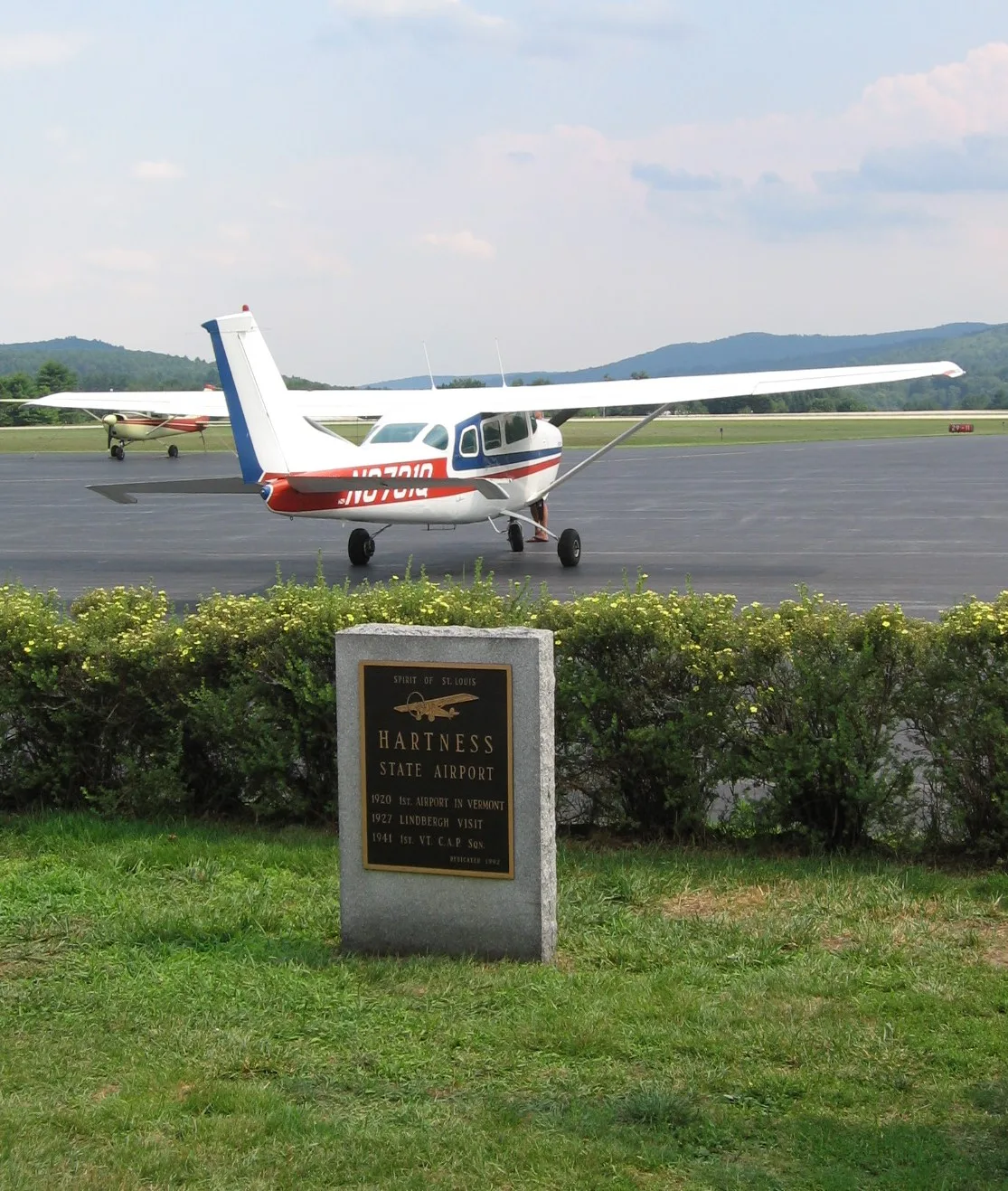
Hartness State Airport in Weathersfield, Vermont
Hartness State Airport in Weathersfield is an airfield (IATA: VSF, ICAO: KVSF). Hartness State Airport is also known as VSF. Ⓦ.
- Operator
- State of Vermont
Cemeteries
Convenience stores
Viewpoints
Schools
Restaurants
Streets nearby
Blue Trail0.3 mi
Red Trail0.4 mi
North Runway Road0.4 mi
Green Trail0.6 mi
Soaring Pines Drive0.6 mi
Reservoir Road0.6 mi
Kendricks Corner Road0.7 mi
Drumlin Road0.7 mi
Airport Road0.8 mi
Bean Hill Road0.8 mi
Butterfield Hill Road0.9 mi
John Jensen Road0.9 mi
Grout Lane0.9 mi
Butterfield Hill0.9 mi
Vermont Route 106Greenbush Cemetery, Perkinsville
1.0 mi
Gurney Road1.0 mi
Kiernan Road1.0 mi
Pine Pitch1.0 mi
Maple Street1.0 mi
Chimney Ridge1.1 mi
Lyons Drive1.1 mi
Murray Road1.2 mi
Black Birch Lane1.2 mi
Titcomb Covered Bridge1.3 mi
Leland Avenue1.3 mi
River StreetSmith's clothespin, New Nails, Kwik Stop
1.3 mi
Piper Road1.3 mi
Boynton Drive1.3 mi
Giddings StreetNorth Springfield
1.3 mi
Jack And Jill Lane1.3 mi
Clark Street1.3 mi
Martin Court1.4 mi
Pierce Road1.4 mi
Old Center Street1.5 mi
Sugar Lot Court1.5 mi
High Street1.5 mi
Stoughton Pond Road1.6 mi
Church Street1.6 mi
Mill Road1.6 mi
Cemeteries nearby
Grout Cemetery0.5 mi
Dams nearby
North Springfield Dam0.9 mi
Springfield Reservoir Dam1.0 mi
Hotels nearby
Inn at Weathersfield1.1 mi
Places of worship nearby
Precision Valley Baptist Church1.2 mi
Perkinsville community church1.6 mi
Residential areas nearby
Pine Brook Condominiums1.2 mi
Rivers nearby
Black River1.1 mi
School buildings nearby
Perkinsville Elementary School1.4 mi
Wholesale stores nearby
Black River Produce1.3 mi
| Named after | James Hartness |
|---|---|
| Elevation | 577 |
| Located in | Springfield |
| Country | United States |
 Public transit map Weathersfield Legend
| Railway | |
| Bus | |
| Streetcar |
 Bicycle map Weathersfield Legend
| Bike path | |
| Bike lane on roadway | |
| Cycling allowed on bus lane | |
| Bicycle street | |
| Open to cyclists | |
| Open to cyclists, good path | |
| Cycling prohibited | |
| Cobblestone |
| Long-distance bike route | (depending on scale) | |
| Long-distance bike route |
 Pedestrian map Weathersfield Legend
| Path |
| Long-distance hiking trail | (depending on scale) | |
| Long-distance hiking trail | ||
| Pedestrians prohibited |