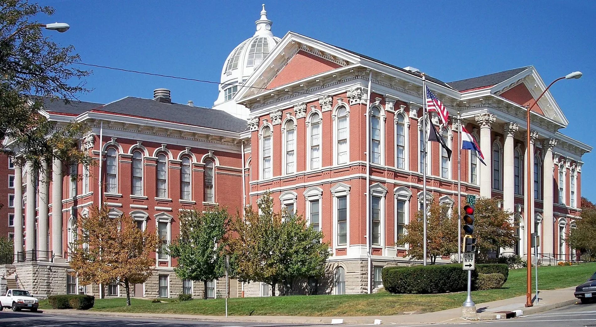
Virginia

This page is the City map of Virginia, a map with streets, paths and places across the state of the United States. Virginia covers around 110,862 square kilometres and had 8,631,393 residents in 2020, compared with 8,001,024 in 2010. The state was founded in 1788 and reaches an elevation of about 290 metres in the supplied regional data. The map includes independent cities, counties and smaller settlements such as Suffolk, Roanoke, Alexandria, Norfolk, Charlottesville and Winchester; five long-distance cycling routes, including the East Coast Greenway, cross Virginia.

City map Virginia
Earth Science and Remote Sensing Unit , Lyndon B. Johnson Space Center, Public domain – Wikimedia Commons
City map Suffolk
Umbra Lab, Inc., CC BY 4.0 – Wikimedia Commons

Suffolk

Suffolk is an independent city in Virginia with 94,324 residents. Its mapped area is 1,110,863,244 square metres, and the recorded elevation is 11 metres.

Suffolk was established as a settlement in 1742 and lies in the southeastern part of Virginia. The city is associated with the coastal plain and the waterways of the Hampton Roads region.

City map Roanoke
Jazmin Quaynor jazminantoinette, CC0 – Wikimedia Commons

Roanoke

Roanoke is an independent city with 100,011 residents and an area of 111,024,283 square metres. The city stands at a recorded elevation of 297 metres.

Roanoke was established in 1852 in the Roanoke Valley of southwestern Virginia. The Roanoke River runs through the wider metropolitan area, which lies near the Blue Ridge and Appalachian Mountains.

Belle Haven

Belle Haven is recorded as an administrative level 8 subdivision in Virginia. The locality is in Fairfax County on the Potomac River, south of Alexandria.

Its position in Northern Virginia places it within the Washington metropolitan area. The nearby Potomac shoreline and the historic Mount Vernon area are significant geographic references.

City map Petersburg
Drew Coffman drewcoffman, CC0 – Wikimedia Commons

Petersburg

Petersburg is an independent city with 33,458 residents and an area of 60,044,686 square metres. Its recorded elevation is 40 metres, and the city was established in 1748.

The city stands at the fall line of the Appomattox River in central Virginia. Petersburg National Battlefield preserves sites connected with the American Civil War siege of 1864 and 1865.

City map Colonial Heights
Nyttend, Public domain – Wikimedia Commons

Colonial Heights

Colonial Heights is an independent city with 18,170 residents and a mapped area of 20,238,333 square metres. The recorded elevation is 29 metres.

The city lies on the south bank of the Appomattox River opposite Petersburg. Its location connects the Richmond metropolitan area with the historic river corridor of central Virginia.

City map Manassas Park
Mojo Hand, CC BY-SA 4.0 – Wikimedia Commons

Manassas Park

Manassas Park is an administrative level 6 city in Northern Virginia. It is situated in Prince William County near the Bull Run stream.

The city forms part of the Washington metropolitan area and is adjacent to Manassas. The nearby Manassas National Battlefield Park preserves sites from the First and Second Battles of Bull Run.

City map Alexandria
Ben Schumin, CC BY-SA 3.0 – Wikimedia Commons

Alexandria

Alexandria is an independent city with 160,035 residents on the Potomac River. It is directly south of Washington, D.C., and belongs to the urbanized Northern Virginia region.

Old Town Alexandria contains buildings dating from the 18th and 19th centuries. The city was founded in 1749 and includes the historic waterfront and the former torpedo factory complex.

St. Paul

St. Paul is recorded as an administrative level 8 locality in southwestern Virginia. It lies in the Appalachian region near the Clinch River.

The town is associated with Russell and Wise counties and the rugged valleys of the southern Appalachian Mountains. U.S. Route 58 provides a major east-west connection through the surrounding area.

City map Falls Church
Ser Amantio di Nicolao, CC BY-SA 3.0 – Wikimedia Commons

Falls Church

Falls Church is an independent city in Northern Virginia. It is surrounded largely by Fairfax County and lies a short distance west of Washington, D.C.

The city takes its name from The Falls Church, an Episcopal church whose congregation dates to the 18th century. Its urban area is connected with the Four Mile Run watershed.

City map Waynesboro
Nyttend, Public domain – Wikimedia Commons

Waynesboro

Waynesboro is an independent city with 22,196 residents and an area of 39,338,150 square metres. The recorded elevation is 392 metres, and the settlement was established in 1798.

The city lies in the Shenandoah Valley along the South River. The Blue Ridge Mountains rise immediately to the east, with Shenandoah National Park beginning farther north along the ridge.

City map Lynchburg
Wesley Nifong wdnifong, CC0 – Wikimedia Commons

Lynchburg

Lynchburg is an independent city with 79,009 residents and a mapped area of 128,584,744 square metres. Its recorded elevation is 192 metres, and its inception dates to 1786.

The city extends along the James River in central Virginia. Lynchburg is known for its steep historic districts and for its connection with Thomas Road Baptist Church and Liberty University.

City map Virginia Beach
Ravali Yan ravali, CC0 – Wikimedia Commons

Virginia Beach

Virginia Beach is an independent coastal city with 459,470 residents and an area of 1,288,515,927 square metres. The recorded elevation is 7 metres, and the city was established in 1906.

Its Atlantic shoreline and the Chesapeake Bay place Virginia Beach at the eastern end of the Hampton Roads region. Back Bay National Wildlife Refuge and False Cape State Park occupy the southern coastal area.

City map Chesapeake
US Army Corps of Engineers, photographer not specified, Public domain – Wikimedia Commons

Chesapeake

Chesapeake is an independent city in southeastern Virginia. Its territory extends from the urban Hampton Roads area southward to rural landscapes near the North Carolina border.

The city includes the Great Dismal Swamp, a large wetland shared with North Carolina. The Elizabeth River and the Intracoastal Waterway connect Chesapeake with Norfolk and Portsmouth.

City map Norfolk
United States Navy, Public domain – Wikimedia Commons

Norfolk

Norfolk is an independent city with 238,005 residents and an area of 249,682,967 square metres. The recorded elevation is 10 metres, and the city was established in 1682.

Norfolk lies on the Elizabeth River and the Chesapeake Bay in Hampton Roads. Naval Station Norfolk is the world’s largest naval station by installation area and supports the city’s major maritime function.

City map Portsmouth
Kristopher Roller krisroller, CC0 – Wikimedia Commons

Portsmouth

Portsmouth is an independent city with 97,915 residents and an area of 120,906,491 square metres. Its recorded elevation is 6 metres, and the city was established in 1752.

The city occupies the southern side of the Elizabeth River opposite Norfolk. The Norfolk Naval Shipyard, founded in 1767, is located in Portsmouth and remains a major historic industrial site.

City map Williamsburg
Thought Catalog thoughtcatalog, CC0 – Wikimedia Commons

Williamsburg

Williamsburg is an independent city with 15,425 residents and an area of 23,514,674 square metres. The recorded elevation is 15 metres, and the city was established in 1638.

Williamsburg was the capital of the Virginia Colony from 1699 to 1780. Colonial Williamsburg, the College of William & Mary and the restored Capitol form the city’s best-known historic complex.

City map Buena Vista
Carol M. Highsmith, Public domain – Wikimedia Commons

Buena Vista

Buena Vista is an independent city in the Shenandoah Valley of western Virginia. It lies along the Maury River near the eastern edge of the Blue Ridge Mountains.

The city is adjacent to Rockbridge County and near Lexington. The surrounding landscape includes forested mountain slopes and the James River watershed.

City map Harrisonburg
Boston Public Library, CC BY 2.0 – Wikimedia Commons

Harrisonburg

Harrisonburg is an independent city with 51,814 residents and an area of 45,039,717 square metres. Its recorded elevation is 404 metres, and the city was established in 1779.

The city lies in the Shenandoah Valley along the North River. James Madison University is located in Harrisonburg, which also serves as a regional centre for Rockingham County.

Saltville

Saltville is an administrative level 8 locality in southwestern Virginia. It lies in Smyth and Washington county territory near the North Fork Holston River.

The locality is known for historic salt extraction from underground brine deposits. Fossil discoveries in the Saltville Valley include remains of Ice Age mammals such as mammoths.

City map Lexington
Chris Abney chrisabney, CC0 – Wikimedia Commons

Lexington

Lexington is an independent city in the Shenandoah Valley of western Virginia. It lies near the Maury River and the southern end of the George Washington National Forest.

Washington and Lee University and the Virginia Military Institute are located in Lexington. General Robert E. Lee is buried at Lee Chapel on the Washington and Lee campus.

City map Manassas
usarmyband, Public domain – Wikimedia Commons

Manassas

Manassas is an independent city with 42,772 residents and an area of 25,729,594 square metres. The recorded elevation is 93 metres, and the city was established in 1975.

The city is in Northern Virginia near Bull Run. The surrounding Manassas National Battlefield was the site of two major Civil War battles in 1861 and 1862.

City map Fairfax
Idawriter, CC BY-SA 3.0 – Wikimedia Commons

Fairfax

Fairfax is an independent city with 24,146 residents and an area of 16,252,178 square metres. Its recorded elevation is 95 metres, and its inception dates to 1805.

The city is surrounded by Fairfax County and forms part of the Washington metropolitan area. Historic Fairfax Courthouse marks the centre of the city and reflects its 19th-century administrative role.

Brodnax

Brodnax is an administrative level 8 town in southern Virginia. It lies in Brunswick and Mecklenburg county territory near the Roanoke River basin.

The locality is close to the North Carolina state line and to U.S. Route 58. Its surrounding landscape belongs to Virginia’s southern Piedmont.

Pamplin City

Pamplin City is an administrative level 8 locality in central Virginia. It lies in Appomattox and Prince Edward county territory near the Appomattox River watershed.

The town is connected with the former railway corridors of the central Piedmont. Appomattox Court House National Historical Park lies east of the locality.

Farmville

Farmville is an administrative level 8 town in Prince Edward County. It stands on the Appomattox River in the central Virginia Piedmont.

Scottsville

Scottsville is an administrative level 8 town on the James River in southern Albemarle County. The locality lies southeast of Charlottesville in the central Piedmont.

The James River formed the historic transport corridor through Scottsville. Nearby roads connect the town with Buckingham, Fluvanna and Albemarle counties.

Grottoes

Grottoes is a settlement with 2,899 residents and an area of 5,317,148 square metres. Its recorded elevation is 339 metres.

The town lies in the Shenandoah Valley near the South River. It is situated between Harrisonburg and Waynesboro, with the Blue Ridge Mountains east of the community.

Jarratt

Jarratt is an administrative level 8 town in southern Virginia. It extends across Greensville and Sussex county territory near the Nottoway River.

The town is located along the railway and Interstate 95 corridor between Petersburg and Emporia. The surrounding region belongs to Virginia’s coastal plain.

City map Emporia
Fred Harvey, Public domain – Wikimedia Commons

Emporia

Emporia is an independent city with 5,766 residents and an area of 18,037,146 square metres. The recorded elevation is 39 metres, and the city was established in 1967.

Emporia lies between the Meherrin River and the North Carolina border. Interstate 95 and U.S. Route 58 meet near the city, making it a transport centre in southern Virginia.

City map Winchester
Todd Cravens toddcravens, CC0 – Wikimedia Commons

Winchester

Winchester is an independent city with 28,120 residents and an area of 23,971,623 square metres. Its recorded elevation is 221 metres, and the city was established in 1752.

The city lies in the northern Shenandoah Valley near the Opequon Creek. Winchester was a major Civil War site and is associated with the historic stone buildings of Old Town.

City map Loudoun County
Umbra Lab, Inc., CC BY 4.0 – Wikimedia Commons

Loudoun County

Loudoun County has 420,959 residents and a recorded area of 1,350,000,000 square metres. The county was established in 1757 in Northern Virginia.

Its eastern area belongs to the Washington metropolitan region, while the western landscape reaches the Blue Ridge Mountains. The Potomac River forms much of the county’s northern boundary with Maryland.

City map Fairfax County
John Sulu, CC BY-SA 4.0 – Wikimedia Commons

Fairfax County

Fairfax County has 1,150,309 residents and an area of 1,053,000,000 square metres. It was established in 1742 and surrounds several independent cities, including Fairfax and Falls Church.

The county lies between the Potomac River and the Occoquan River. Tysons, Reston and George Mason University are major urban and institutional places within its territory.

City map Arlington County
Theodore Christopher, CC0 – Wikimedia Commons

Arlington County

Arlington County has 234,965 residents and is directly across the Potomac River from Washington, D.C. It is an urban county in Northern Virginia.

Arlington National Cemetery occupies a prominent site on the Potomac shore. The county also contains the Pentagon and the Rosslyn urban district.

City map Prince William County
Billy Hathorn, CC BY-SA 3.0 – Wikimedia Commons

Prince William County

Prince William County has 482,204 residents and an area of 902,000,000 square metres. The county was established in 1731 in Northern Virginia.

The Potomac River forms the county’s eastern boundary, while Bull Run crosses its northern area. Manassas and Manassas Park are independent cities within or adjacent to the county’s urban corridor.

City map Northumberland County
Taber Andrew Bain, CC BY 2.0 – Wikimedia Commons

Northumberland County

Northumberland County has 11,839 residents and an area of 740,000,000 square metres. It was established in 1648 on Virginia’s Northern Neck.

The county lies between the Potomac River and the Rappahannock River, which reach Chesapeake Bay through separate estuaries. Its landscape includes tidal creeks and rural coastal plain.

City map Stafford County
Mojo Hand, CC BY-SA 3.0 – Wikimedia Commons

Stafford County

Stafford County has 156,927 residents and an area of 725,000,000 square metres. The county was established in 1664 along the lower Potomac River.

Fredericksburg borders Stafford County to the south, while the Potomac forms its eastern boundary. Aquia Creek and the Marine Corps Base Quantico are prominent geographic references in the county.

City map King George County
Mojo Hand, CC BY-SA 3.0 – Wikimedia Commons

King George County

King George County has 26,723 residents and an area of 486,000,000 square metres. It was established in 1720 on the Northern Neck of Virginia.

The county is bounded by the Potomac River to the north and the Rappahannock River to the south. Dahlgren lies on the Potomac and contains the Naval Surface Warfare Center Dahlgren Division.

City map Accomack County
Calvin Beale, Public domain – Wikimedia Commons

Accomack County

Accomack County has 32,973 residents and occupies the northern part of Virginia’s Eastern Shore. The county lies on a peninsula between the Chesapeake Bay and the Atlantic Ocean.

Its barrier islands include Assateague Island, which extends into Maryland. The Atlantic coast and Chesapeake Bay create extensive tidal marshes and maritime habitats across the county.

City map Clarke County
Calvin Beale, Public domain – Wikimedia Commons

Clarke County

Clarke County has 14,783 residents and an area of 462,000,000 square metres. It was established in 1836 in the northern Shenandoah Valley.

The county borders the Potomac River and Maryland to the north. Berryville is the county seat, and the Blue Ridge Mountains form the eastern edge of the valley.

Fauquier County

Fauquier County has 72,972 residents and an area of 1,687,000,000 square metres. The county was established in 1759 in northern Virginia.

The Blue Ridge Mountains form its western boundary, while the Piedmont extends east toward the Washington metropolitan region. The Rappahannock River crosses the county’s southern area.

City map Frederick County
US Census Bureau, Public domain – Wikimedia Commons

Frederick County

Frederick County has 91,419 residents and an area of 1,076,000,000 square metres. It was established in 1743 in the northern Shenandoah Valley.

Winchester is an independent city within the county’s urban area. The county includes the Opequon Creek valley and borders West Virginia along the Potomac River.

City map Fredericksburg
James Barker barkernotbaker, CC0 – Wikimedia Commons

Fredericksburg

Fredericksburg is an independent city with 27,982 residents and an area of 27,220,477 square metres. Its recorded elevation is 18 metres, and it was established in 1691.

The city stands on the Rappahannock River between Washington, D.C., and Richmond. Fredericksburg’s historic district and the Fredericksburg and Spotsylvania National Military Park preserve sites from the Revolutionary and Civil wars.

City map Louisa County
Nyttend, Public domain – Wikimedia Commons

Louisa County

Louisa County has 37,596 residents and an area of 1,323,000,000 square metres. The county was established in 1742 in central Virginia.

The county lies between Charlottesville and Richmond and includes Lake Anna, a large reservoir on the North Anna River. The historic Mineral area is located in the western part of the county.

City map Orange County
Capella Space, CC BY 4.0 – Wikimedia Commons

Orange County

Orange County has 36,254 residents and an area of 889,000,000 square metres. It was established in 1734 in central Virginia.

The county reaches from the Piedmont toward the Blue Ridge Mountains. Montpelier, the former home of James Madison, is located near Orange and is a nationally significant historic estate.

City map Spotsylvania County
Calvin Beale, Public domain – Wikimedia Commons

Spotsylvania County

Spotsylvania County has 140,032 residents and an area of 1,068,000,000 square metres. Its recorded elevation is 94 metres, and the county was established in 1721.

The county surrounds much of Fredericksburg’s southern and western area. Spotsylvania contains major Civil War sites, including the Battle of Spotsylvania Court House battlefield.

City map Warren County
Dougtone, CC BY-SA 2.0 – Wikimedia Commons

Warren County

Warren County has 40,727 residents and was established in 1836 in the northern Shenandoah Valley. The county lies at the junction of the Shenandoah and South Fork Shenandoah rivers.

Front Royal is the county seat and the northern gateway to Shenandoah National Park. Skyline Drive begins near Front Royal and follows the crest of the Blue Ridge Mountains.

City map Lee County
Capella Space, CC BY 4.0 – Wikimedia Commons

Lee County

Lee County has 24,742 residents in the southwestern tip of Virginia. The county borders Kentucky to the northwest and Tennessee to the south.

The Powell River crosses the county, and the surrounding terrain belongs to the Cumberland Mountains. Cumberland Gap National Historical Park lies nearby at the Virginia-Kentucky-Tennessee junction.

City map Charlottesville
Billy Hathorn, CC BY-SA 3.0 – Wikimedia Commons

Charlottesville

Charlottesville is an independent city with 46,553 residents and an area of 26,569,159 square metres. Its recorded elevation is 181 metres, and the city was established in 1762.

The University of Virginia, founded by Thomas Jefferson in 1819, is located in Charlottesville and is a UNESCO World Heritage Site. Jefferson’s Monticello stands southeast of the city and is also part of the UNESCO designation.

City map Alleghany County
Upstateherd, CC BY-SA 4.0 – Wikimedia Commons

Alleghany County

Alleghany County has 15,223 residents and an area of 1,162,000,000 square metres. It was established in 1822 in western Virginia.

The county lies in the Allegheny Mountains near the Jackson River. Covington is the principal city in the surrounding region, which connects the Shenandoah and New River watersheds.

City map Amherst County
Nyttend, Public domain – Wikimedia Commons

Amherst County

Amherst County has 31,307 residents and an area of 1,240,000,000 square metres. The county was established in 1758 along the eastern flank of the Blue Ridge Mountains.

The James River forms much of the county’s northern boundary, while the Tye River drains the western hills. Amherst lies northeast of Lynchburg in the central Virginia Piedmont.

City map Bath County
Nyttend, Public domain – Wikimedia Commons

Bath County

Bath County has 4,209 residents and an area of 1,384,000,000 square metres. It was established in 1790 in western Virginia.

The county is located in the Allegheny Mountains and includes the headwaters of the Jackson River. Hot Springs is known for The Omni Homestead Resort, whose history reaches back to the 18th century.

City map Bedford County
Unknown author Unknown author or not provided, Public domain – Wikimedia Commons

Bedford County

Bedford County has 79,462 residents and an area of 1,992,000,000 square metres. The county was established in 1753 in central Virginia.

Smith Mountain Lake extends across the county and is formed by the Roanoke River. The Peaks of Otter rise along the Blue Ridge Mountains in the northern part of Bedford County.

Bland County

Bland County has 6,270 residents and an area of 929,000,000 square metres. It was established in 1861 in southwestern Virginia.

The county lies in the Appalachian Mountains near the New River. Interstate 77 crosses Bland County through a mountainous corridor between Wytheville and West Virginia.

City map Botetourt County
Bruce Harms, Photographer, Public domain – Wikimedia Commons

Botetourt County

Botetourt County has 33,596 residents and an area of 1,414,000,000 square metres. The county was established in 1769 near the southern end of the Shenandoah Valley.

The James River and the Maury River drain parts of the county, while the Blue Ridge and Allegheny Mountains surround its valleys. Fincastle is the historic county seat.

City map Buchanan County
Tim Kiser ( w:User:Malepheasant ), CC BY-SA 2.5 – Wikimedia Commons

Buchanan County

Buchanan County has 20,355 residents and an area of 1,305,000,000 square metres. It was established in 1858 in the coal-producing Appalachian region.

The county lies along the headwaters of the Levisa Fork of the Big Sandy River. Grundy is the county seat, and steep ridges define much of the local terrain.

City map Campbell County
Nyttend, Public domain – Wikimedia Commons

Campbell County

Campbell County has 55,696 residents and an area of 1,314,000,000 square metres. The county was established in 1782 in the central Piedmont.

Lynchburg borders Campbell County to the north, and the Staunton River forms part of its southern boundary. The county extends across the James River drainage basin.

City map Carroll County
National Park Service photographer, Public domain – Wikimedia Commons

Carroll County

Carroll County has 29,724 residents in southwestern Virginia. It lies on the Blue Ridge plateau near the North Carolina border.

The New River forms a major drainage corridor west of the county, while the Blue Ridge Parkway passes nearby. Galax is an independent city adjacent to Carroll County.

City map Craig County
Nyttend, Public domain – Wikimedia Commons

Craig County

Craig County has 4,892 residents and an area of 856,000,000 square metres. The county was established in 1851 in the Appalachian Mountains.

The county lies northwest of Roanoke and includes valleys drained by Craig Creek. Jefferson National Forest covers substantial mountainous areas around Craig County.

City map Dickenson County
Dickenson, Lilburn, Public domain – Wikimedia Commons

Dickenson County

Dickenson County has 14,124 residents and an area of 864,000,000 square metres. It was established in 1880 in southwestern Virginia.

The county lies in the coalfields of the Appalachian Mountains near the Kentucky border. The McClure River and Pound River are important waterways in the surrounding watershed.

City map Floyd County
Nyttend, Public domain – Wikimedia Commons

Floyd County

Floyd County has 15,476 residents and an area of 987,000,000 square metres. It was established in 1831 on the Blue Ridge plateau.

The county lies southeast of Roanoke and includes headwaters of the Little River. The Blue Ridge Parkway runs near Floyd County, connecting the region with North Carolina.

Data sources: OpenStreetMap (ODbL), Wikidata (CC0) · Image: Wikimedia Commons

Virginia – Facts

Population 8631393
Area 110862 km²
Subregions 133
Named after Colony of Virginia
Year built 1788
Elevation 290 m
Located in United States
Country United States
Body of water Atlantic Ocean
Nickname Old Dominion
Native name Virginia
Official name Commonwealth of Virginia
Described by Armenian Soviet Encyclopedia, Otto's encyclopedia, Brockhaus and Efron Encyclopedic Dictionary, Jewish Encyclopedia of Brockhaus and Efron, The Nuttall Encyclopædia, 1922 Encyclopædia Britannica, Encyclopædia Britannica 11th edition, The American Cyclopædia, Collier's New Encyclopedia, 1921, The New Student's Reference Work, New International Encyclopedia
Part of contiguous United States, South Atlantic states
Website https://www.virginia.gov/

Data source: Wikidata (CC0)

Streets in Virginia