
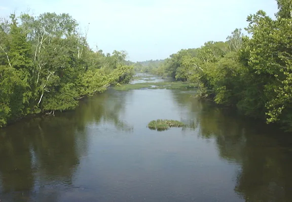
Appomattox River in Cumberland County, Virginia
Appomattox River in Cumberland County is a river. Appomattox River is also known as Apamatuck River. Appomattox River also exists in Petersburg, Amelia County, Appomattox County, Dinwiddie County and Prince Edward County. Ⓦ.
- Waterway Type
- river
Image
Fast food restaurants
Places of worship
Streets nearby
River RoadGreen Creek Church
0.8 mi
West Bunker Hill Road1.5 mi
Cherry Grove Lane1.5 mi
Rockhouse Road1.7 mi
Jamestown Road2.0 mi
Ligontown Road2.0 mi
Bell Road2.2 mi
Smokey Lane2.2 mi
Richard Lane2.2 mi
High Hill RoadStoddert
2.3 mi
Oak View Drive2.5 mi
Lockett RoadMacedonia Church, Lockett House, Double Bridges, Jamestown Church
2.6 mi
Crowder Road2.6 mi
Stonewall Drive2.7 mi
Ashwood Road3.1 mi
Curtin Lane3.2 mi
Duker Road3.2 mi
Reed Rock RoadAmelia County Fire Services Coordinator
3.2 mi
Garnett Road3.3 mi
James Town RoadHolt's Corner
3.4 mi
Angola Lane3.5 mi
Thompson Road3.5 mi
Apricot Lane3.6 mi
Guinea RoadCotton Town, Centenary Church, Guinea Church, Midway Church
3.6 mi
East Sayler's Creek RoadDeatonville
3.8 mi
Wilson Lane3.8 mi
Angola Road3.8 mi
Scuffletown Road3.8 mi
Bland Lane3.8 mi
Sayler's Creek RoadBattle of Sailor's Creek, Overton/Hillsman House
3.9 mi
Kershaw Trail4.1 mi
Milden Road4.1 mi
Seymour Trail4.1 mi
Stoney Point RoadAngola, Rocky Mount Church
4.2 mi
Stony Point Road4.2 mi
Buildings nearby
Hillsman House3.9 mi
Cemeteries nearby
Dawson Cemetery1.6 mi
Guinea Cemetery2.4 mi
Centenary Cemetery2.6 mi
Dams nearby
T&R Scott Dam3.5 mi
Houses nearby
Lockett House2.5 mi
Places of worship nearby
Rerock Church2.9 mi
Amelia Church3.1 mi
Streams nearby
Sandy Creek1.8 mi
Saylers Creek3.1 mi
Little Saylers Creek3.7 mi
Waters nearby
Doctor W B Blanton Pond1.7 mi
Swans Lake3.9 mi
Ancel Pond4.1 mi
| Length | 253 |
|---|---|
| Located in | Virginia, Chesterfield County, Hopewell, Colonial Heights, Petersburg, Dinwiddie County, Amelia County, Powhatan County, Cumberland County, Prince Edward County, Buckingham County, Appomattox County |
| Country | United States |
| Mouth | James River |
| Tributary | Saylers Creek, Buffalo Creek, Bush River, Cabin Creek, Deep Creek, Flat Creek, Namozine Creek, Swift Creek |
| Described by | Sytin Military Encyclopedia |
 Public transit map Cumberland County Legend
| Railway | |
| Bus | |
| Streetcar |
 Bicycle map Cumberland County Legend
| Bike path | |
| Bike lane on roadway | |
| Cycling allowed on bus lane | |
| Bicycle street | |
| Open to cyclists | |
| Open to cyclists, good path | |
| Cycling prohibited | |
| Cobblestone |
| Long-distance bike route | (depending on scale) | |
| Long-distance bike route |
 Pedestrian map Cumberland County Legend
| Path |
| Long-distance hiking trail | (depending on scale) | |
| Long-distance hiking trail | ||
| Pedestrians prohibited |