
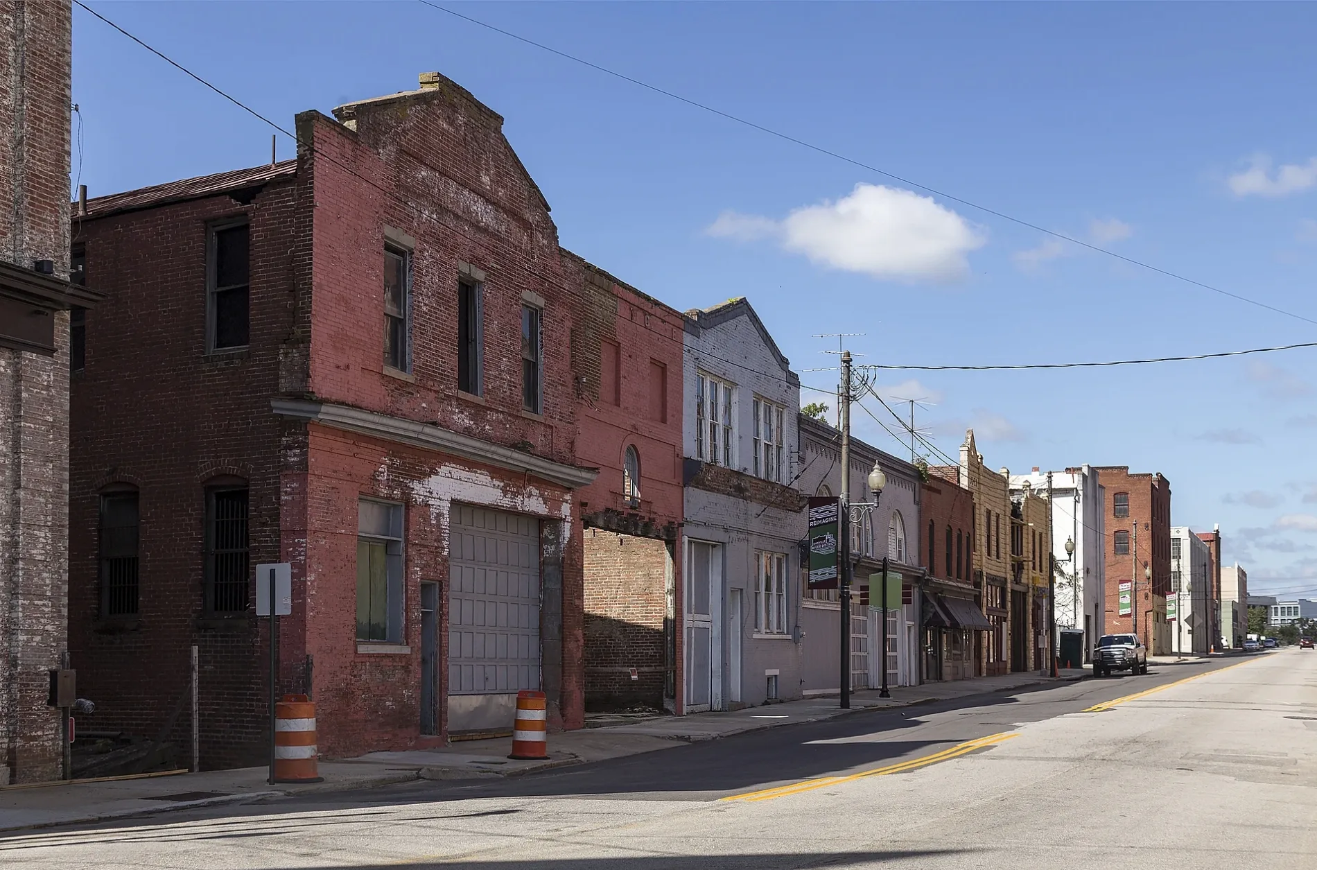
Newton Street in Danville, Virginia
Newton Street in Danville is a residential street. It runs in a northeast-southwest direction and crosses Bridge Street, Craghead Street, Lynn Street, Monument Street, Court Street, South Ridge Street and Dame Street and ends at East Green Street, while the other end is a cul-de-sac. Newton Street also exists in Gloucester County and Bristol.
- Road Type
- residential street
- Route
- northeast-southwest
Image
Bars
Fire stations
Stations
Convenience stores
Cemeteries
Places of worship
Restaurants
Cafes
Town halls
Museums
- Danville Science Center (Web) – approx. 0.3 mi.
Platforms
Gas stations
Streets nearby
Court Street0.1 mi
Wilson StreetAetz Chayin Synagogue
0.1 mi
Loyal StreetThe Golden Leaf Bistro
0.1 mi
Tazewell Street0.2 mi
South Ridge Street0.2 mi
Shelton Street0.2 mi
Riverwalk Trail0.2 mi
Craghead StreetDanville Science Center, Links Coffee House
0.2 mi
Patton StreetCity of Danville Municipal Building, Korner Kafe
0.2 mi
Dame Street0.2 mi
South Market Street0.2 mi
Colquhoun StreetMoseley Memorial Church
0.2 mi
East Green Street0.2 mi
Cabell Street0.2 mi
Boatwright Avenue0.3 mi
South Floyd Street0.3 mi
Main Street Plaza Brick Walk0.3 mi
South Union Street0.3 mi
Jefferson Avenue0.3 mi
North Market Street0.3 mi
Temple Avenue0.3 mi
Main StreetDanville, Dell Anno's Pizza, Main Street United Methodist Church, First Baptist Church, First Presbyterian Church
0.3 mi
Spring StreetDanville Temple Church of the Lord Jesus Christ of the Apostolic Faith
0.4 mi
North Floyd Street0.4 mi
Allotment gardens nearby
Danville Community Market Community Garden0.2 mi
Buildings nearby
Danville FD Headquarters500 ft
Municipal Building0.2 mi
Galileo Magnet High School0.2 mi
Old Register & Bee Building0.2 mi
Dan River Research Building0.3 mi
PATHS Medical Center0.3 mi
Danville House0.3 mi
Cafes nearby
Di’lishi Danville0.3 mi
Commercial areas nearby
Danville Public Library0.2 mi
Courthouses nearby
Danville Circuit Court0.2 mi
Event venues nearby
The Venue0.3 mi
Fire stations nearby
Danville FD - Station 10.1 mi
Hair salons nearby
Auburn & Co. Salon0.3 mi
Parks nearby
Shelton Street Park0.2 mi
South Union Street Pocket Park0.2 mi
Future Riverfront Park0.3 mi
Picnic areas nearby
Main St. Plaza Pergula0.3 mi
Places of worship nearby
First Christian Church0.4 mi
Post offices nearby
Danville Post Office0.4 mi
Public restrooms nearby
Public Bathroom0.3 mi
Pubs nearby
Me's Burgers & Brews0.3 mi
Recreation grounds nearby
Main Street Plaza0.3 mi
Sporting goods stores nearby
The Brick Running Store0.3 mi
Wine shops nearby
Vintages by the Dan0.3 mi
 Public transit map Danville Legend
| Railway | |
| Bus | |
| Streetcar |
 Bicycle map Danville Legend
| Bike path | |
| Bike lane on roadway | |
| Cycling allowed on bus lane | |
| Bicycle street | |
| Open to cyclists | |
| Open to cyclists, good path | |
| Cycling prohibited | |
| Cobblestone |
| Long-distance bike route | (depending on scale) | |
| Long-distance bike route |
 Pedestrian map Danville Legend
| Path |
| Long-distance hiking trail | (depending on scale) | |
| Long-distance hiking trail | ||
| Pedestrians prohibited |