
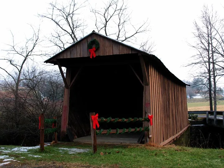
Jack's Creek Covered Bridge in Patrick County, Virginia
Jack's Creek Covered Bridge in Patrick County is a historic object (Heritage monument). It runs in a southeast-northwest direction and ends in a cul-de-sac. Jack's Creek Covered Bridge is located near Mills Hs Road. Nearby you can find a place of worship and a viewpoint. Ⓦ.
- Road Type
- footpath
- Route
- southeast-northwest
Image
Streets nearby
Mills Hs Road500 ft
Shady Lane0.3 mi
Jacks Creek Road0.4 mi
Blue Ridge Road0.4 mi
Hill Side Road0.4 mi
Woolwine HighwayWoolwine, Woolwine Volunteer Fire Department, Orchard View Market, Ye Olde Sign Shop, Dollar General, Buffalo Ridge, West Liberty Church, Cruzes Store
0.5 mi
Piney Ridge Lane0.5 mi
Elamsville RoadElamsville, Fairview Church, Ross-Harbour Church
0.8 mi
Shuff Ridge Lane0.9 mi
Lone Ivy1.0 mi
Jack's Creek Road1.0 mi
Bob White Road1.1 mi
Church Hill Lane1.1 mi
Morrison School Road1.1 mi
Rose Wood Road1.2 mi
Oakwood Lane1.2 mi
Logging Road1.2 mi
Kids Valley Lane1.3 mi
Mill House RoadWoolwine United Methodist Church
1.3 mi
Hickory Ridge Lane1.3 mi
Lost Paradise Lane1.4 mi
Blue Grass Road1.5 mi
Branch Lane1.6 mi
State Route 7081.6 mi
Dan Atkins Lane1.8 mi
Lee Elgin Road1.8 mi
Windy Ridge Road1.8 mi
Ridge Road2.0 mi
Hylton Hollow Lane2.0 mi
Bowling Store Lane2.0 mi
Lone Ivy Road2.1 mi
Sycamore Church Road2.2 mi
Brammer Spur Road2.2 mi
Banks nearby
Carter Bank and Trust1.4 mi
Buildings nearby
Smith River Rescue Squad1.6 mi
Fire stations nearby
Woolwine Volunteer Fire Department1.6 mi
Industrial areas nearby
Hopkins Lumber Contractors0.5 mi
Worley Machine Enterprises0.7 mi
Hanesbrands0.9 mi
Post offices nearby
Woolwine Post Office1.4 mi
Streams nearby
Smith River550 ft
Jacks Creek0.6 mi
Jill Creek0.9 mi
Buffalo Creek1.0 mi
Conners Creek1.3 mi
Little Sycamore Creek2.1 mi
Rich Run2.1 mi
Viewpoints nearby
Bob White Covered Bridge1.8 mi
Other nearby
Woolwine Substation0.6 mi
| Year built | 1914 |
|---|---|
| Located in | Woolwine |
| Country | United States |
| Crosses | Smith River |
| Location | Woolwine |
 Public transit map Patrick County Legend
| Railway | |
| Bus | |
| Streetcar |
 Bicycle map Patrick County Legend
| Bike path | |
| Bike lane on roadway | |
| Cycling allowed on bus lane | |
| Bicycle street | |
| Open to cyclists | |
| Open to cyclists, good path | |
| Cycling prohibited | |
| Cobblestone |
| Long-distance bike route | (depending on scale) | |
| Long-distance bike route |
 Pedestrian map Patrick County Legend
| Path |
| Long-distance hiking trail | (depending on scale) | |
| Long-distance hiking trail | ||
| Pedestrians prohibited |