
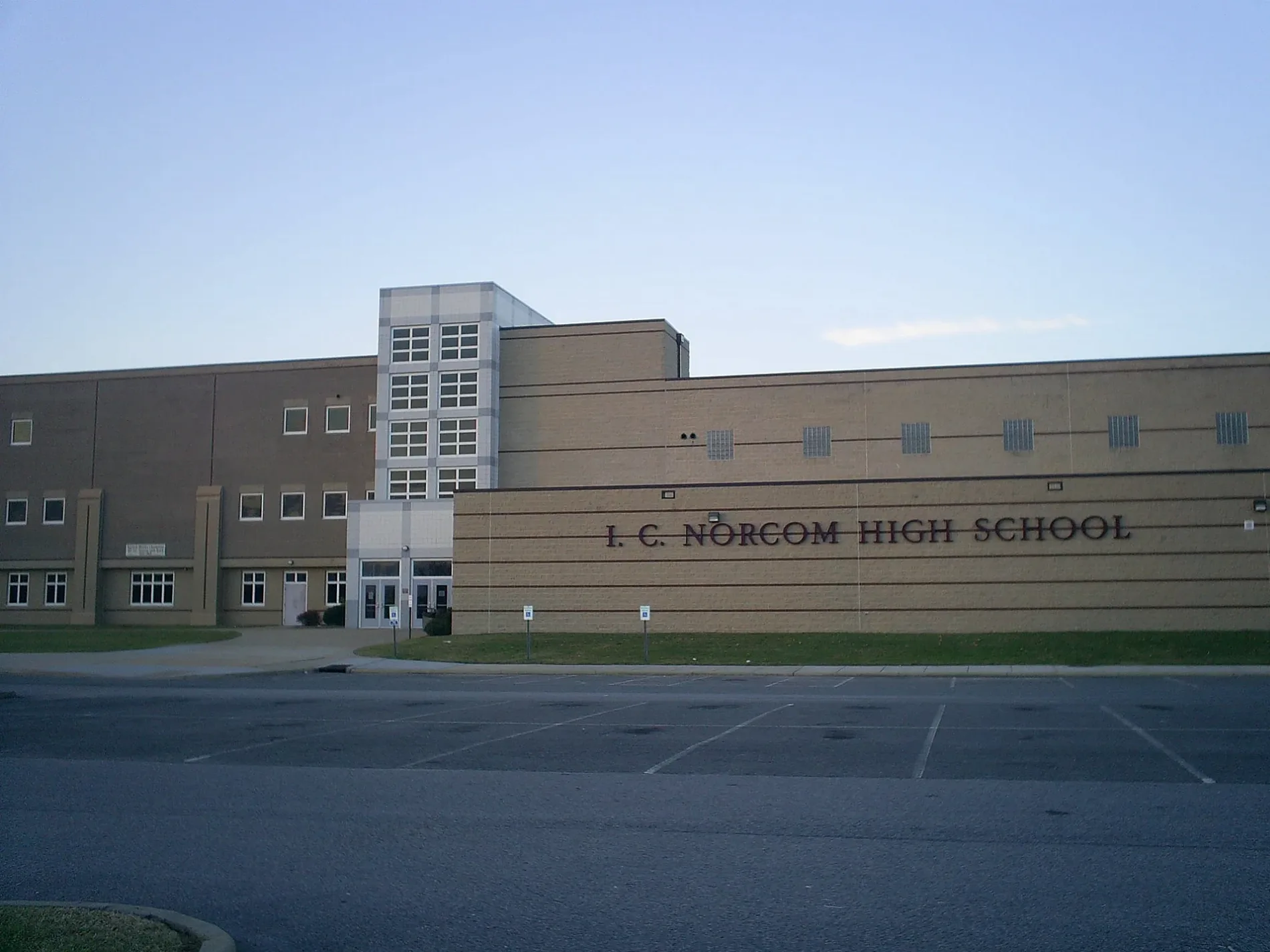
I C Norcom High School in Portsmouth, VA 23704
I C Norcom High School in Portsmouth, VA 23704 is a school building, London Boulevard 1801 (23704). Ⓦ.
- House Number
- 1801
- Postal Code
- 23704
- Street
- London Boulevard
- Building Type
- school building
Image
Social facilities
Cafes
Car washes
Bars
Places of worship
Fast food restaurants
Supermarkets
Charging stations
Restaurants
Tourist information centers
Clinics
Convenience stores
Garden centers
Streets nearby
Peninsula Avenue300 ft
High StreetTidewater Coffee, Jimmy John's, Bangkok Garden Noodle House, Super Wok, High & Loudoun, High Street Pizza & Pour House, 619 Cantina, The Book Club, Mile Zero Marine, High & Willet, Hand Wash Car Wash
500 ft
Queen StreetFood Lion, China Ocean, London Square, Olde Towne Commons, Gino's Pizzeria
550 ft
Ruth Brown Way0.1 mi
County StreetWalgreens, Westhaven Apartments, Portsmouth Police Department Training Academy, Portsmouth Police Detectives, Portsmouth Fire Department Administration, New St. Mark C.O.G.I.C, Sun's Sub and Pub
0.2 mi
North StreetPortsmouth Olde Town Historic District, Emanuel African Methodist Episcopal Church, Greenwich Square Information Board, Yellow Fever of 1855
0.2 mi
King StreetPortsmouth Volunteers for the Homeless, First Church of Christ, Scientist
0.2 mi
Twine Avenue0.2 mi
Williamsburg AvenueFirst Home Care - Tidewater, Portsmouth Health Clinic
0.2 mi
London BoulevardDomino's
0.2 mi
Yorktown Avenue0.2 mi
Holladay Street0.2 mi
Godwin StreetKing Square
0.2 mi
Talley Circle0.2 mi
Bain Street0.3 mi
Armstrong StreetPark View, Holley Square At Westbury
0.3 mi
Liverpool Street0.3 mi
Armstromg Street0.3 mi
Jamestown Avenue0.3 mi
Chesapeake Avenue0.3 mi
Boston Street0.3 mi
Owens Street0.4 mi
Richmond Avenue0.4 mi
A Street0.4 mi
Sean Sykes Avenue0.4 mi
Columbia StreetPortsmouth City Hall, Harbor Vista
0.4 mi
Elm Avenue0.4 mi
Primrose Street0.4 mi
Ann Street0.5 mi
Phoebus Street0.5 mi
Crawford ParkwaySpanish American War 1898-1902, LOVE, Olde Towne Portsmouth, Fort Nelson, Cornwalis at Portsmouth, Arnold's British Defenses, 1781, Craney Island, Crawford Bay, Worthington Square
0.5 mi
Williams Street0.5 mi
Leckie StreetFirst Congregational Church
0.5 mi
Butler Street0.5 mi
Goode Way0.5 mi
Hatton Street0.5 mi
Wall Street0.5 mi
Buildings nearby
Veterans Memorial Building0.2 mi
Cemeteries nearby
Oak Grove Cemetery0.4 mi
Motels nearby
Super Value Inn Ports Mouth/Olde Town Area0.5 mi
Museums nearby
Portsmouth Colored Community Library Museum0.4 mi
Parks nearby
Beazley Community Center0.3 mi
Columbia Park0.4 mi
Places of worship nearby
Third Baptist Church0.2 mi
Union Pentecostal Church Number 20.3 mi
Cottage Place Methodist Church0.3 mi
Variety stores nearby
Family Dollar0.2 mi
Dollar Tree0.4 mi
Water parks nearby
Splash Park0.5 mi
| Year built | 1913 |
|---|---|
| Located in | Virginia |
| Country | United States |
| Website | http://nhs.ppsk12.us/ |
 Public transit map Portsmouth Legend
| Railway | |
| Bus | |
| Streetcar |
 Bicycle map Portsmouth Legend
| Bike path | |
| Bike lane on roadway | |
| Cycling allowed on bus lane | |
| Bicycle street | |
| Open to cyclists | |
| Open to cyclists, good path | |
| Cycling prohibited | |
| Cobblestone |
| Long-distance bike route | (depending on scale) | |
| Long-distance bike route |
 Pedestrian map Portsmouth Legend
| Path |
| Long-distance hiking trail | (depending on scale) | |
| Long-distance hiking trail | ||
| Pedestrians prohibited |