
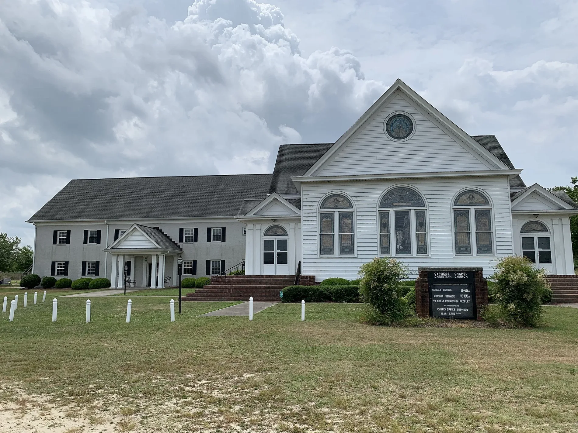
Cypress Chapel Christian Church in Suffolk, Virginia
Cypress Chapel Christian Church in Suffolk is a Church, Cypress Chapel Road 1891 (23434). Ⓦ.
- House Number
- 1891
- Postal Code
- 23434
- Street
- Cypress Chapel Road
- Amenity
- place of worship
- Building Type
- church
Image
Schools
Gas stations
Convenience stores
Post offices
Places of worship
Cemeteries
Fire stations
Streets nearby
White Marsh RoadSaunders, Balm of Gilead Church, Pauls Branch Church
0.6 mi
Clay Hill Road1.0 mi
Jethro Byrd Lane1.3 mi
County Road 6301.4 mi
Desert Road1.4 mi
Roundtree Crescent1.4 mi
Headquarters Access Road1.7 mi
Pines Trail1.7 mi
Cypress Chapel Road1.7 mi
Carolina Road7-Eleven, Speedway, Suffolk, South Suffolk, Carolina & Granby
2.1 mi
Rountree Crescent2.2 mi
Babbtown RoadBarrett Cemetery
2.2 mi
Oscar Babb Lane2.3 mi
Railroad Ditch Road2.3 mi
Hatton Road2.4 mi
Ditch Road2.4 mi
Riddick Lassiter Road2.5 mi
Pitt RoadSkeeter Cemetery
2.7 mi
Washington Ditch Road2.8 mi
Clover Lane2.9 mi
Skeetertown RoadCarver Terrace
2.9 mi
Cherry Grove Road3.0 mi
Myava Lane3.2 mi
Adams Swamp Road3.3 mi
Airport RoadNurney, Mount Ararat Church
3.3 mi
Badger RoadSkeetertown
3.4 mi
Darden Lane3.4 mi
Holly Terrace Road3.4 mi
Deer Forest Road3.4 mi
Meadow Country Road3.5 mi
Greenway Road3.5 mi
Stay A Way3.8 mi
Copeland RoadBakers Crossing, Nurneysville, Gethsemane Church
3.9 mi
Badger Ditch Road3.9 mi
Whaleyville Drive4.0 mi
Abandoned railways nearby
Suffolk & Carolina Railway0.9 mi
Portsmouth Branch (ACL)2.4 mi
Buildings nearby
Cypress Chapel Community House300 ft
Cemeteries nearby
Badger Cemetery3.5 mi
Commercial buildings nearby
Dismal Swamp General Store0.5 mi
Ditches nearby
Railroad Ditch2.3 mi
Washington Ditch3.0 mi
Badger Ditch3.7 mi
Office buildings nearby
Great Dismal Swamp National Wildlife Refuge1.8 mi
Residential buildings nearby
Green Acres3.4 mi
Streams nearby
Dragon Swamp1.7 mi
Council Swamp3.2 mi
Wetlands nearby
Moss Swamp2.5 mi
Other nearby
Umphlett Airstrip3.5 mi
| Located in | Virginia |
|---|---|
| Country | United States |
 Public transit map Suffolk Legend
| Railway | |
| Bus | |
| Streetcar |
 Bicycle map Suffolk Legend
| Bike path | |
| Bike lane on roadway | |
| Cycling allowed on bus lane | |
| Bicycle street | |
| Open to cyclists | |
| Open to cyclists, good path | |
| Cycling prohibited | |
| Cobblestone |
| Long-distance bike route | (depending on scale) | |
| Long-distance bike route |
 Pedestrian map Suffolk Legend
| Path |
| Long-distance hiking trail | (depending on scale) | |
| Long-distance hiking trail | ||
| Pedestrians prohibited |