
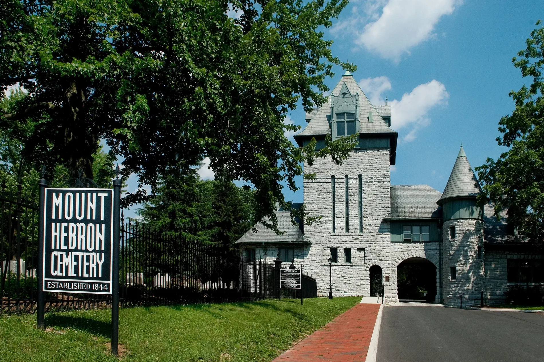
Mount Hebron Cemetery in Winchester, Virginia
Mount Hebron Cemetery in Winchester is a cemetery (Elevation 218 m). Mount Hebron Cemetery also exists in Carroll County. Ⓦ.
- Land Use
- cemetery
Image
Police stations
Universities
Toy stores
Tobacco shops
Theaters
Clothing stores
Restaurants
Antique stores
Galleries
Artworks
Dentist offices
Tattoo studios
Gift shops
Bars
Bookstores
Housewares stores
Streets nearby
Sharp Street400 ft
Philpot Street500 ft
South East Lane0.1 mi
South Kent StreetAllen D McCorkle DDS, Patsy Cline
0.1 mi
Billings AlleyMeraki Ink
0.1 mi
North Kent StreetFrederick County Sheriffs Office
0.2 mi
Woolen Mill Lane0.2 mi
South Cameron StreetBlye's Jewelers
0.2 mi
Rouss AvenueConfederate Soldier Monument, Willie Sutton's Saloon
0.2 mi
East Piccadilly StreetPiccadilly Grill Diner, Big L's Bagels, The Monument, Daniel Morgan, Winchester Police Department
0.2 mi
North Cameron StreetJohn B. Hayes Tobacconist
0.2 mi
Jolley Lane0.2 mi
Lincoln Street0.2 mi
East Lane0.2 mi
East Boscawen StreetBenny Meleto’s, Sexi Mexi, Admiral Richard Byrd
0.2 mi
Woodstock Lane0.2 mi
National AvenueExxon
0.2 mi
East Fairfax Lane0.2 mi
North Loudoun StreetWinchester, Winchester Book Gallery, Winchester Post Office, Bright Box Theater, Union Jack Pub & Restaurant, V2 Raw Bar, Snow White Grill, Red Fox Creamery, Dividing Creek Beer Company, Polka Dot Pot, The American Bar, Runner's Retreat, Old Warsaw Galleries, Gringo Gordo Empanada Shop, Mosaic Church, Silver Cloud Gift Shop, Blue Peacock Antiques, Bell's, Flashback 2.0, Still Meadow Boutique, Tin Top Handmade Art, Old Town Silversmiths, Posh Pets Boutique, Kasbah, Mountain Trails, Incredible Flying Objects, Village Square Restaurant, Nibblins, Eugene B. Smith Gallery & Frame Studio, Roma Old Town Wood-Fired Pizzeria, Bright Center, Manolete's Cocina Gourmet, Pizzoco Pizza Parlor, Yun's Cleaners, Botas Leon Guanajuato, C's Classy Cutz, Stars and Stripes Apple Statue
0.3 mi
West LaneCartwright Funeral Home
0.3 mi
Baker StreetWinchester Health Clinic
0.3 mi
Diehl Street0.3 mi
Charles Street0.3 mi
Elk Street0.3 mi
Athey Alley0.3 mi
Banks nearby
Bank of Clarke County0.3 mi
Buildings nearby
Office & Lodge0.3 mi
Cemeteries nearby
Winchester National Cemetery0.2 mi
Commercial buildings nearby
Farmers and Merchants National Bank Building0.2 mi
Convenience stores nearby
Bo's Express0.1 mi
Hotels nearby
George Washington Hotel0.2 mi
Museums nearby
Old Court House Civil War Museum0.2 mi
Parking lots nearby
Court Square Autopark550 ft
George Washington Autopark0.2 mi
Loudoun Street Autopark0.3 mi
Parks nearby
Timbrook Park0.2 mi
Elk Street Park0.3 mi
Places of worship nearby
Old Stone Church0.2 mi
Centenary Reformed United Church of Christ0.2 mi
Market Street United Methodist Church0.2 mi
Public buildings nearby
Joint Judicial Center0.1 mi
Timbrook Public Safety Center0.2 mi
Pubs nearby
Piccadilly's Public House and Restaurant0.2 mi
Railways nearby
Shenandoah Subdivision0.2 mi
Restaurants nearby
Village Square Restaurant0.2 mi
Retail buildings nearby
Handworks Gallery0.3 mi
Streams nearby
Town Run0.2 mi
Town halls nearby
Rouss City Hall0.2 mi
Train stations nearby
Old B&O Train Depot0.2 mi
| Year built | 1844 |
|---|---|
| Heritage designation | National Register of Historic Places listed place, Virginia Historic Landmark |
| Located in | Winchester |
| Country | United States |
 Public transit map Winchester Legend
 | Railway | |
| Bus | |
| Streetcar |
 Bicycle map Winchester Legend
 | Bike path | |
| Bike lane on roadway | |
| Cycling allowed on bus lane | |
| Bicycle street | |
| Open to cyclists | |
| Open to cyclists, good path | |
| Cycling prohibited | |
| Cobblestone |
| Long-distance bike route | (depending on scale) | |
| Long-distance bike route |
 Pedestrian map Winchester Legend
 | Path |
| Long-distance hiking trail | (depending on scale) | |
| Long-distance hiking trail | ||
| Pedestrians prohibited |