
Mississippi River in Town of Trenton, Wisconsin
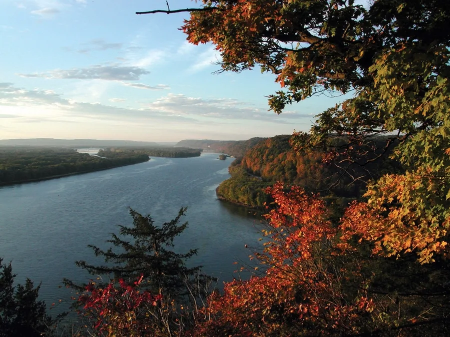
Mississippi River in Town of Trenton is a river. Mississippi River is also known as The Mississippi. Mississippi River also exists in Town of Diamond Bluff, Town of Oak Grove, Town of Isabelle and Town of Maiden Rock. Ⓦ.
- Waterway Type
- river
Streets nearby
Bay Point Park0.2 mi
Bay Point Drive0.2 mi
Jackson Street0.3 mi
Levee RoadGateway To Red Wing, A Tribute, Balance Of Power
0.3 mi
Old West Main StreetAce Hardware, Godfather's Pizza, Red Wing Brewery, Wisteria Twig Tea Room & Cafe, Red Wing Chevrolet-Buick-Cadillac
0.4 mi
Mechanics Street0.4 mi
Buchanan Street0.4 mi
Jefferson Street0.4 mi
Hill StreetSubway, The Mac Shack & Specialties, Kwik Trip
0.4 mi
West 3rd StreetCut Above Home, Malmquist, Liberty's Restaurant And Lounge, Snipz, Carlson's, Klompenboot, River Town Games, Mandy's Coffee & Café, Maestro, Strauss Optical, Red Wing Arts Clay And Creative Center, Glowing Tree
0.4 mi
Minnesota Street0.4 mi
Franklin Street0.4 mi
Clay Street0.4 mi
825th StreetNorth Red Wing, Pucketville
0.4 mi
Red Wing Riverfront Trail0.4 mi
Main StreetRed Wing Shoe Museum, Phileo, Whimsy's, Red Wing Oils & Vinegars, Red Wing Confectionary, Adam's Tobacco Shop, Duluth Trading Company, Randy's, BP, Dairy Queen, Kwik Trip
0.5 mi
Fulton StreetCaribou Coffee
0.5 mi
Cedar Street0.5 mi
Dakota Street0.5 mi
Broad StreetFirst Flight, Red Wing
0.5 mi
Levee StreetRed Wing, Ever Upward, Red Wing Arts
0.5 mi
West End Avenue0.5 mi
West 4th StreetSaint Paul's Lutheran Church, Associated Bank, Jordan Towers
0.5 mi
Pine Street0.5 mi
West 5th StreetRed Wing, Red Wing Fire Department
0.6 mi
Grandview Avenue0.6 mi
West AvenueGoodhue County Courthouse, Christ Episcopal Church
0.6 mi
East AvenueSynchronous, Goodhue County Sheriffs Office, Red Wing Police Department, Jake On Base, Saint John's Lutheran School, Red Wing Public Library
0.6 mi
Harding Street0.6 mi
Washington Street0.6 mi
Seminary Avenue0.6 mi
Williams AvenueGoodhue County Historical Society Museum
0.6 mi
West 6th StreetFirst Presbyterian Church, Mahn Family Funeral And Cremation Services
0.7 mi
Oak Street0.7 mi
Abandoned railways nearby
Cannon Valley Line Connection0.3 mi
Buildings nearby
Chicago Great Western Depot0.4 mi
E. S. Hoyt House0.5 mi
Sheldon Theatre0.7 mi
Hotels nearby
AmericInn0.5 mi
Holiday Inn Express & Suites Red Wing0.5 mi
The Saint James Hotel0.6 mi
Marinas nearby
Red Wing Yacht Club0.3 mi
Parks nearby
Levee Park0.5 mi
John Rich Park0.6 mi
Post offices nearby
United States Post Office Red Wing MN0.6 mi
Railways nearby
River Subdivision0.4 mi
School buildings nearby
Jefferson Elementary0.7 mi
Supermarkets nearby
Family Fare0.5 mi
Train stations nearby
Red Wing station0.5 mi
| Length | 3766 |
|---|---|
| Located in | United States |
| Country | United States |
| Source | Lake Itasca |
| Mouth | Gulf of Mexico |
| Tributary | Black River, Arkansas River, Ohio River, Saint Croix River, Wisconsin River, Rock River, Illinois River, Kaskaskia River, Minnesota River, Des Moines River, White River, Apple River, Big Muddy River, St. Francis River, Yazoo River, Big Black River, Maquoketa River, Wolf River, Rice Creek, Iowa River, Turkey River, Loosahatchie River, Meramec River, Wapsipinicon River, Chippewa River, River des Peres, Bayou Pierre, Catfish Creek, Crow River, Duck Creek, Hatchie River, Henderson Creek, Little Maquoketa River, Marys River, Obion River, Prairie River, Rum River, Rush River, Salt River, Schoolcraft River, Skunk River, Swan River, Trempealeau River, Turtle River, Upper Iowa River, Vermillion River, Wind River, Yellow River, Village Creek, Brazeau Creek, Cinque Hommes Creek, Nokasippi River, Apple Creek, Coles Creek, River aux Vases, Minnehaha Creek, Fox River, Bassett Creek, Sucker Creek, Missouri River, Rice River |
| Native name | Mississippi River |
| Described by | Sytin Military Encyclopedia, Small Brockhaus and Efron Encyclopedic Dictionary, Brockhaus and Efron Encyclopedic Dictionary, Jewish Encyclopedia of Brockhaus and Efron, The Nuttall Encyclopædia, Great Soviet Encyclopedia (1926–1947), The Encyclopedia Americana, The American Cyclopædia, Encyclopædia Britannica 11th edition, Collier's New Encyclopedia, 1921, The New Student's Reference Work, New International Encyclopedia, Meyer’s Universum, Fünfzehnter Band, Meyer’s Universum, Siebzehnter Band, Meyer’s Universum, Achtzehnter Band, Granat Encyclopedic Dictionary |
Public transit map Town of Trenton Legend
| Railway | |
| Bus | |
| Streetcar |
Bicycle map Town of Trenton Legend
| Bike path | |
| Bike lane on roadway | |
| Cycling allowed on bus lane | |
| Bicycle street | |
| Open to cyclists | |
| Open to cyclists, good path | |
| Cycling prohibited | |
| Cobblestone |
| Long-distance bike route | (depending on scale) | |
| Long-distance bike route |
Pedestrian map Town of Trenton Legend
| Path |
| Long-distance hiking trail | (depending on scale) | |
| Long-distance hiking trail | ||
| Pedestrians prohibited |