
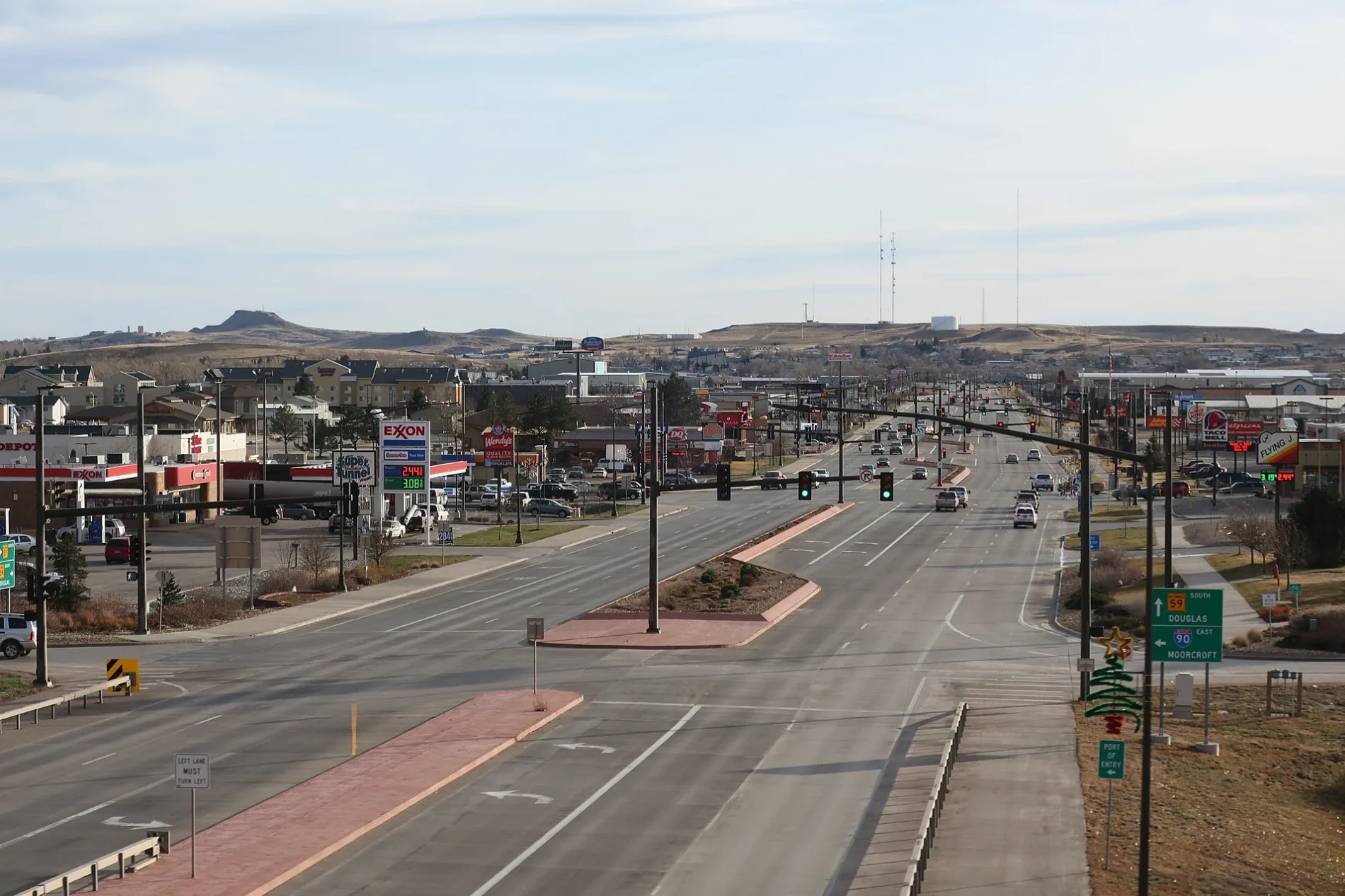
South Douglas Highway in Gillette, WY 82718
South Douglas Highway in Gillette, WY 82718 (Campbell County) is a four-lane expressway. It runs in a north-south direction and crosses Jasper Street, East Lakeway Road, East Boxelder Road, East 2nd Street, East 3rd Street, East 4th Street, East 5th Street, East 6th Street, East 7th Street, East 8th Street, East 9th Street and East 10th Street. It ends in a cul-de-sac and connects Gillette and Campbell County. South Douglas Highway is also known as WYO 59. This street is part of the highway "59". Ⓦ.
- Road Type
- expressway
- Lanes
- 4
- Speed Limit
- 55 mph
- Route
- north-south
Image
Streets nearby
Robin Drive0.1 mi
Rapid Street0.1 mi
Sassick Street0.2 mi
Blacktooth Avenue0.2 mi
Dove Road0.2 mi
Needle Court0.2 mi
Rimrock Drive0.3 mi
Le Tourneau Drive0.3 mi
Gannett Court0.3 mi
Wind River Drive0.4 mi
Road Runner Drive0.4 mi
Gallery View Drive0.5 mi
Grouse Avenue0.5 mi
State Highway 59 South0.5 mi
Victoria Road0.5 mi
Waterfall Road0.5 mi
Chukar Drive0.6 mi
Owl Road0.6 mi
Hawk Court0.6 mi
Pheasant Drive0.6 mi
Antler Road0.7 mi
Pheasant Court0.7 mi
Doe Court0.7 mi
Wolff Road0.8 mi
Fawn Court0.8 mi
Game Trail Court0.9 mi
Ramshorn Avenue0.9 mi
Ptarmigan Avenue0.9 mi
Quail Avenue1.0 mi
Whitetail Street1.0 mi
Buildings nearby
Komatsu0.1 mi
Spencer Fluid Power0.2 mi
Interstate0.4 mi
Arnold Machinery0.5 mi
Liebherr0.9 mi
Car dealerships nearby
Empire Auto Sales0.5 mi
Floyd's Truck Center0.8 mi
Convenience stores nearby
Big D300 ft
Gas stations nearby
Sinclair150 ft
Shell500 ft
Industrial areas nearby
Antelope Valley Business Park0.1 mi
Parks nearby
Antelope Valley Park0.4 mi
Crestview Estates Park0.7 mi
Places of worship nearby
Redemption Church0.5 mi
Residential areas nearby
Antelope Valley0.1 mi
Eagle Ridge Subdivision0.5 mi
Crestview Estates0.6 mi
Pinnacle Heights0.9 mi
Undeveloped lands nearby
Premier Subdivision0.8 mi
| Located in | Converse County, Campbell County |
|---|---|
| Country | United States |
 Public transit map Campbell County Legend
| Railway | |
| Bus | |
| Streetcar |
 Bicycle map Campbell County Legend
| Bike path | |
| Bike lane on roadway | |
| Cycling allowed on bus lane | |
| Bicycle street | |
| Open to cyclists | |
| Open to cyclists, good path | |
| Cycling prohibited | |
| Cobblestone |
| Long-distance bike route | (depending on scale) | |
| Long-distance bike route |
 Pedestrian map Campbell County Legend
| Path |
| Long-distance hiking trail | (depending on scale) | |
| Long-distance hiking trail | ||
| Pedestrians prohibited |