
Horizon Church in Sutherland
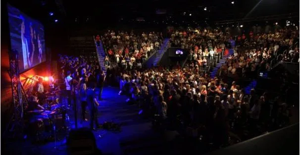
Horizon Church in Sutherland Shire Council is a Pentecostala church, Stapleton Avenue 7 (2232). Ⓦ.
- House Number
- 7
- Postal Code
- 2232
- Street
- Stapleton Avenue
- Amenity
- place of worship
- Building Type
- building
- Website
- https://horizonchurchsydney.com/
Image
Restaurants
Places of worship
Charity shops
Bicycle shops
Bank
Cafés
Courthouse
Bookmakers
Bus stops
Library
Fast food restaurants
E-cigarette shops
Post offices
Roads nearby
Bristol Lane100 m
Stapleton AvenueSutherland Library
150 m
Merton Street200 m
The Grand ParadeThe Grand Pde opp Vermont St
200 m
Belmont StreetSt Patricks Church Sutherland, The Greek Islands Taverna
200 m
Eton StreetBlack Sheep Cafe & Baa, Carhole Cafe, Sutherland Public School, Eton St, Sutherland Best Meats, Sutherlands Best Fresh, Domino's
200 m
Toronto Parade200 m
Old Princes HighwayGloria Jean's, Kuro Neko, St Vincent de Paul, Sutherland, Mr India, Stapletons, Kirrawee
250 m
Acton Street250 m
Eton ArcadeTAB, Eliette, Vape Industries, Oak Davis, Your Cycle Mechanic
250 m
Flora StreetWhite Horse Cafe, Sutherland Post Office, Sutherland Kebab House, St.George, Subway, Sutherland Local Court, Toy Library, Flora St before Merton St, Sutherland Station, Stand F, The Convenient Point, Sugar Rae's, Sutherland Station, Flora St, Stand F, 7th Heaven, Fox Photo Services, Sutherland Uniting Church
250 m
Muston LaneZambrero
300 m
McCubbens Lane350 m
Clio StreetClio St at Glencoe St, Clio St at Acacia Rd, Clio St opp Glencoe St, Clio St at Toronto Pde
350 m
Oxford StreetClub on East
350 m
Robertson LanePlus Milk Bar
350 m
East ParadeSutherland, Cafe 2232, Sutherland Seafood and Chinese, Sutherland Station, East Pde, Stand E, Sutherland, Platform 2, Bike Shed - Sutherland Station, East Pde, Bike Lockers - Sutherland Station, East Pde 2, Sutherland Station, East Pde, Bike Lockers - Sutherland Station, East Pde 1, Sutherland Station, Stand A, Sutherland Station, Stand D, Sutherland Station, Stand C, Sutherland Station, Stand B
400 m
Boyle StreetBoyles Hotel
400 m
Jannali Avenue400 m
Glencoe Street400 m
Robertson Street400 m
President AvenueSt Patricks College, President Av, Durban Cycles, Rosin Court, President Av at Auburn St, President Av before Glencoe St, President Av at Acacia Rd
400 m
Boyle LaneAra Hair, IGA
450 m
Gray Street450 m
Waratah Street500 m
Leonay StreetLeonay St at Kurrajong St
550 m
Buildings nearby
Centrelink200 m
Australian Air League250 m
Power Room / Signaling Room400 m
Network Satellite Sutherland400 m
Car parks nearby
Park&Ride - Sutherland300 m
Community centres nearby
Stapleton Community Centre100 m
Funeral directors nearby
Olsens Farewells200 m
Gardens nearby
pigface400 m
Industrial areas nearby
Sutherland Reservoirs300 m
Parks nearby
Forby Sutherland Memorial Garden150 m
Clio Street Reserve400 m
Albert Hutchinson Reserve400 m
Rita Harris Park550 m
Petrol stations nearby
7-Eleven200 m
Places of worship nearby
St John's Sutherland150 m
Grace Chinese Christian Church200 m
Sutherland Presbyterian Church400 m
Police stations nearby
Sutherland Police Station300 m
Public buildings nearby
Sutherland Shire Council100 m
Sheds nearby
Sutherland District Scout Hall350 m
Supermarkets nearby
Coles450 m
Theatres nearby
Sutherland Entertainment Centre100 m
The Pavilion150 m
| Located in | New South Wales |
|---|---|
| Country | Australia |
 Public transport map Sutherland Legend
| Railway | |
| Bus | |
| Tram |
 Cycling map Sutherland Legend
| Cycle path | |
| Cycle lane on road | |
| Cycling on bus lane | |
| Bicycle street | |
| Cyclists allowed | |
| Cyclists allowed, good surface | |
| No cycling | |
| Cobblestones |
| Long-distance cycle route | (depending on scale) | |
| Long-distance cycle route |
 Walking map Sutherland Legend
| Path |
| Long-distance hiking trail | (depending on scale) | |
| Long-distance hiking trail | ||
| No pedestrians |