
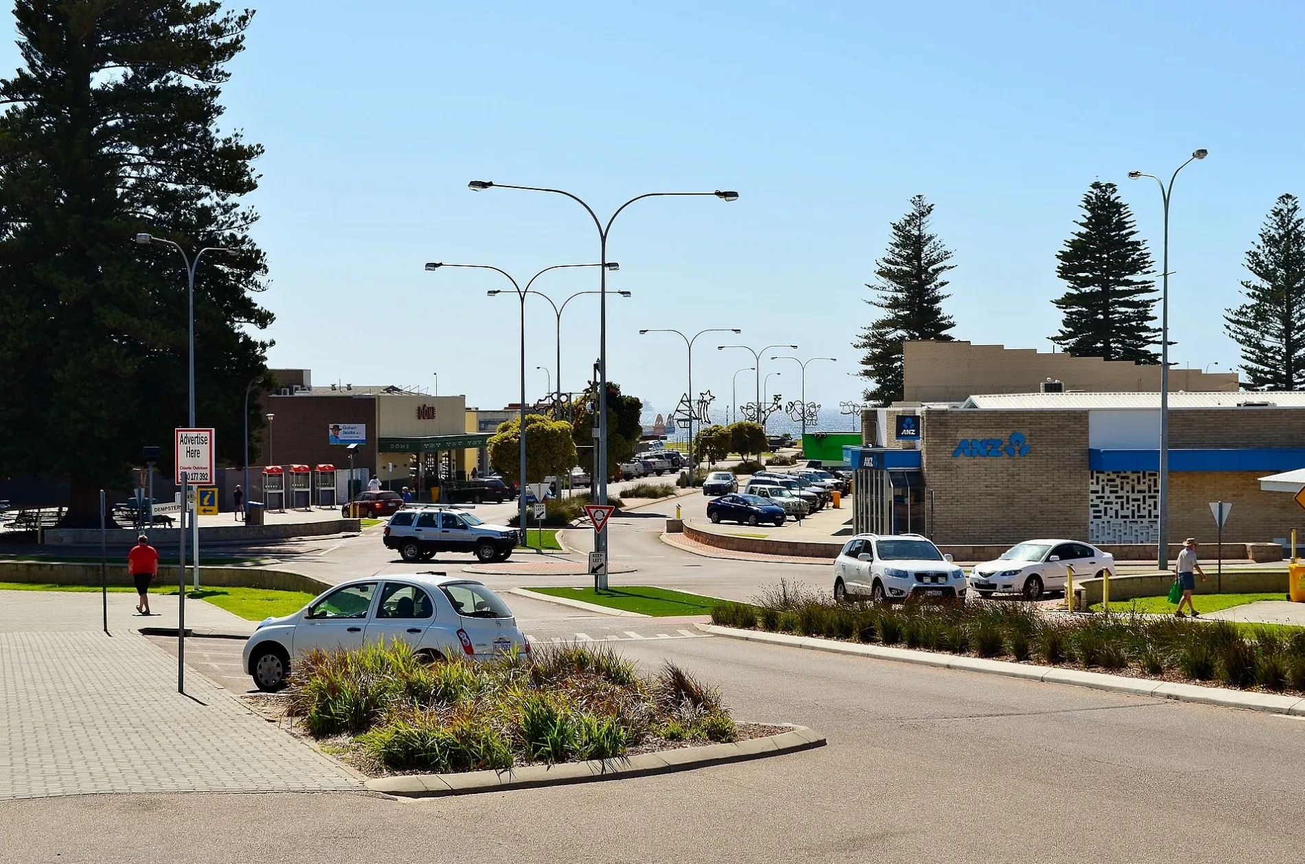
James Street in Esperance
James Street in Shire Of Esperance is an asphalted tertiary road. It runs in a southeast-northwest direction and ends at The Esplanade, while the other end is a cul-de-sac. This road is part of the bicycle route "Great Ocean Trail". In the vicinity, you can find a clothing shop and a fast food restaurant. James Street also exists in City of Perth, City of Fremantle, City Of Busselton, Shire Of Collie and Shire Of Bridgetown-Greenbushes.
- Road Type
- tertiary road
- Route
- southeast-northwest
Image
Roads nearby
The EsplanadeBeachfront Resort, Captain Huon, The Jetty Resort, Coffee Cat, Ocean Blue Restaurant, Aurelias Ice Creamery and Cafe, First Esperamce Scout Group, Avis
150 m
Langham Lane200 m
Windich StreetEsperance Uniting Church Centre, ABC Esperance
250 m
The Esplanade Service RoadPier Hotel, LiquorSTAX
300 m
Andrew StreetEsperance Hotel, ANZ, SANDY HOOK TAVERN, ROAST AND TOAST LUNCH BAR AND CAFE, Bankwest
300 m
Dempster StreetIGA, Down Town Espresso Bar, LiquorBarons, SportsPower, Miarhetts Hair Design, Bradshaws Pharmacy, Dempster Street Barber Shop, Esperance Motor Hotel, Esperance Police Station, Loxe Floral and Home Co., Esperance Courthouse, Aunty Joan's Dolly Mix, Retravision, West End Soapy, Banksia Medical and Health, Subway, Westpac, Esperance LPO, Just One More Stitch, Golden Orient, South Coast Ink, Dempster Sporting, Computer Alley, Esperance Home Hardware, Ampol, Esperance Red Cross Shop
300 m
Kemp StreetComfort Inn Bay of Isles, Eljay's Bar and Restaurant
400 m
Council Place450 m
Forrest StreetFlight Centre, Brumby's Bakeries, Red Rooster
450 m
Norfolk Lane450 m
Eyre Street450 m
Hicks StreetEsperance
500 m
Tupper Street550 m
Jane Street550 m
Randell Street600 m
Brazier Street600 m
Stubbing Street700 m
Coleman Street700 m
William StreetMcDonald's, Top End Takeaway
700 m
Layton Street700 m
Stubbs Street750 m
Jehu Street750 m
Padbury Street750 m
Leake Street750 m
Hamersley Street750 m
Corry Street850 m
Black Street850 m
Birch Street900 m
Pink Lake Road900 m
Beaches nearby
Bow Park600 m
Buildings nearby
Bus stop (former railway station)100 m
Dutton Arcade350 m
Scouts Hall650 m
Esperance Bay Yacht Club700 m
Esperance Tennis Club800 m
Cafés nearby
Break Away Cafe450 m
Holiday apartment nearby
The Yot Spot750 m
Hotels nearby
Hospitality150 m
Motel nearby
Bayview Motel550 m
Museum nearby
Historic Village50 m
Parks nearby
James Street Park50 m
Museum Park150 m
Pavilions nearby
Esperance Netball Association750 m
Esperance Indoor Stadium900 m
Petrol stations nearby
Coles Express350 m
Restaurants nearby
Xing's Sushi & Noodle300 m
Shopping malls nearby
Esperance Boulevard200 m
Sports centres nearby
Bay of Isles Leisure Centre850 m
Tourist information offices nearby
Esperance Visitors Centre350 m
 Public transport map Esperance Legend
| Railway | |
| Bus | |
| Tram |
 Cycling map Esperance Legend
| Cycle path | |
| Cycle lane on road | |
| Cycling on bus lane | |
| Bicycle street | |
| Cyclists allowed | |
| Cyclists allowed, good surface | |
| No cycling | |
| Cobblestones |
| Long-distance cycle route | (depending on scale) | |
| Long-distance cycle route |
 Walking map Esperance Legend
| Path |
| Long-distance hiking trail | (depending on scale) | |
| Long-distance hiking trail | ||
| No pedestrians |