
Roper Road NW in McIntyre Industrial, Edmonton, Alberta
Roper Road NW in McIntyre Industrial in South Industrial District is a two-lane, lit secondary road (60 km/h). It runs in an east-west direction starting from 51 Avenue NW and crosses 86 Street NW, 84 Street NW, 75 Street NW, 72 Street NW, 70 Street NW, 59 Street NW, 54 Street NW, 50 Street NW, 48 Street NW, 45 Street NW and 42 Street NW. It connects Roper Industrial, McIntyre Industrial, Pylypow Industrial and Southeast Industrial. In the vicinity, you can find among other things a car parts shop, a theatre, a studio and a weapons shop. The nearest stops are 2609, 2018, 2618 and 22152. The bus lines 506 and 507 serve this stop.
- Road Type
- secondary road
- Speed Limit
- 60
- Lanes
- 2
- Route
- east-west
Image
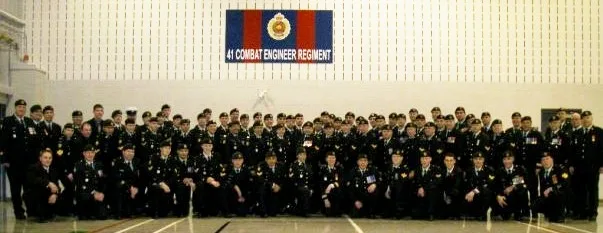
Weapons shops
Roads nearby
84 Street NW880 CHED, Global Edmonton
200 m
McIntyre Road NW300 m
83 Street NW500 m
75 Street NW2317, 66 Street & 51 Avenue, 66 Street & McIntyre Road
550 m
Davies Road NW2455, 86 Street & Davies Road, Davies Transit Centre
600 m
72 Street NW600 m
Roper Business Center ParkingFocus Security Inc., Boreal Wilderness Institute, A&T Footwear, Ninja Noodle, Mr. Sub, Jobsite Workwear
600 m
Whitemud Drive NW700 m
66 Street NW66 Street & 43 Avenue, 66 Street & 41 Avenue, Cannabis House - Whitemud - Bitcoin Well ATM
750 m
56 Avenue NW750 m
80 Street NW2268
800 m
70 Street NW850 m
51 Avenue NW1,0 km
Shops nearby
Barbecue Country300 m
Banks nearby
BMO250 m
Buildings nearby
Ledcor750 m
Cafés nearby
Tim Hortons400 m
Car dealerships nearby
Edmonton BMW450 m
Dodge Southtown Chrysler800 m
Car parks nearby
Ledcor Parkade600 m
Car repair shops nearby
Hughes200 m
Lube City250 m
Car washes nearby
Shell700 m
Commercial buildings nearby
German Canadian Cultural Association100 m
The UPS Store200 m
Acklands-Grainger Inc.200 m
Roper 75400 m
Amre Supply Co Ltd.450 m
Roper Business Center Building 2550 m
Roper Business Center550 m
Constructions nearby
Gerry Wright LRT Operations & Maintenance Facility B950 m
Convenience stores nearby
Shell Select750 m
Fast food restaurants nearby
Subway250 m
Taco Del Mar250 m
Quiznos300 m
Government buildings nearby
Provincial Archives of Alberta600 m
Industrial areas nearby
Wagner Plaza800 m
Light rail lines nearby
Valley Line1000 m
Military areas nearby
Lt-Col Philip Debney Armoury200 m
Motorcycle shops nearby
Cycle Works Edmonton350 m
Nature reserves nearby
Roper Pond Constructed Wetland950 m
Office buildings nearby
Corus Edmonton200 m
Amec Foster Wheeler900 m
Railwaies nearby
Gerry Wright Operations and Maintenance Facility650 m
Retail areas nearby
McIntyre Centre450 m
Sports centres nearby
Edmonton Soccer Centre South1,1 km
Streams nearby
Mill Creek1000 m
Transport buildings nearby
Davies Station1000 m
Woodlands nearby
Mill Creek Ravine1000 m
Public transport map McIntyre Industrial Legend
| Railway | |
| Bus | |
| Tram |
Cycling map McIntyre Industrial Legend
| Cycle path | |
| Cycle lane on road | |
| Cycling on bus lane | |
| Bicycle street | |
| Cyclists allowed | |
| Cyclists allowed, good surface | |
| No cycling | |
| Cobblestones |
| Long-distance cycle route | (depending on scale) | |
| Long-distance cycle route |
Walking map McIntyre Industrial Legend
| Path |
| Long-distance hiking trail | (depending on scale) | |
| Long-distance hiking trail | ||
| No pedestrians |