
Nelson Lane in Fort McMurray, Alberta
Nelson Lane in Fort McMurray is a two-lane, asphalted residential street.
- Road Type
- residential street
- Lanes
- 2
Image
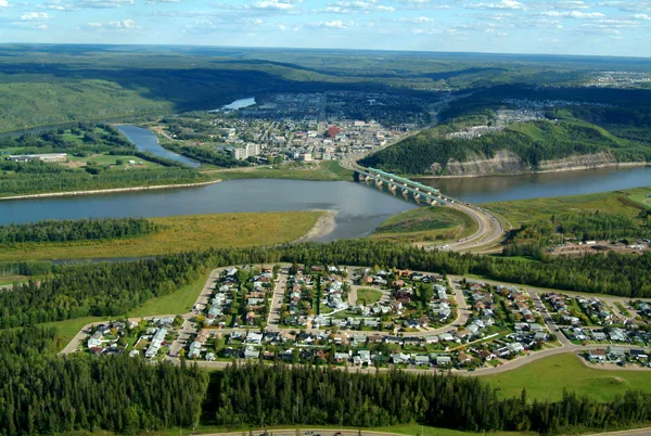
School
Supermarkets
Benches
Places of worship
Beauty salons
Fast food restaurants
Convenience stores
Restaurants
Bank
Clinic
Café
Off-licences
Petrol station
Tourist information
Tobacconist's
Roads nearby
O'Coffey Crescent150 m
Cree Place250 m
Waterhouse Street250 m
Sandulac Street250 m
Cree Road Park Trail300 m
Swanson Crescent300 m
Kodiak Crescent300 m
Ewashko Crescent350 m
Cree Lane350 m
Carteret Drive350 m
Cinnamon Street350 m
Couture Lane350 m
Grizzly Bay400 m
Bear Paw Drive400 m
Bruin Bay400 m
Tower Road450 m
Polar Bay450 m
Cree Road500 m
Black Bear Place500 m
Black Bear Crescent500 m
Cokerill Crescent550 m
Caouette Crescent600 m
Card Court600 m
Card Crescent600 m
Bussieres Drive750 m
Burry Road800 m
Deer TrailBanca en memoria de Peter Joseph cleyle, Letrero
800 m
Thickwood BoulevardFaceCosmedics, Evergreen Community Church
800 m
Brett DriveWood Buffalo Gospel Hall
850 m
Burton Place850 m
Bourque Bay850 m
Eglert Drive850 m
Clausen Crescent900 m
Kennedy Crescent950 m
Bacon Place950 m
Cartier Road950 m
Abraham Gate950 m
Abraham Drive950 m
Pope Bay1000 m
Brown Bay1000 m
Chandler Bay1000 m
Confederation WayReal Canadian Liquor Store, Jomaa's Pizza, Liquor Depot
1000 m
Harpe Way1,0 km
Langevin Road1,0 km
Body of waters nearby
Carteret Drive Storm Pond250 m
Parks nearby
Carteret Drive Park150 m
Nelson Lane Park200 m
Cree Road Park300 m
Streams nearby
Conn Creek750 m
 Public transport map Fort McMurray Legend
 | Railway | |
| Bus | |
| Tram |
 Cycling map Fort McMurray Legend
 | Cycle path | |
| Cycle lane on road | |
| Cycling on bus lane | |
| Bicycle street | |
| Cyclists allowed | |
| Cyclists allowed, good surface | |
| No cycling | |
| Cobblestones |
| Long-distance cycle route | (depending on scale) | |
| Long-distance cycle route |
 Walking map Fort McMurray Legend
 | Path |
| Long-distance hiking trail | (depending on scale) | |
| Long-distance hiking trail | ||
| No pedestrians |