
Canada Line Bridge Bikeway in City Centre, Richmond, British Columbia
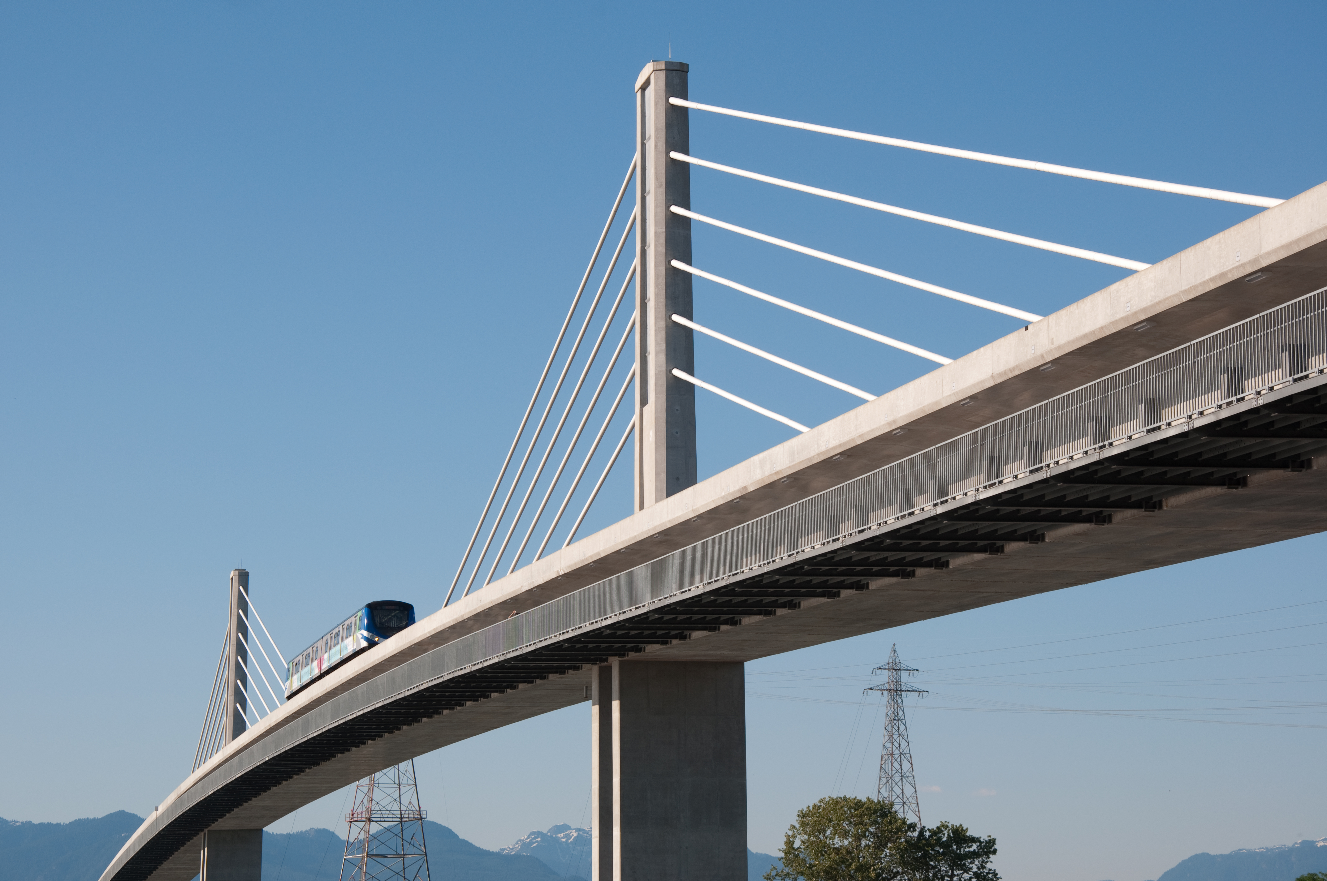
Canada Line Bridge Bikeway in Richmond is an asphalted cycle path. It runs in a northeast-southwest direction and crosses River Drive and ends at Van Horne Way, while the other end is a cul-de-sac. This road is part of the bicycle route "North Arm Bridge Bikeway".
- Bicycle
- designated
- Road Type
- cycle path
- Route
- northeast-southwest
Image
Car hires
Bicycle hires
Stations
Theatres
Pharmacy
Bus stops
Opticians
Restaurants
Cafés
Subway stops
Convenience stores
Bar
Roads nearby
North Arm Bridge Bikeway200 m
Van Horne WayLime
300 m
River RoadSea Harbour Restaurant, Quick Shuttle, West Parkade, Starbucks, River Rock Casino Gift Shop, Chopsticks Noodle House, Zio's, Rock House Burgers and Fries No, Privé Bar, River Rock Theatre, Nextmod Auto Solutions Ltd., Mr Rent a car, Azure Auto Gallery, Oui Patisserie, Wasuta Pasta, Lime, Citation Kitchens, River Rd (WB) at 6100 Block, Juan's Auto Service, RBC, CoCo Fresh Tea & Juice, SYU Japanese Cuisine & Sushi Bar, Just Poké, Code Ninjas, Modern Wellness, Yochi Cups, Musicworks Canada, Little Kitchen Academy, Enroute.run, Makabaka Athleisure, Aww! Pet Grooming & Supplies, Thermomix Cooking Studio, Oval Optical, 11 AM Tea House, Water Off a Duck's Back, Scotiabank, Fortune Terrace Chinese Cuisine, Deer Garden Signatures, Richmond Olympic Experience, River Rd (WB) at Hollybridge Way, Origo Club
450 m
Oak Street BridgeVCC 1 / VCC 2 Border
450 m
Number 4 Road500 m
Finlayson Drive500 m
Bridgeport Trail550 m
Gilmore Crescent550 m
River DriveNorth level crossing, Guideway Direction Reversal Point
550 m
Gilmore Court550 m
Great Canadian WayBridgeport Station Bay 11, Bridgeport Station Bay 12, Great Canadian Way (NB) at Beckwith Rd, Bridgeport, Bridgeport Station Bay 1, Bridgeport Station Bay 2, Bridgeport Station Bay 13, Bridgeport Village
600 m
Jow Street650 m
Beckwith RoadBrighouse Auto Electric Services, Enterprise, Boson Coffee, Ramakien Muay Thai, Ba Ba Tang, Costco Tire Centre, Routes, Costco Pharmacy, Costco Optical
650 m
Vancouver - Blaine Highway650 m
Gage Road750 m
Smith StreetCurion Dental
750 m
Railways nearby
Washrack200 m
Canada Line Operations and Maintenance Centre250 m
Vehicle Cleaning and Inspection Facility250 m
Apartment buildings nearby
Aster Place700 m
Car parks nearby
River Rock Casino Resort - Lot #8888600 m
Commercial areas nearby
Bridgeport Business Park650 m
Commercial buildings nearby
Ace Badminton500 m
Constructions nearby
Office Building650 m
Courtyard Marriott and Residence Inn Marriott700 m
Craft shops nearby
Michaels650 m
Disused railways nearby
Van Horne Lead Spur 2200 m
Van Horne Lead500 m
Marpole Bridge600 m
Events venues nearby
River Rock Conference Center650 m
Hotels nearby
The Hotel at River Rock600 m
East Resort Tower650 m
Holiday Inn Express Vancouver Airport - Richmond700 m
Industrial areas nearby
Univar Canada Ltd50 m
Office buildings nearby
Bridgeport Business Centre700 m
Service buildings nearby
Wheel lathe250 m
Operations Facility Substation & Generator450 m
Subway lines nearby
North tail track100 m
SkyTrain Canada Line100 m
Yard Pocket150 m
Maintenance track250 m
Washtrack300 m
Maintenance of way track300 m
North Arm Bridge350 m
South tail track450 m
Bypass track500 m
Transition track500 m
Wholesale shops nearby
Costco750 m
Other nearby
Kidd #2 Substation400 m
Public transport map City Centre Legend
| Railway | |
| Bus | |
| Tram |
Cycling map City Centre Legend
| Cycle path | |
| Cycle lane on road | |
| Cycling on bus lane | |
| Bicycle street | |
| Cyclists allowed | |
| Cyclists allowed, good surface | |
| No cycling | |
| Cobblestones |
| Long-distance cycle route | (depending on scale) | |
| Long-distance cycle route |
Walking map City Centre Legend
| Path |
| Long-distance hiking trail | (depending on scale) | |
| Long-distance hiking trail | ||
| No pedestrians |