
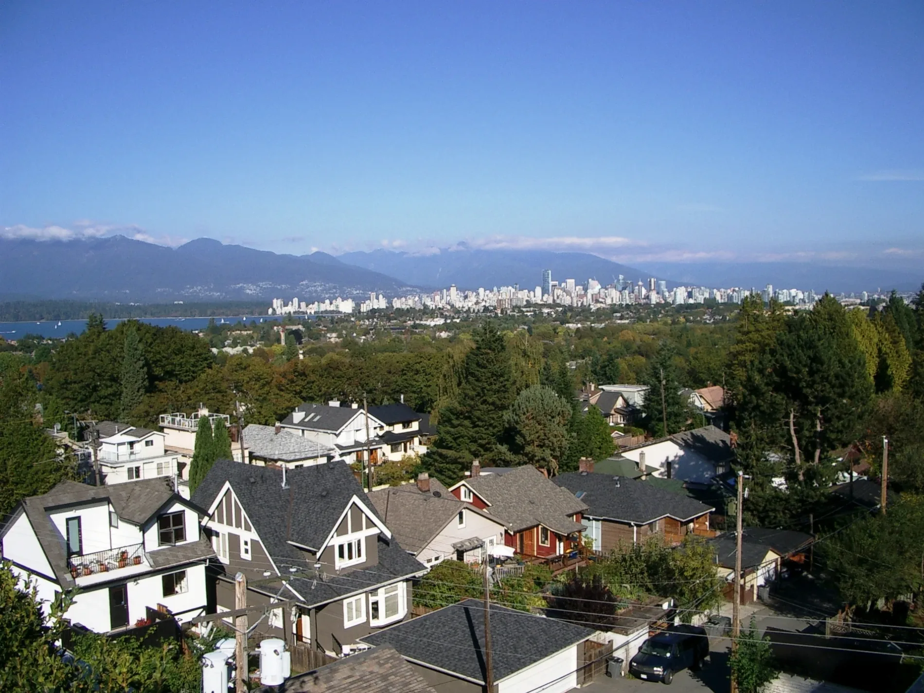
West 19th Avenue in Dunbar-Southlands, Vancouver, British Columbia
West 19th Avenue in Vancouver is a two-lane, asphalted residential street. There is no cycle path. It runs in an east-west direction starting from Camosun Street and crosses Crown Street, Wallace Street, Highbury Street, Dunbar Street and Collingwood Street and ends at Quadra Street. In the vicinity, there is a hearing aid centre. The nearest bus stop in the vicinity is Dunbar St (NB) at West 18th Ave (approx. 250 m away). West 19th Avenue also exists in Arbutus-Ridge, South Cambie and Riley Park.
- Road Type
- residential street
- Lanes
- 2
- Route
- east-west
Image
Hearing aid centres
Roads nearby
West 20th Avenue150 m
West 18th AvenueBC Liquor Store, Tim Hortons
150 m
West 21st Avenue250 m
Highbury Street250 m
West 16th AvenueWest 16th Ave (WB) at Alma St, West 16th Ave (EB) at Trimble St, West 16th Ave (WB) at Wallace St, West 16th Ave (EB) at Crown St, West 16th Ave (WB) at Discovery St, West 16th Ave (WB) at Sasamat St, West 16th Ave (WB) at Blanca St, West 16th Ave (WB) at Camosun St
300 m
Wallace Street300 m
West 17th AvenueLa Notte, Stylish Cut, Touch of Beauty
300 m
Dunbar StreetDunbar Loop Bay 1, Shell Car Wash, Dunbar St (NB) at West 43rd Ave, Dunbar St (SB) at Southwest Marine Dr, Dunbar St (NB) at Southwest Marine Dr, Dunbar St (SB) at West 43rd Ave, Dunbar St (NB) at West 38th Ave, Dunbar St (SB) at West 35th Ave, Dunbar St (SB) at West 31st Ave, Dunbar St (SB) at West 37th Ave, Dunbar St (SB) at West 33rd Ave, Dunbar St (SB) at West 29th Ave, Dunbar St (SB) at West 39th Ave, Dunbar St (SB) at West 27th Ave, Dunbar St (NB) at West 28th Ave, Dunbar St (NB) at West 36th Ave, Dunbar St (NB) at West 31st Ave, Shoppers Drug Mart, Dunbar St (SB) at West King Edward Ave, Dunbar St (NB) at West 39th Ave, Dunbar St (NB) at West 34th Ave, Top Cut Barber, Dunbar Nails & Lashes, Dunbar Family Dental, BMO, Stong's Replenish Cafe, Wild Sushi, Cosy Inn Cafe, Dunbar Theatre, The Cheese Inn, Bynns, H-Mart, Pink Elephant Cafe, Moon Sushi, Dunbar, London Drugs, Dunbar St (NB) at West 30th Ave, Dunbar Barber Shop, Scotiabank, JAK's Beer Wine Spirits, Bread Culture, Central Dunbar, Alta Vista Animal Hospital, Kuma, Dunbar St (SB) at West 21st Ave, Dunbar St (NB) at West 22nd Ave, Dunbar St (SB) at West 17th Ave, Chicko Chicken, North Dunbar, Dunbar Loop Bay 6, New District Wine Beer Spirits, Papa John's, Dunbar St (NB) at West King Edward Ave, La Canapa Boutique Dunbar, Dunbar St (NB) at West 18th Ave, Dairy Queen, Pure Integrative Pharmacy
350 m
West 22nd Avenue400 m
West 15th Avenue400 m
West 23rd AvenueLittle Free Library
450 m
West 14th Avenue500 m
Crown Street500 m
Collingwood StreetCrêpe & Café
550 m
West 24th Avenue550 m
Quadra Street600 m
West 13th Avenue600 m
West King Edward AvenueWest King Edward Avenue (EB) at Blenheim Street, West King Edward Avenue (EB) at Quesnel Drive, West King Edward Ave (WB) at Balaclava St, Little Free Library, West King Edward Ave (EB) at Dunbar St, West King Edward Avenue (WB) at Blenheim Street, West King Edward Avenue (WB) at Puget Drive
650 m
Dunbar DiversionAlma St (SB) at West 12th Ave, Dunbar Diversion (SB) at West 14th Ave, Dunbar Diversion (NB) at West 14th Ave
650 m
Camosun TrailsMap
650 m
Children's Bog Boardwalk700 m
Camosun Street700 m
Alma StreetAlma St (NB) at West 12th Ave, Lotusland Electronics & Music, Alma St (SB) at West 10th Ave, The Salon, The Kitchen Dada Sushi Bar & Grill, Alma St (NB) at West 10th Ave, 7-Eleven, Point Grey, Alma St (NB) at West Broadway
700 m
Ridgeway750 m
Dunkirk Street800 m
West 26th AvenueTD, RBC, YNP Dunbar Pharmacy
800 m
West 12th Avenue850 m
Quesnel DriveQuesnel Drive (NB) at West King Edward Avenue, Quesnel Drive (SB) at West King Edward Avenue
850 m
Galiano Road900 m
Waterloo StreetGreen Leaf Sushi
900 m
Musqueamview Street900 m
West 10th AvenueWhite Dwarf Books, Folkart Interiors, 4Cats Arts Studio, Skull Skates, DH Garden Centre, Little Kitchen Academy, QW Piano Academy, Energy Wellness Medispa, Queen's Beauty Salon, Connie Skincare & Wax Bar, Jericho Integrated Health Clinic, Open Door Music School, Folkstone Dental, West 10th Ave (WB) at Courtenay St, West 10th Ave (EB) at Courtenay St, West 10th Ave (WB) at Discovery St, West 10th Ave (EB) at Trimble St, West 10th Avenue (EB) at Crown Street, West 10th Avenue (WB) at Camosun Street, West 10th Ave (WB) at Wallace Cres, West 10th Avenue (WB) at Crown Street, West 10th Avenue (EB) at Camosun Street, West 10th Medical Pharmacy, Subway, Little Umbrella, West 10th Ave (EB) at Wallace St, West 10th Ave (EB) at Discovery St, Mollie's Stationery, Sasamat, West Point Grey Time Co., The Brush & Wand Studio, West 10th Eyes, Butterfly Beauty Salon, Friends of Winter, LifeLabs, Dentists in Point Grey, Liquid Sound, Spring Hair Design, West 10th Ave (EB) at Blanca St, Sushi Inn Japanese Cuisine, Sasamat Dental, West 10th Ave (EB) at Highbury St, West Point Cycles, Rajio Japanese Public House, Little Smiles Dental Centre, Topaz Facial Studio, West 10th Ave (WB) at Tolmie St, Everyday Sushi, Pizza Hut, Pizza Pizza, Trinity Tree Cannabis, Liberty Wine Merchants, VPL: West Point Grey Branch, TD Canada Trust, West 10th Ave (EB) at Tolmie St, West 10th Avenue (WB) at Sasamat Street, Four Olives Restaurant, Sun Sushi, Crazy Zhang Fusion Tea & BBQ Rice, RBC, West 10th Avenue (EB) at Sasamat Street, Hime Sushi, Laura K Jewitt, Tenth and Proper, Busy Bee Cleaners, Takumi Japanese Restaurant, Mix the Bakery, Burgoo, Sasamat Barber Shop, Urban Yarns, Aloe Beara, eliane's, Ame Japanese Toys, Domino's, The Ilka Cake Shop, Tapestry Music, Pure Pharmacy, WELL Health Medical Centres - Point Grey, Bean Around The World, Bella Roma, Danoo Cafe, Point Grey Eyecare, Language Arts Base, West 10th Ave (WB) at Trimble St, Ginger & Chili, Gild & Co, University Veterinary Clinic, Bitcoin ATM Localcoin
900 m
Blenheim StreetThe Local Farm Market, McDonald's
950 m
Apartment buildings nearby
The Grey450 m
Raphael at Alma900 m
Body of waters nearby
Devil's Hole750 m
Buildings nearby
WineKitz800 m
Buntains Insurance950 m
Cafés nearby
Grounds For Coffee950 m
Churches nearby
Dunbar Heights Baptist Church450 m
Hardware shops nearby
Home Hardware300 m
Houses nearby
RBC Inc600 m
Parks nearby
Quadra West Park600 m
Park Site on Blenheim700 m
Residential areas nearby
Blenheim Manor750 m
School buildings nearby
Lord Byng Secondary600 m
Jules Quesnel Elementary600 m
Service buildings nearby
Highbury Rectifier Station850 m
Sports centres nearby
Lord Byng Pool600 m
Public transport map Dunbar-Southlands Legend
| Railway | |
| Bus | |
| Tram |
Cycling map Dunbar-Southlands Legend
| Cycle path | |
| Cycle lane on road | |
| Cycling on bus lane | |
| Bicycle street | |
| Cyclists allowed | |
| Cyclists allowed, good surface | |
| No cycling | |
| Cobblestones |
| Long-distance cycle route | (depending on scale) | |
| Long-distance cycle route |
Walking map Dunbar-Southlands Legend
| Path |
| Long-distance hiking trail | (depending on scale) | |
| Long-distance hiking trail | ||
| No pedestrians |