
Sherwood Street in Kanata South, Ottawa, Ontario
Sherwood Street in Ottawa is a two-lane, asphalted residential street. No sidewalks. It runs in a southeast-northwest direction starting from Abbeyhill Drive and ends at Paddock Way.
- Road Type
- residential street
- Lanes
- 2
- Route
- southeast-northwest
Image
Florist's
Bakeries
Doctor's office
Game shops
Paint shops
Kitchen showrooms
Bus stops
Convenience stores
Fast food restaurants
Kindergarten
Bar
Hairdressers
Driving schools
Roads nearby
Banning RoadAbbeyhill / Banning
100 m
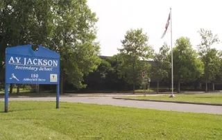
Abbeyhill DriveAbbeyhill / A.Y. Jackson High school, Moose McGuire's, Dogz Days, Feda Computers, Emendo, Abbeyhill / Hazeldean Mall, Abbeyhill / Old Colony, Circle K
150 m
Balbair Road150 m
Old Colony Road150 m
Paddock Way200 m
Oakburn Road250 m
Singal Street250 m
Country Lane West250 m
Abbotsford Road250 m
William's Walk300 m
Braco Street300 m
Oriole Avenue350 m
Aldburn PlaceFood Africana, Syrian Bakery, Ginestra Flower Shop
350 m
Post Road400 m
Bradley Farm Court400 m
Stokes Crescent450 m
Baneberry Crescent500 m
Dalriada Lane550 m
Torcastle Way550 m
Morrena RoadGlen Cairn Coop Preschool
550 m
Castlefrank RoadCastlefrank / AD. 50, Castlefrank / Winchester, Castlefrank/hazeldean, Castlefrank / Mckitrick, Castlefrank / Kakulu, Castlefrank / Glamorgan, Castlefrank / Hungerford, Castlefrank / AD. 114, Castlefrank / Mccurdy, Castlefrank / Tamblyn, Castlefrank / Aird, Castlefrank / Abbeyhill, Lorenzo's, Burrito Express, Castlefrank / Stokes, Castlefrank / Macneil, Castlefrank / Sheldrake, Castlefrank / Katimavik
600 m
Turret Court650 m
Winchester Drive650 m
Sheldrake DriveSheldrake / Laurie, Sheldrake / Morton, Sheldrake / Binscarth, Sheldrake / Castlefrank
650 m
Sumner Street700 m
McKitrick Drive750 m
Melanie Crescent800 m
Allotment gardens nearby
Hope Living Community Garden500 m
Kanata South Community Garden600 m
Beauty salons nearby
The Spa600 m
Community centres nearby
Glen Cairn Community Centre400 m
Ice rinks nearby
Jack Charron Arena (Kanata)450 m
Libraries nearby
Ottawa Public Library - Hazeldean Branch500 m
Parks nearby
Graham Ball Softball Diamond400 m
Beaton Park400 m
Morrena Park450 m
Places of worship nearby
Glen Cairn United Church100 m
Kanata Community Christian Reformed Church550 m
Residential areas nearby
Rankin Terrace400 m
CCC 235400 m
CCC 252500 m
Castlefrank Co-operative550 m
Social facilities nearby
Hope Living600 m
Sports pitches nearby
Glen Cairn Tennis Club350 m
East Diamond450 m
Frank MacDonald Fastball Diamond700 m
Swimming pools nearby
Glen Cairn Outdoor Pool400 m
Wading Pool - Glen Cairn400 m
Terraced houses nearby
Condo Office450 m
Public transport map Kanata South Legend
| Railway | |
| Bus | |
| Tram |
Cycling map Kanata South Legend
| Cycle path | |
| Cycle lane on road | |
| Cycling on bus lane | |
| Bicycle street | |
| Cyclists allowed | |
| Cyclists allowed, good surface | |
| No cycling | |
| Cobblestones |
| Long-distance cycle route | (depending on scale) | |
| Long-distance cycle route |
Walking map Kanata South Legend
| Path |
| Long-distance hiking trail | (depending on scale) | |
| Long-distance hiking trail | ||
| No pedestrians |