
Singal Street in Kanata South, Ottawa, Ontario
Singal Street in Ottawa is a two-lane, asphalted residential street. No sidewalks. It runs in a southeast-northwest direction starting from Desmond Avenue and ends at Balbair Road.
- Road Type
- residential street
- Lanes
- 2
- Route
- southeast-northwest
Image
Doctor's office
Bar
Driving schools
E-cigarette shops
Pet shops
Bus stops
Paint shops
Game shops
Kitchen showrooms
Hairdressers
Bicycle shops
Massage parlours
Kindergarten
Roads nearby
Abbotsford Road100 m
Balbair Road100 m
Coburn Avenue200 m
Braco Street200 m
Desmond Avenue200 m
Bradley Farm Court250 m
Old Colony Road250 m
Sherwood Street250 m
Country Lane West250 m
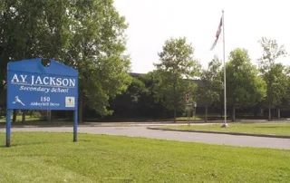
Abbeyhill DriveAbbeyhill / A.Y. Jackson High school, Moose McGuire's, Dogz Days, Feda Computers, Emendo, Abbeyhill / Hazeldean Mall, Abbeyhill / Old Colony, Circle K
350 m
Oakburn Road400 m
McDermot Court450 m
Oriole Avenue450 m
Tanguay Court450 m
Carbrooke StreetCarbrooke / Desmond, Carbrooke / Abbeyhill, Carbrooke / Hazeldean, Guilbault Automotive & Tire Discount Center, Petro-Canada
500 m
Hazeldean RoadHazeldean / Carbrook, Wendy's, Tim Hortons, Hazeldean / Edgewater, Hazeldean / Young, 436 Hazeldean, Hazeldean / Castlefrank, Hazeldean / Terry Fox, Sobeys Pharmacy, Hazeldean / Carbrooke, Spectrum Kitchen & Bath Design, Benjamin Moore, Kumon, Hazeldean / Irwin Gate, Hazeldean / Kincardine, Fresh Ink Tattoo, Kanata Nail Studio, Tony's Place, Hazeldean Florist, Yummy, Hazeldean / Eagleson, Cash 4 You, Young Drivers, Ottawa Academy of Martial Arts, Clear Sky Vapes, Kundstadt Sports, Beachcomber Hot Tubs, Hunter Douglas Flooring, Hazeldean Medical Clinic, Minnesota's Billiards Pub, Walker's Prestige Barber Shop
500 m
Lightfoot Place550 m
Irwin GateIrwin / Pickford, Irwin Gate / Pickford, Irwin / Hazeldean
550 m
Banks nearby
BMO400 m
Beauty salons nearby
Touch Nails & Spa350 m
Cafés nearby
Starbucks450 m
Cannabis shops nearby
Shinybud Cannabis Co.350 m
Carpet shops nearby
Alexanian400 m
Clothing shops nearby
Plato's Closet350 m
Coffee shops nearby
Brew It Boutique350 m
Dental practices nearby
Dr. Freeman Bill350 m
Fast food restaurants nearby
Pizza Pizza350 m
Greek on Wheels400 m
Florist's nearby
In Bloom350 m
Medical supply shops nearby
Wellwise400 m
Pet shops nearby
Wild Birds Unlimited350 m
Petrol stations nearby
Petro-Canada450 m
Pharmacies nearby
Click Pharmacy400 m
Shoppers Drug Mart400 m
Photography shops nearby
Jiffy Photo350 m
Places of worship nearby
Glen Cairn United Church250 m
Residential areas nearby
Pickford Court500 m
Residential buildings nearby
Office500 m
Restaurants nearby
Buster's Bar & Grill300 m
Pho Moonlight400 m
Retail areas nearby
Hilltop Centre350 m
Van Leeuwen Centre500 m
Retail buildings nearby
Ontario Children and Youth Services350 m
The Wellness Group350 m
Nibav Lifts400 m
Century 21400 m
Social facilities nearby
Fairfield Manor Retirement Residence450 m
Sports pitches nearby
Glen Cairn Tennis Club450 m
Veterinary practices nearby
Kanata Animal Hospital350 m
Public transport map Kanata South Legend
| Railway | |
| Bus | |
| Tram |
Cycling map Kanata South Legend
| Cycle path | |
| Cycle lane on road | |
| Cycling on bus lane | |
| Bicycle street | |
| Cyclists allowed | |
| Cyclists allowed, good surface | |
| No cycling | |
| Cobblestones |
| Long-distance cycle route | (depending on scale) | |
| Long-distance cycle route |
Walking map Kanata South Legend
| Path |
| Long-distance hiking trail | (depending on scale) | |
| Long-distance hiking trail | ||
| No pedestrians |