
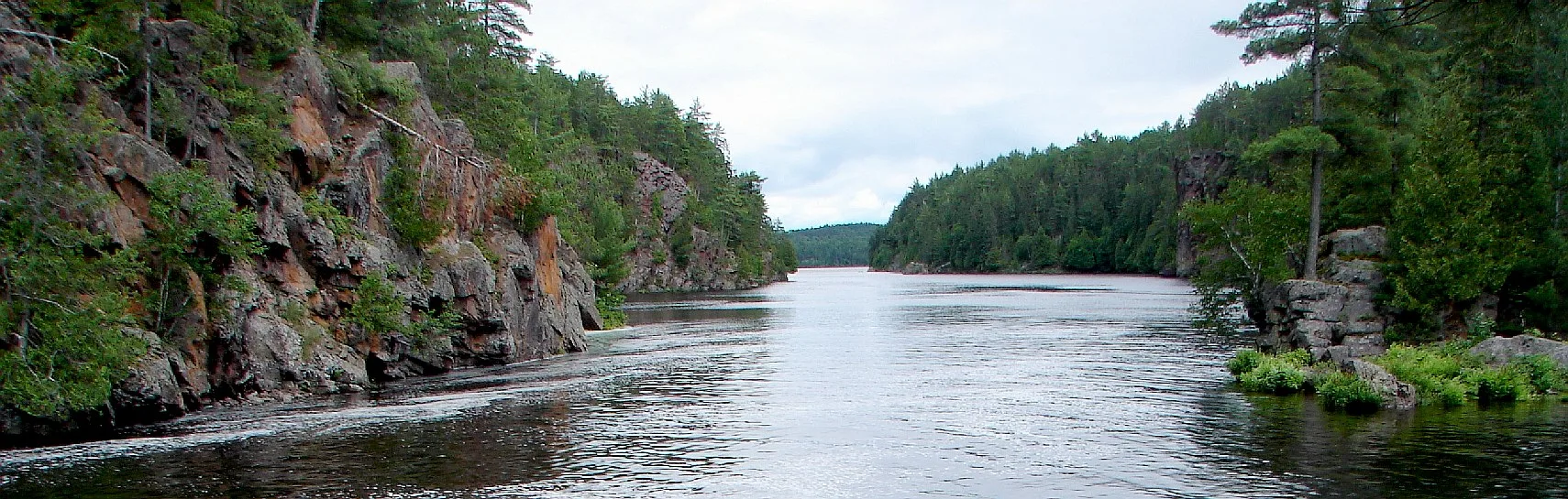
Mattawa River in Bonfield Township, Ontario
Mattawa River in Bonfield Township is a river. Mattawa River also exists in Papineau-Cameron Township, Calvin and Mattawa. Ⓦ.
- Waterway Type
- river
Hotels
Petrol stations
Campsite
Off-licences
Roads nearby
Fitzgerald Road1,8 km
Whitehouse Road2,1 km
VMUTS Trail 102,7 km
Rice Bay2,7 km
Pineland Drive2,9 km
Portage Pin de Musique3,0 km
VMUTS trail number 653,7 km
Portage de la Mauvaise Musique3,8 km
Gibson Mill Road4,5 km
VMUTS trail number 694,9 km
VMUTS trail number 105,1 km
VMUTS trail 365,8 km
Allen Road5,9 km
Wunders Road6,1 km
Georges Road6,4 km
Pine Lake Road7,1 km
Shields Point Road7,1 km
Barry Road7,4 km
Songis RoadCamp Conewango
7,4 km
Line 3 Road NCedar Gables
7,5 km
Tyes Road7,5 km
VMUTS trail number 247,6 km
Land Use nearby
22 Wing Cottage Club3,1 km
Body of waters nearby
Bigfish Lake2,0 km
Whitethroat Lake3,5 km
Walder Lake4,0 km
Crescent Lake4,5 km
Magee Lake4,7 km
Brumal Lake5,3 km
Barse Lake5,5 km
Dinner Lake5,5 km
Glassy Lake5,6 km
Froggy Lake6,2 km
La Chapelle Lake6,7 km
Loren Lake7,0 km
Round Lake7,1 km
Olmstead Lake7,2 km
Chime Lake7,4 km
L Lake7,5 km
Buildings nearby
Cedar Gables Lodge7,4 km
Campsite nearby
Camp Conewango2,1 km
Rivers nearby
Mauvause Musique Rapids3,8 km
North River5,0 km
Streams nearby
Glassy Creek2,6 km
Cahill Creek4,9 km
Doule Creek6,0 km
Walder Creek6,1 km
Bushtrail Creek6,2 km
Balsam Creek6,4 km
| Length | 52 |
|---|---|
| Located in | Nipissing District |
| Country | Canada |
| Origin | Trout Lake |
| Mouth | Ottawa River |
| Tributary | Kaibuskong River, Amable du Fond River |
Public transport map Bonfield Township Legend
| Railway | |
| Bus | |
| Tram |
Cycling map Bonfield Township Legend
| Cycle path | |
| Cycle lane on road | |
| Cycling on bus lane | |
| Bicycle street | |
| Cyclists allowed | |
| Cyclists allowed, good surface | |
| No cycling | |
| Cobblestones |
| Long-distance cycle route | (depending on scale) | |
| Long-distance cycle route |
Walking map Bonfield Township Legend
| Path |
| Long-distance hiking trail | (depending on scale) | |
| Long-distance hiking trail | ||
| No pedestrians |