
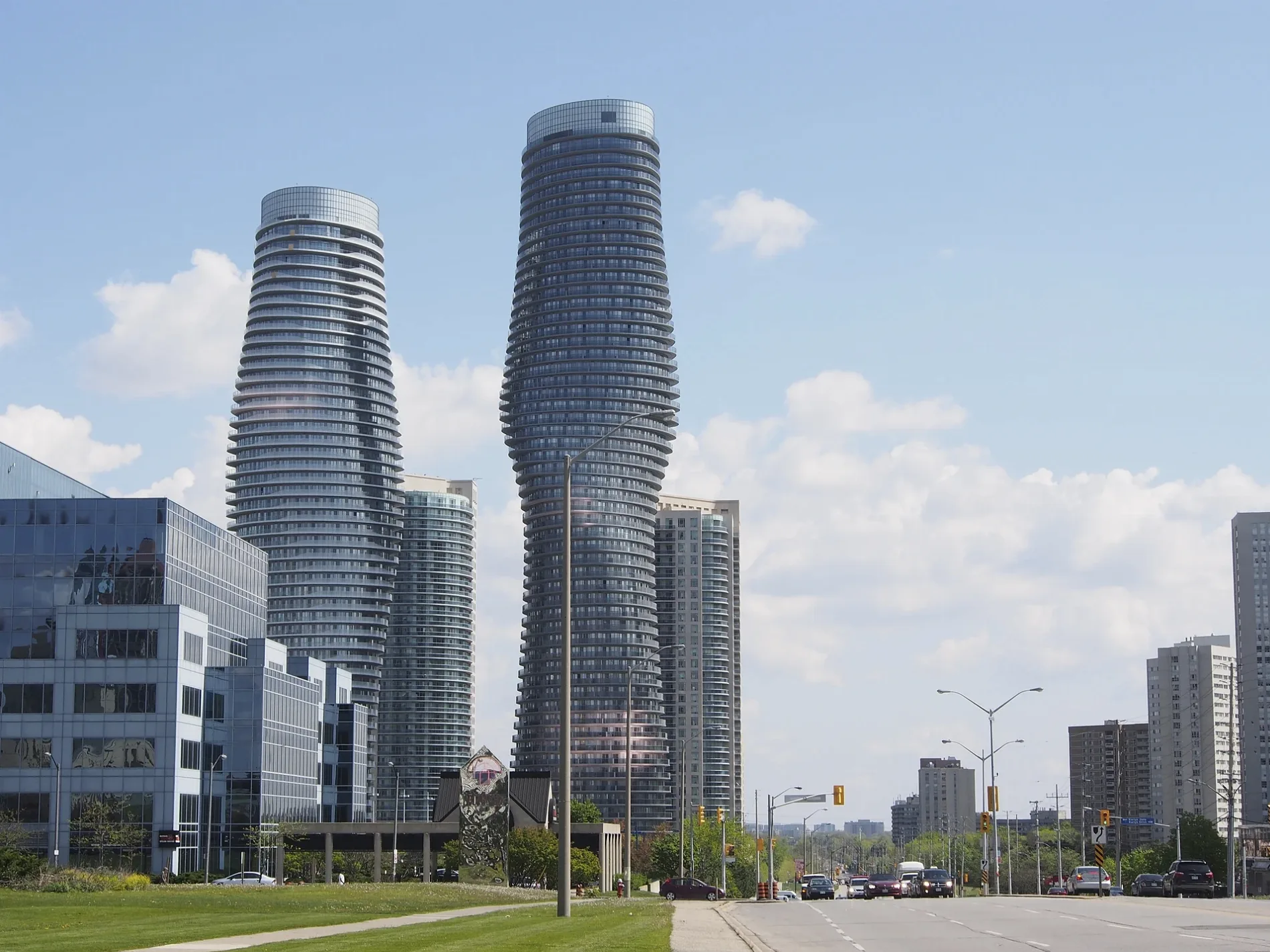
Burnhamthorpe Road East in City Centre, Mississauga, Ontario
Burnhamthorpe Road East in City Centre in Mississauga is an asphalted, lit secondary road (60 km/h). The road has sidewalks. It runs in a northeast-southwest direction and crosses Fieldgate Drive, Golden Orchard Drive, Bough Beeches Boulevard, Havenwood Drive, Wilcox Road, Molly Avenue, Flamewood Drive, Westminster Place, Cawthra Road, Autumn Harvest Drive, Tomken Road and Corbet Drive. It connects Applewood, Mississauga Valleys, Rockwood Village, Rathwood and City Centre. The nearest stop is Arista Way. The bus line 26 stops here.
- Road Type
- secondary road
- Speed Limit
- 60
- Lanes
- 7
- Route
- northeast-southwest
Image
Bus stops
- bus lines 26
Roads nearby
Burnhamthorpe TrailBurnhamthorpe Rd W At Confederation Pky, Absolute Avenue, Burnhamthorpe Rd At Hurontario St, Robert Speck Parkway, Parking payment terminal, Burnhamthorpe Road At Duke Of York Boulevard, Hurontario Street, SBI Canada Bank, Kariya Gate, ICICI Bank, Square One Health Group, Pizza Nova, Mississauga Celebration Square, Burnhamthorpe Road At Living Arts Drive
50 m
Arista Way150 m
Absolute AvenueAbsolute Sales Centre
250 m
Hurontario StreetMatthews Gate, Esso, Tim Hortons, Hurontario Street At Central Parkway, RBC, Circle K, Fairview, Hurontario Street At Burnhamthorpe Road, Hurontario Street At Elm Drive
250 m
Burnhamthorpe Road300 m
Kaneff Crescent300 m
Robert Speck ParkwayRobert Speck Parkway at Burnhamthorpe Road East
300 m
Mississauga Valley BoulevardMississauga Valley Boulevard At Arista Way, Mississauga Valley Boulevard North Of Central Parkway, Iona Hairsysling, Iona Doctors Clinic, Subway, Grand LV Nails & Spa, Mississauga Valley Boulevard at Trisha Downs, Mississauga Valley Boulevard at Fairview Road, Mississauga Valley Boulevard at Michelle Row, Mississauga Valley Boulevard at Silver Creek Boulevard, Mississauga Valley Boulevard at Gwendale Crescent, Mississauga Valley Boulevard At Mississauga Valley Community Centre, Mississauga Valley Boulevard South of Bloor Street, Medical Centre & Pharmacy One, Greek Grill, Mississauga Valley Boulevard at Bloor Street, Mississauga Valley Boulevard At Central Parkway, Mississauga Valley Boulevard at Lolita Gardens, Mississauga Valley Boulevard at Thornwood Public School, Mississauga Valley Boulevard at Voltaire Crescent, Mississauga Valley Boulevard at Central Parkway East, Mississauga Valley at Silver Creek Boulevard, Mississauga Valley Boulevard at Cliff Road North, Mississauga Valley Boulevard at Cliff Road, Mississauga Valley Boulevard At Elm Drive, Mississauga Valley Boulevard At Kaneff Crescent, Kaneff Presentation Centre
300 m
Cooksville Creek TrailRobert Speck Parkway West Of Shipp Drive, Kaizen Health Group - Parkway (Square One)
350 m
Bishopstoke Lane350 m
Burnhamthorpe Road WestBurnhamthorpe Road At Duke Of York Boulevard, National Bank, Living Arts Drive Stop, Chai Pain The Indian Streetary, Postnet, D Cleaners, Burnhamthorpe Rd At Sussex Gate, Mississauga Smiles Dentistry, Vogue Optical, M-City Dental, Aboud Health, Burnhamthorpe Road At Kariya Drive, Burnhamthorpe Rd W At Confederation Pky, Wine Rack, Java-U Coffee House
350 m
Matthews GatePassport Health Mississauga Travel Clinic
400 m
Meadows BoulevardMeadows Boulevard At Robert Speck Parkway, Meadows Boulevard At Bishopstoke Lane, Meadows Boulevard At Woodington Drive, Meadows Boulevard At Prince George Avenue, Kumon, English as a Second Language Learning Centre, Monisha Discount Warehouse Passport Photos, Untouchables Sports Cards & Gaming, Connect Hearing, Nails for You
400 m
Sussex GateGoodfellas Wood Oven Pizza, Café Nicole, Avis, Starbucks, Wicked Chicken, Budget, Turtle Jack’s, Pro Beauty Suites
450 m
Enfield PlaceUdupi Madras Cafe, KEB Hana Bank Canada, Madras Peppers
450 m
Shipp Drive450 m
Obelisk Way500 m
Elm Drive EastElm Drive At Hurontario Street, Elm Drive At Obelisk Way, Elm Drive East Of Hurontario Street, Elm Drive East at Mississauga Valley Boulevard
550 m
Kariya DriveKariya Drive at Burnhamthorpe Road West, The Wave Bar & Lounge, Kariya Drive At North Enfield Place, Gong Cha, Kariya Drive At Enfield Place, Gyu-Kaku
600 m
Kariya GateKariya Drive at City Centre Drive, Haidilao Hot Pot, Mr. Lube
650 m
Elm Drive WestElm Drive At Hurontario Street, Elm Drive At Kariya Drive
650 m
City Centre DriveCity Centre Drive at Kariya Drive, Popeyes, City Centre Drive At Square One Drive, City Centre Drive South of Robert Speck Parkway, City Centre Drive North of Kariya Gate, City Centre Drive at Square One Parking Lot 1, City Centre Drive at Robert Speck Parkway, Dr. Bobby Brown & Associates, IS2 Workforce Solutions, Smile Solutions Orthodontists Drs. Eckler, Black & Leung, Pharmasave, Kingsbridge Medical Centre, The Keg, Rabba, Mississauga, Greenspoke Repair Post, 201 City Centre Drive, Mercer Street @ City Centre Drive, Bar6ix, Chellsey Institute of Beauty and Health Inc., Impark, Pedi N Nails, Tim Hortons, 4080 Living Arts Dr, Panera Bread, McDonald's, City Centre Drive at Duke of York Boulevard
650 m
Square One Centre Walk650 m
Webb DriveWebb Drive At Redmond Road, Webb Drive East Of Confederation Parkway, Webb Drive West Of Duke Of York Boulevard, Webb Drive At Confederation Parkway, Confederation Parkway
700 m
Erskine Road750 m
Apartment buildings nearby
The Arista150 m
Absolute World - South200 m
Place IV250 m
Absolute World - North250 m
Compass Creek350 m
Commercial areas nearby
Treetops150 m
Symcor450 m
Morguard600 m
CIBC650 m
Commercial buildings nearby
De Bousquet PC, Barristers and Solicitors500 m
Sussex Centre600 m
Constructions nearby
EXS750 m
Hotels nearby
Delta Hotels by Marriott Toronto Mississauga400 m
Office buildings nearby
Intact300 m
Railways under construction nearby
Hurontario LRT350 m
Residential areas nearby
Absolute200 m
Absolute World250 m
Widesuites450 m
One City Centre550 m
The Towne700 m
Residential buildings nearby
Absolute Vision150 m
Restaurants nearby
Befkire Bar + Kitchen600 m
Social facilities nearby
Chartwell Classic Retirement Residences250 m
Streams nearby
Cooksville Creek600 m
Public transport map City Centre Legend
| Railway | |
| Bus | |
| Tram |
Cycling map City Centre Legend
| Cycle path | |
| Cycle lane on road | |
| Cycling on bus lane | |
| Bicycle street | |
| Cyclists allowed | |
| Cyclists allowed, good surface | |
| No cycling | |
| Cobblestones |
| Long-distance cycle route | (depending on scale) | |
| Long-distance cycle route |
Walking map City Centre Legend
| Path |
| Long-distance hiking trail | (depending on scale) | |
| Long-distance hiking trail | ||
| No pedestrians |