
Bukit Batok Central in Guilin
Bukit Batok Central in Bukit Batok is a two-lane, asphalted main road (50 km/h). It crosses Bukit Batok Central Link, Bukit Batok Street 21, Bukit Batok Avenue 1, Bukit Batok West Avenue 2, Bukit Batok West Avenue 3, Bukit Batok Bus Interchange, Bukit Batok Interchange, Bukit Batok East Avenue 3 and Bukit Batok East Avenue 2 and ends in a cul-de-sac. It connects Bukit Batok Central, Guilin, Brickland and Bukit Batok East. In the vicinity, there is among other things a restaurant. The nearest stop is Opposite Blk 628. The bus lines 61, 77, 106, 106A, 157, 173, 174, 174e, 176, 177, 178, 187, 188, 188e, 189, 453, 506, 852, 868, 941, 945, 947, 985, 990, 991 and 992 serve this stop.
- Road Type
- main road
- Lanes
- 2
- Speed Limit
- 50
Image
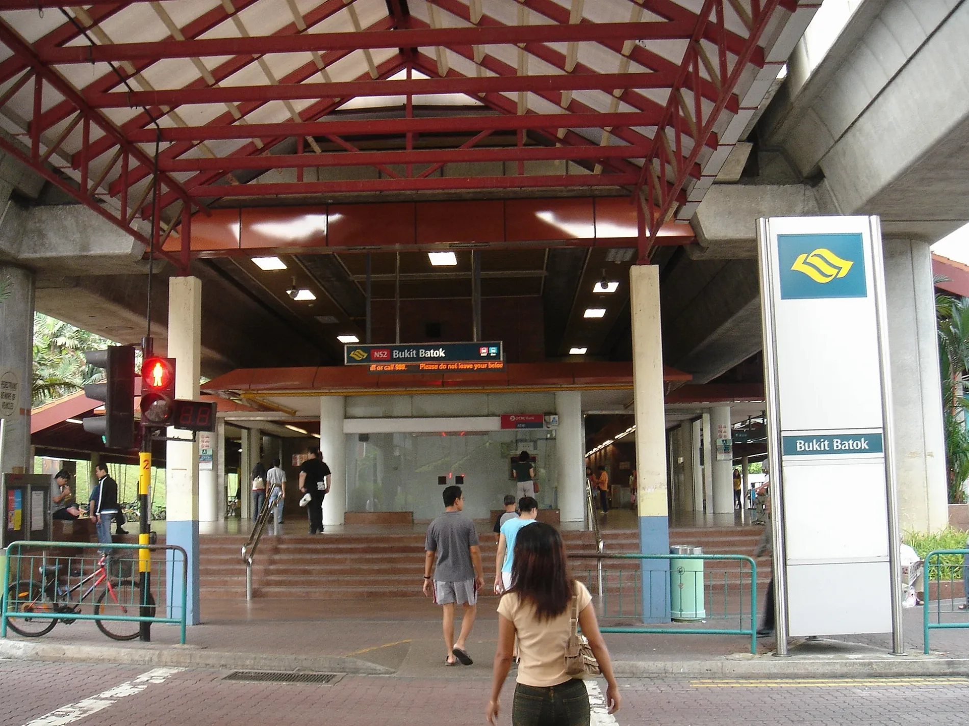
Roads nearby
Bukit Batok Bus InterchangeMcDonald's, UOB, OCBC
50 m
CarparkBukit Batok Interchange
150 m
Bukit Batok Interchange150 m
Bukit Batok East Avenue 2Blk 503, Opposite Blk 242, Opposite Blk 258
250 m
Bukit Batok CentralAfter Bukit Batok Station/Blk 628, OCBC Business, Newhouse Furnishing, Tai Hin Pawnshop, Blk 644, Time's Vege, Texas Chicken, 肯德基, Cold Storage, Sunny Choice, The Coffee Bean & Tea Leaf, Popular, Blk 225, Bukit Batok Central, Opposite Blk 120
300 m
Bukit Batok Street 527-Eleven, Ren Ci @ Bukit Batok Street 52, Blk 514
300 m
Bukit Batok Street 21Opposite Blk 217, Blk 217, Opposite Bukit View Secondary School, Bukit View Secondary School, Wan Hao Kopitiam, Viet Corner, Nurul Delight, New Chef Western
350 m
Bukit Batok Central LinkBukit Batok, Bukit Batok Public Library, Harvey Norman, Cathay Cineplex, Ya Kun Family Cafe, Watsons, Guardian, Starbucks, Bukit Batok Central Post Office, Koufu, Valu$, Bata
450 m
Bukit Batok West Avenue 2After Bukit Batok West Avenue 5
450 m
Bukit Batok West Avenue 3Opposite Blk 140, Opposite Princess Elizabeth Primary School, Opposite Blk 127
500 m
Bukit Batok East Avenue 5500 m
Bukit Batok East Avenue 6Opposite Bukit View Secondary School, Blk 291A, Bukit Batok Swimming Complex
600 m
Bukit Batok Park ConnectorOpposite Blk 102, NTUC FairPrice, Bukit Batok Community Club
600 m
Regent Heights650 m
Bukit Batok Street 22700 m
Bukit Batok Industrial Park AGreen basikal
700 m
Bukit Batok East Avenue 3Blk 283, Excelsior Clinic, Blk 231, Hybrid Scuba, DIY Laundry, Giant (Express), Bread Garden
700 m
Ulu Pandan Park ConnectorFu Jiang Food Court, Blk 288C
800 m
Bukit Batok Street 23Paws Love It, Paws To Heaven, Blk 291E, Opposite Midview Building, Toyo Tires, SBST Bukit Batok Depot, Midview Building, A1 motor Co., Opposite SBST Bukit Batok Depot, Opposite Blk 291E, Hua Chin 2000, Autozone, Bridgestone
800 m
Leisure nearby
Civil Service Club @ Bukit Batok400 m
Buildings nearby
Cambridge Industrial Trust650 m
Commercial areas nearby
Bukit Batok Town Centre250 m
Bukit Batok East Point800 m
Community centres nearby
Bukit Batok Community Club500 m
Golf courses nearby
above carpark golf range550 m
Industrial buildings nearby
Mass Technologies650 m
Swift Precision Engineering Pte Ltd650 m
Propell Building700 m
Parks nearby
Bukit Batok Neighbourhood Park400 m
Places of worship nearby
Tong Tien Kung Temple500 m
Ling Hong Tong & Tua Peh Kong Temple500 m
Masjid Ar-Raudhah550 m
Residential areas nearby
The Jade300 m
Gombak Gardens300 m
Guilin Breeze400 m
Hillgrove Gardens400 m
Bukit Batok Green500 m
Golden Daisy600 m
The Dew700 m
Skypeak @ Bukit Batok700 m
Schools nearby
Bukit View Secondary School500 m
Bukit View Primary School650 m
Keming Primary School800 m
Self-storages nearby
Storhub700 m
Shopping malls nearby
West Mall350 m
Sports pitches nearby
Tennis courts600 m
Subway lines nearby
North South Line (NS)450 m
Swimming pools nearby
tower a pool600 m
tower b pool600 m
tower-C pool650 m
 Public transport map Guilin Legend
| Railway | |
| Bus | |
| Tram |
 Cycling map Guilin Legend
| Cycle path | |
| Cycle lane on road | |
| Cycling on bus lane | |
| Bicycle street | |
| Cyclists allowed | |
| Cyclists allowed, good surface | |
| No cycling | |
| Cobblestones |
| Long-distance cycle route | (depending on scale) | |
| Long-distance cycle route |
 Walking map Guilin Legend
| Path |
| Long-distance hiking trail | (depending on scale) | |
| Long-distance hiking trail | ||
| No pedestrians |