
Haddow Grove in Burntisland
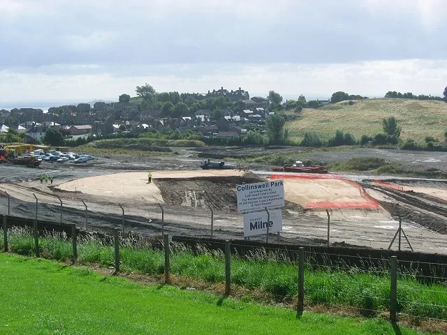
Haddow Grove in Alba / Scotland, Burntisland is an asphalted, lit residential street. The road has sidewalks. It runs in an east-west direction starting from Haugh Road and ends in a cul-de-sac. Haddow Grove also exists in North Lanarkshire.
- Road Type
- residential street
- Speed Limit
- 20 mph
- Route
- east-west
Image
Dentist
Guest house
Hairdressers
Beauty salons
Opticians
Travel agencies
Bus stops
Tourist information offices
Pubs
Museum
- Burntisland Heritage Exhibition (Burntisland Heritage Trust, opening hours: week 25–34 Th-Sa 11–16, free, web) at High Street (KY3 9DB) – approx. 500 m.
- Museum of Communication (wheelchair accessible, opening hours: May–Sep: Wed 11–16; Sat 11–16, free, web) at High Street 131 (KY3 9AA) – approx. 550 m.
Restaurants
Social facility
Bank
Florist's
Roads nearby
Shepherd Crescent150 m
Rossend Terrace150 m
Durie Park200 m
Melville Gardens200 m
Half Moon Walk200 m
Sailors' WalkNational Smiles
200 m
Seamill Gardens250 m
Seals Craig View250 m
Burnside Gardens300 m
Kirkton Gardens300 m
Oxcars Avenue300 m
Collinswell Drive350 m
Car Craig View350 m
West Broomhill Road350 m
Seaforth Place350 m
Monks Walk400 m
Geds Mill Close400 m
Fidra Avenue400 m
Harbour Place Turning CircleHarbour Place Turning Circle
400 m
Little Craigs View400 m
Harbour Place400 m
Kirkton Drive450 m
Inchgarvie Avenue450 m
Colinswell RoadDunearn Bank, Silverbarton Terrace, Stenhouse Drive
450 m
Braehead450 m
Dunearn Bank500 m
Aberdour RoadChurch Street, Righteous Rides, Cromwell Road, Grange Garage, Adam's Autocare, RDB Car Sales, Jubilee Tavern, Martin's Lodge, SM Autos
500 m
Kinninmonth Avenue500 m
Silverbarton Terrace500 m
Grange RoadThe Book Exchange
550 m
Meldrum Crescent550 m
Stenhouse Drive600 m
Kilmundy DriveGrange Road
650 m
Bendameer RoadGrange Farm Cottage, Bendameer Road
650 m
Bare rocks nearby
Familars Rocks500 m
Body of waters nearby
Seamill Pond100 m
Buildings nearby
Burntisland Tide Mill (remains of)150 m
BiFab200 m
Commercial buildings nearby
Half Moon House200 m
Briggs Marine300 m
Convenience stores nearby
Castle Stores50 m
Grasslands nearby
Duncan’s Field350 m
Industrial buildings nearby
K&S Fabrication300 m
Playgrounds nearby
Haugh Road100 m
Railway lines nearby
Fife Circle Line300 m
Residential buildings nearby
Abbot's View100 m
Rossend Castle200 m
Streams nearby
Kirkton Burn450 m
Woodlands nearby
Ross Brae300 m
Public transport map Burntisland Legend
| Railway | |
| Bus | |
| Tram |
Cycling map Burntisland Legend
| Cycle path | |
| Cycle lane on road | |
| Cycling on bus lane | |
| Bicycle street | |
| Cyclists allowed | |
| Cyclists allowed, good surface | |
| No cycling | |
| Cobblestones |
| Long-distance cycle route | (depending on scale) | |
| Long-distance cycle route |
Walking map Burntisland Legend
| Path |
| Long-distance hiking trail | (depending on scale) | |
| Long-distance hiking trail | ||
| No pedestrians |