
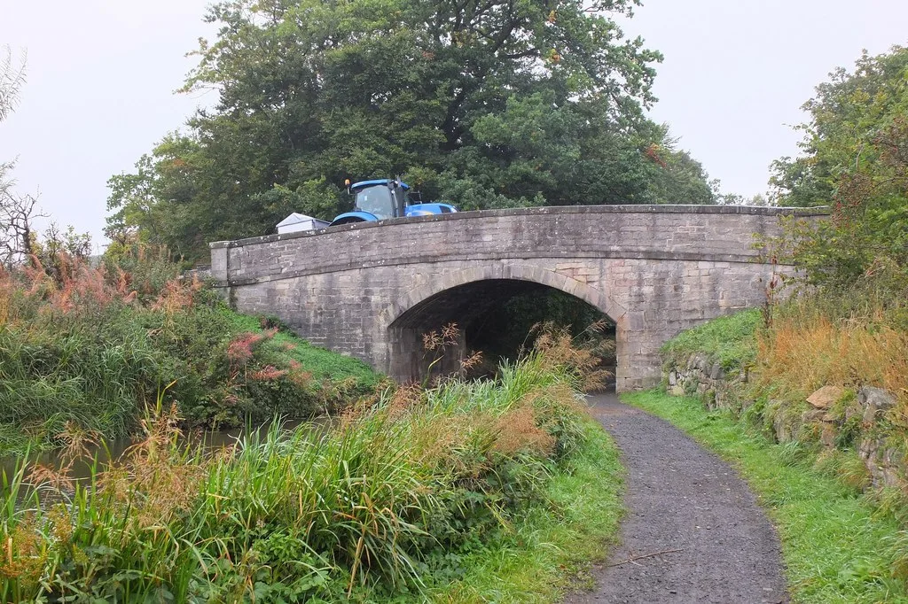
Gogar Moor Bridge in Edinburgh
Gogar Moor Bridge in City of Edinburgh is a single-lane, asphalted, unlit tertiary road. It runs in a northeast-southwest direction starting from Gogarmuir Road. Gogar Moor Bridge is also known as Union Canal, Gogar Moor Bridge.
- Road Type
- tertiary road
- Lanes
- 1
- Speed Limit
- 60 mph
- Route
- northeast-southwest
Image
Roads nearby
Addiston Farm Road500 m
Ransfield RoadRansfield Cottages
600 m
Gogarmuir RoadRoddinglaw, Trefoil Centre
650 m
East Croft1,4 km
Research Avenue NorthJack Copland Centre, Hermiston Walk, Scottish Whisky Research Institute, Research Park
1,4 km
Freelands Road1,4 km
Tormain Bank1,5 km
Roddinglaw RoadRoddinglaw
1,5 km
West Croft1,5 km
Ratho Park Road1,5 km
North Platt Gardens1,5 km
North Platt Crescent1,6 km
Tormain Drive1,6 km
Union Canal TowpathAllan Park Road, Slateford Bowling Club Pavilion, Craiglockhart Junction, Brian Miller Motors, Brown's Body Services
1,6 km
Dalmahoy RoadTimmins Court, Dalmahoy Road, Dalmahoy Country Club
1,6 km
CanalsideNavvie
1,6 km
Body of waters nearby
Kierhill Pond950 m
Buildings nearby
Dovecot700 m
Golf Shop750 m
Club House800 m
Icehouse800 m
Steading1000 m
Ashley House1000 m
Ashley Stables1000 m
Addistoun House1,1 km
Metal Forge1,1 km
The Jack Copland Centre1,3 km
Ratho Byres Forge1,4 km
Gogarburn Golf Club1,4 km
Sports Hut1,5 km
Commercial areas nearby
Science and Advice for Scottish Agriculture (SASA)700 m
Constructions nearby
Old Gas Works1,7 km
Farmyards nearby
Gogarbank Farm950 m
Ransfield1,0 km
Freelands1,4 km
Forests nearby
Lidgate Wood1,6 km
Gardens nearby
Ashley900 m
Golf courses nearby
Ratho Park Golf Club600 m
Guest house nearby
Kellerstain Stables1,4 km
Industrial areas nearby
Roddinglaw Business Park900 m
Parks nearby
Ratho Park1,6 km
Railway lines nearby
Edinburgh and Glasgow Main Line1,3 km
Restaurants nearby
Ratho Park Carvery1,6 km
Sports centres nearby
Skirmish Paintball1,3 km
Streams nearby
Gogar Burn750 m
Wetlands nearby
Ransfield Marsh1,4 km
(Seasonal Marsh)1,4 km
Other nearby
Addiston Mains helipad550 m
Roddinglaw1,1 km
| Heritage designation | category B listed building |
|---|---|
| Located in | City of Edinburgh, Edinburgh |
| Country | United Kingdom |
| Crosses | Edinburgh and Glasgow Union Canal |
| Carries thoroughfare | unclassified road |
 Public transport map City of Edinburgh Legend
| Railway | |
| Bus | |
| Tram |
 Cycling map City of Edinburgh Legend
| Cycle path | |
| Cycle lane on road | |
| Cycling on bus lane | |
| Bicycle street | |
| Cyclists allowed | |
| Cyclists allowed, good surface | |
| No cycling | |
| Cobblestones |
| Long-distance cycle route | (depending on scale) | |
| Long-distance cycle route |
 Walking map City of Edinburgh Legend
| Path |
| Long-distance hiking trail | (depending on scale) | |
| Long-distance hiking trail | ||
| No pedestrians |