
Ballifeary Road
Ballifeary Road in Highland, Ballifeary is a two-lane, asphalted, lit residential street. It runs in a northeast-southwest direction starting from Bishops Road and crosses Ballifeary Lane and Dunachton Road. It ends in a cul-de-sac. In the vicinity, there is among other things a guest house. The nearest bus stop in the vicinity is Balifearry Lane (approx. 150 m away).
- Road Type
- residential street
- Lanes
- 2
- Speed Limit
- 20 mph
- Route
- northeast-southwest
Image
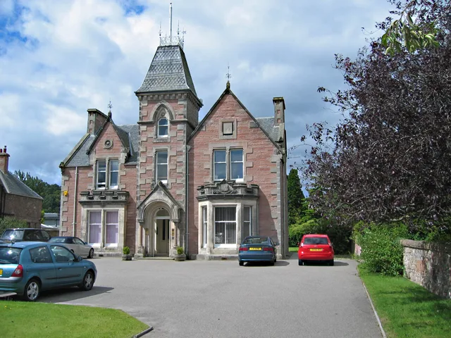
Guest house
Roads nearby
Dunachton Road150 m
Springfield Court200 m
Bruce AvenueBalifearry Lane, Laidlaw's
200 m
Springfield Gardens200 m
Ballifeary Lane250 m
Torvean AvenueBught Park Stores
250 m
Warrand Road250 m
Bught DriveBught Camp Site
300 m
Lindsay Avenue300 m
Wellingtonia Court300 m
Maxwell Drive400 m
Bught Avenue500 m
Tomnahurich Roundabout500 m
Bught LaneAquadome, Bught, Café Botanics
550 m
Glenurquhart Road600 m
Laurel AvenueLaurel Avenue, Laurel Avenue Community Shop, Dalneigh Pharmacy, L.A. Foodstore
650 m
Great Glen WayGNR Sutherland
650 m
Tomnahurich Swing Bridge650 m
Queens Park Roundabout700 m
Bruce GardensBruce Gardens
700 m
Kinmylies Road700 m
Bught Road700 m
Torvean Swing Bridge750 m
General Booth RoadTorvean
850 m
Torvean Roundabout850 m
Buildings nearby
Bridge Keeper650 m
Campsite nearby
Bught Caravan & Campsite300 m
Caravan site nearby
Torvean Caravan Park750 m
Cemeteries nearby
Tomnahurich Cemetery300 m
Commercial buildings nearby
CMS Highland550 m
Fast food restaurants nearby
Black BX Food650 m
Gardens nearby
Inverness Botanic Gardens700 m
Greenhouses nearby
Tropical House650 m
Cactus House650 m
Guest house nearby
Kinnoch Lodge350 m
Ballifeary Guest House400 m
Ice rinks nearby
Inverness Ice Centre500 m
Miniature golfs nearby
Inverness Crazy Golf600 m
Parks nearby
Bught Park150 m
Public buildings nearby
Highland Archive and Registration Centre650 m
Recreation grounds nearby
Canal Park750 m
Sports centres nearby
Inverness Leisure500 m
Sports pitches nearby
Lister Park250 m
Queen's Park Stadium450 m
Inverness Pump Track600 m
Inverness Skate Park600 m
Highland RFC750 m
Theatres nearby
Florians Theatre400 m
Other nearby
Torvean Ave250 m
Public transport map Ballifeary Legend
| Railway | |
| Bus | |
| Tram |
Cycling map Ballifeary Legend
| Cycle path | |
| Cycle lane on road | |
| Cycling on bus lane | |
| Bicycle street | |
| Cyclists allowed | |
| Cyclists allowed, good surface | |
| No cycling | |
| Cobblestones |
| Long-distance cycle route | (depending on scale) | |
| Long-distance cycle route |
Walking map Ballifeary Legend
| Path |
| Long-distance hiking trail | (depending on scale) | |
| Long-distance hiking trail | ||
| No pedestrians |