
Lindsay Avenue in Dalneigh and Columba
Lindsay Avenue in Highland, Dalneigh and Columba is a two-lane, lit residential street and it runs in a north-south direction starting from Smith Avenue and ends at Maxwell Drive.
- Road Type
- residential street
- Lanes
- 2
- Speed Limit
- 20 mph
- Route
- north-south
Image
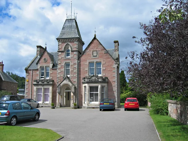
Guest house
Charity shops
Bus stops
Roads nearby
Maxwell Drive100 m
Ballifeary Lane150 m
Bruce AvenueBalifearry Lane, Laidlaw's
150 m
Smith Avenue300 m
Ballifeary RoadBallifeary, Struy Guest House
300 m
Bruce Park300 m
Dalneigh Crescent300 m
Dochfour DriveSmith Avenue, Dochfour Drive
350 m
Laurel AvenueLaurel Avenue, Laurel Avenue Community Shop, Dalneigh Pharmacy, L.A. Foodstore
350 m
Park Road350 m
Springfield Court350 m
Dalneigh RoadDalneigh Stores
400 m
Laurel Place400 m
Dunachton Road400 m
Wellingtonia Court400 m
Springfield Gardens450 m
Bishops Park450 m
Royal Ness Court450 m
Ness Walk450 m
St Fergus Drive500 m
Bruce GardensBruce Gardens
500 m
St Valery Avenue550 m
St Margaret's Road550 m
Columba Road600 m
St Andrew Drive600 m
St Mungo Road600 m
St. Mary's AvenueDalneigh
650 m
Glenurquhart RoadBallifeary Lane, Cemetery Gates, Balifearry Lane, Glenurquhart Road, Council Buildings, Scotmid, 1st Pizza Direct, Blue Ocean Takeaway, Bosta B&B, Heathcote B&B
650 m
St John's AvenueSt Johns Avenue
650 m
Rowan RoadRowan Road
700 m
Buildings nearby
Inverness Bowling Club500 m
Inverness Tennis and Squash Club550 m
Cemeteries nearby
Tomnahurich Cemetery150 m
Chalet nearby
Ladies Lodge350 m
Lairds Lodge350 m
Churches nearby
Dalneigh Church700 m
Guest house nearby
Ballifeary Guest House300 m
Eastdene350 m
Kinnoch Lodge350 m
The Elms400 m
Aye Stay400 m
Corunna Guest House and Garden Cottage450 m
Moyness House550 m
Acorn House600 m
Hospital nearby
Royal Northern Infirmary450 m
Parks nearby
Bught Park400 m
Public buildings nearby
Highland Council Headquarters600 m
Residential buildings nearby
Elmbank Residential Home400 m
Other nearby
R.N.I. S/S400 m
Public transport map Dalneigh and Columba Legend
| Railway | |
| Bus | |
| Tram |
Cycling map Dalneigh and Columba Legend
| Cycle path | |
| Cycle lane on road | |
| Cycling on bus lane | |
| Bicycle street | |
| Cyclists allowed | |
| Cyclists allowed, good surface | |
| No cycling | |
| Cobblestones |
| Long-distance cycle route | (depending on scale) | |
| Long-distance cycle route |
Walking map Dalneigh and Columba Legend
| Path |
| Long-distance hiking trail | (depending on scale) | |
| Long-distance hiking trail | ||
| No pedestrians |