
Castle Hill in Carmarthen
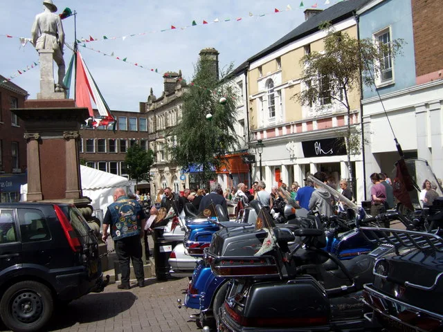
Castle Hill in Sir Gaerfyrddin / Carmarthenshire, Carmarthen is a two-lane, asphalted main road (road number A484). It runs in a north-south direction starting from Spilman Street and crosses Queen Street, The Mount, Coracle Way and Old Station Road and ends at Carmarthen Bridge. This road is part of the bicycle route "National Cycle Network Route 47". Castle Hill also exists in Pembrokeshire, Vale of Glamorgan, Denbighshire, Monmouthshire and Cardiff.
- Road Type
- main road
- Lanes
- 3
- Speed Limit
- 20 mph
- Route
- north-south
Image
Bar
Pubs
Craft shops
Tobacconist's
Charity shops
Cafés
Bookshops
Herbalists
Community centre
Hotels
Restaurants
Clothing shops
Bank
Hairdressers
Supermarkets
Roads nearby
Towy Side50 m
Carmarthen Bridge100 m
The Mount100 m
Bank Lane150 m
Dan-y-Banc150 m
Bridge StreetY Barbican, OreKnot Creative Hub, The Vaults
150 m
Nott SquareNomads, Club XO, Taylors, Morgan Le Fay, Plantasmagorica
150 m
Queen Street150 m
King StreetYr Hen Dderwen, Lloyds Bank, Oriel King Street Gallery, Donuts & Dragons, Co-op Food
200 m
Spilman StreetIvy Bush Royal Hotel
200 m
Parade Road250 m
Conduit Lane250 m
Old Station Road250 m
St. Peter's Court250 m
Station ApproachCarmarthen, A Dean Carpets, Carmarthen Rail Station
250 m
Wood's Row300 m
Church Lane300 m
Heol LlangynnwrThe Range, Heol Llangynnwr, Oak Leaves, Nantycaws
350 m
Heol Dŵr FachCwrw
350 m
The Parade350 m
Church Street350 m
Stickle Footpath350 m
Heol San Pedr350 m
Ger y Llan350 m
Southern Terrace350 m
Shops nearby
Powerpools350 m
Abandoned railways nearby
Carmarthen to Aberystwyth Line200 m
Buildings nearby
Towyside100 m
Clee Tompkinson Francis100 m
John Farr-Davies & Co. Solicitors150 m
Carmarthen Castle150 m
Ty Myrddin200 m
University of Wales - yr atom200 m
Cafés nearby
Time Coffee Bar150 m
Car repair shops nearby
Danny Jones350 m
ATS Euromaster400 m
Charity shops nearby
British Red Cross200 m
Community centres nearby
Saint Peter's Civic Hall200 m
Fast food restaurants nearby
The Spread Eagle150 m
Hotels nearby
Hotel Spilman200 m
Libraries nearby
Carmarthen Library350 m
Places of worship nearby
Carmarthen Evangelical Church350 m
St. Peter's350 m
Pubs nearby
Stag and Pheasant200 m
Railway lines nearby
South Wales Railway - Carmarthen Branch200 m
Retail areas nearby
Towy Ford Retail Park300 m
Specialist shops nearby
Towy Works Builders Merchant100 m
Theatres nearby
Lyric Theatre150 m
Town halls nearby
County Hall50 m
Public transport map Carmarthen Legend
| Railway | |
| Bus | |
| Tram |
Cycling map Carmarthen Legend
| Cycle path | |
| Cycle lane on road | |
| Cycling on bus lane | |
| Bicycle street | |
| Cyclists allowed | |
| Cyclists allowed, good surface | |
| No cycling | |
| Cobblestones |
| Long-distance cycle route | (depending on scale) | |
| Long-distance cycle route |
Walking map Carmarthen Legend
| Path |
| Long-distance hiking trail | (depending on scale) | |
| Long-distance hiking trail | ||
| No pedestrians |