
Turnpike Road in Croesyceiliog
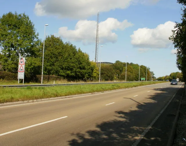
Turnpike Road in Torfaen, Croesyceiliog is a minor road. It runs in a north-south direction and crosses Plantation Drive, The Highway, Woodland Road and Llan-Yr-Avon Way. It ends in a cul-de-sac and connects Llanyrafon and Croesyceiliog.
- Road Type
- minor road
- Route
- north-south
Image
Doctor's office
Pubs
Kindergarten
Bus stops
Post offices
Convenience stores
Hairdressers
Dentist
Places of worship
Roads nearby
Llwyn Onn250 m
The Pastures250 m
Gloucester Close250 m
Plas Derwen400 m
Dynevor Close400 m
Worcester Path450 m
Tenby Close450 m
Blue Court450 m
Turnpike RoadLlanyravon Way, Discount Pram Centre
450 m
Woodland RoadCroesyceiliog School, Evans Yard, Woodland View
450 m
Worcester Close450 m
Pembroke Place500 m
Narberth Crescent500 m
Hanfield Park500 m
Dorstone Walk500 m
Roath Court500 m
Rumney Walk500 m
Fairoak Lane500 m
Tretower Court500 m
Poplar Road500 m
Llan-Yr-Avon WayLlanyravon Way, Kidwelly Road, Llanyrafon Methodist Church (o/s), Llanyrafon Methodist Church (after)
550 m
Dunraven Road550 m
Kenfig Place550 m
Miskin Green550 m
Manorbier Drive550 m
Hawarden Green600 m
Kidwelly Road600 m
Grey Waters600 m
Millers Ride600 m
Goodrich Court600 m
Caernarvon Crescent600 m
Hensol Close650 m
Liswerry Close650 m
Kidwelly Close650 m
Church CloseSt Mary's Church
650 m
Nevern Walk650 m
Bryn Garw650 m
Liswerry Drive700 m
Riversmead750 m
St. Brides Close800 m
Ceredig Court800 m
St Donats Place800 m
Ogmore Place850 m
Penrice Green850 m
Beaumaris DriveSalon Rene, Tino’s Barbers, Sara Lisa Beauty
900 m
Buildings nearby
Llanyrafon Community Centre950 m
Parks nearby
Northfields Park650 m
Places of worship nearby
Llanyrafon Methodist Church300 m
Shopping malls nearby
Llanyravon Shopping Centre900 m
Sports pitches nearby
The Welsh Padel Centre700 m
 Public transport map Croesyceiliog Legend
| Railway | |
| Bus | |
| Tram |
 Cycling map Croesyceiliog Legend
| Cycle path | |
| Cycle lane on road | |
| Cycling on bus lane | |
| Bicycle street | |
| Cyclists allowed | |
| Cyclists allowed, good surface | |
| No cycling | |
| Cobblestones |
| Long-distance cycle route | (depending on scale) | |
| Long-distance cycle route |
 Walking map Croesyceiliog Legend
| Path |
| Long-distance hiking trail | (depending on scale) | |
| Long-distance hiking trail | ||
| No pedestrians |