
Hanover Street in Brighton and Hove
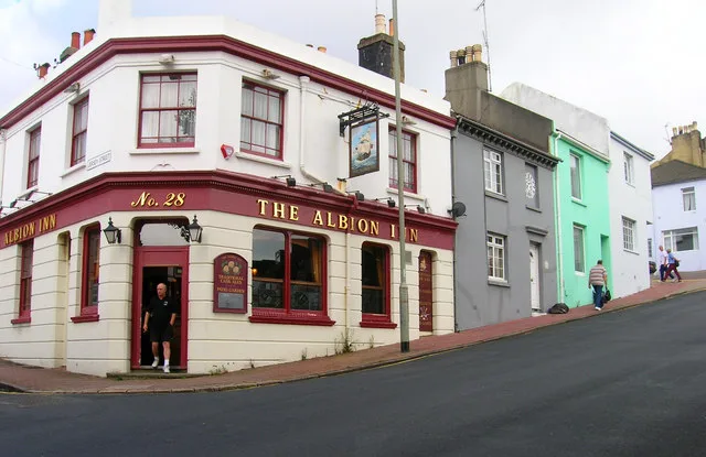
Hanover Street in Brighton and Hove is a residential street. It runs as a one-way street in a northeast-southwest direction starting from Islingword Road and ends at Southover Street. Hanover Street also exists in Portsmouth and Warrington.
- Road Type
- residential street
- Speed Limit
- 20 mph
- Route
- northeast-southwest
Image
Roads nearby
St James Passage50 m
Hanover MewsSantoro
100 m
Hanover Terrace150 m
Washington StreetSouthover Convenience Store
150 m
Coleman Street150 m
Jackson Street200 m
Lincoln StreetHanover, Sea Breeze
200 m
Islingword RoadArchers, Food & Wine Store, Yummie Pizza, Arka, Café des Couleurs, Pizza Me, Enterprise Car Club, Islingword Road Post Office, O'Flinn Pharmacy, Stanford Medical Centre
200 m
Milton Road200 m
Lincoln Cottages200 m
Howard RoadThe Howard
200 m
Wellington RoadMorley Lodge, Station Road, Church Road, Clarendon Place
250 m
Newark Place250 m
Ewart StreetThe Codfather, Ewart Street
250 m
Grant Street250 m
Hampden RoadHilly Laine
300 m
Southover StreetThe Geese, Sir Charles Napier, Dover Castle, China Star, Guyatri News
300 m
Islingword Street300 m
Grove Street300 m
Cobden RoadCobden Arms
350 m
Southampton StreetThe Constant Service
350 m
Beaufort Terrace350 m
Finsbury Road400 m
Montreal Road400 m
Quebec StreetHugh Barlow-Brown Guitars
450 m
Shops nearby
Q Estate Agent200 m
Apartment buildings nearby
Percy & Wagner Almshouses150 m
Milton Court200 m
Hanover Court300 m
Westmount400 m
Crown Hill400 m
Buildings nearby
Finsbury Lodge Flats 1-5350 m
Community centres nearby
Saint Joseph's Hall200 m
Hanover Community Centre250 m
Convenience stores nearby
Premier200 m
Gardens nearby
Hanover Community Centre Garden250 m
Houses nearby
Lion House200 m
Southover Wines350 m
Fixo400 m
Kindergartens nearby
The Nest Day Nursery350 m
Laundries nearby
Soapbox400 m
Office buildings nearby
Fox & Sons200 m
Places of worship nearby
Church of the Annunciation150 m
Saint Joseph's Church250 m
Pubs nearby
The Admiral150 m
Village200 m
The Greys Freehouse200 m
Residential areas nearby
Percy & Wagner Almshouses : BN2 9SW150 m
Terraced houses nearby
Hanover Garage200 m
 Public transport map Brighton and Hove Legend
| Railway | |
| Bus | |
| Tram |
 Cycling map Brighton and Hove Legend
| Cycle path | |
| Cycle lane on road | |
| Cycling on bus lane | |
| Bicycle street | |
| Cyclists allowed | |
| Cyclists allowed, good surface | |
| No cycling | |
| Cobblestones |
| Long-distance cycle route | (depending on scale) | |
| Long-distance cycle route |
 Walking map Brighton and Hove Legend
| Path |
| Long-distance hiking trail | (depending on scale) | |
| Long-distance hiking trail | ||
| No pedestrians |