
Southover Street in Brighton and Hove
Southover Street in Brighton and Hove is an asphalted, lit residential street. The road has sidewalks. It runs in a southeast-northwest direction starting from Richmond Terrace and crosses Southover Place, Hanover Street, Hanover Terrace, Newhaven Street, Coleman Street, Lewes Street, Belgrave Street, Washington Street, Newark Place, Lincoln Street and Jersey Street. In the vicinity, you can find 3 pubs, a fast food restaurant and a newsagent's.
- Road Type
- residential street
- Speed Limit
- 20 mph
- Route
- southeast-northwest
Image
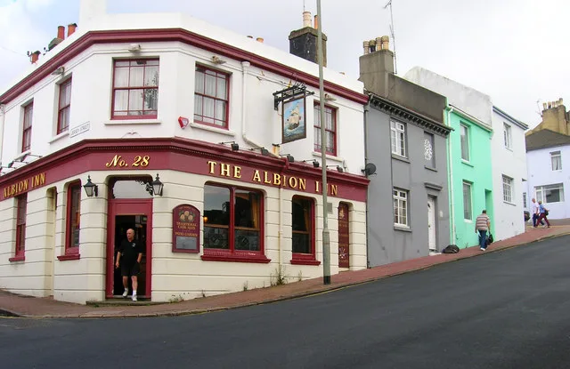
Pubs
Roads nearby
Grove Street100 m
Newark Place100 m
Southampton StreetThe Constant Service
100 m
Lincoln Cottages150 m
Ewart StreetThe Codfather, Ewart Street
150 m
Montreal Road150 m
Lincoln StreetHanover, Sea Breeze
150 m
Quebec StreetHugh Barlow-Brown Guitars
150 m
Finsbury Road150 m
Jackson Street200 m
Washington StreetSouthover Convenience Store
200 m
Beaufort Terrace250 m
Islingword Street250 m
St James Passage250 m
Hanover Street300 m
Grant Street300 m
Islingword RoadArchers, Food & Wine Store, Yummie Pizza, Arka, Café des Couleurs, Pizza Me, Enterprise Car Club, Islingword Road Post Office, O'Flinn Pharmacy, Stanford Medical Centre
300 m
Cobden RoadCobden Arms
300 m
Coleman Street350 m
Howard RoadThe Howard
350 m
Hanover Terrace350 m
Hampden RoadHilly Laine
350 m
Hanover MewsSantoro
350 m
Milton Road400 m
Wellington RoadMorley Lodge, Station Road, Church Road, Clarendon Place
450 m
Shops nearby
Q Estate Agent450 m
Apartment buildings nearby
Crown Hill200 m
Westmount200 m
Percy & Wagner Almshouses400 m
Milton Court400 m
Hanover Court500 m
Buildings nearby
Finsbury Lodge Flats 1-5200 m
Community centres nearby
Hanover Community Centre50 m
Saint Joseph's Hall400 m
Convenience stores nearby
Premier450 m
Gardens nearby
Hanover Community Centre Garden50 m
Houses nearby
Southover Wines100 m
Fixo150 m
Lion House350 m
Kindergartens nearby
The Nest Day Nursery200 m
Laundries nearby
Soapbox150 m
Office buildings nearby
Fox & Sons450 m
Places of worship nearby
Church of the Annunciation150 m
Saint Joseph's Church450 m
Pubs nearby
The Greys Freehouse200 m
Village300 m
The Admiral400 m
Residential areas nearby
Percy & Wagner Almshouses : BN2 9SW400 m
Terraced houses nearby
Hanover Garage150 m
 Public transport map Brighton and Hove Legend
| Railway | |
| Bus | |
| Tram |
 Cycling map Brighton and Hove Legend
| Cycle path | |
| Cycle lane on road | |
| Cycling on bus lane | |
| Bicycle street | |
| Cyclists allowed | |
| Cyclists allowed, good surface | |
| No cycling | |
| Cobblestones |
| Long-distance cycle route | (depending on scale) | |
| Long-distance cycle route |
 Walking map Brighton and Hove Legend
| Path |
| Long-distance hiking trail | (depending on scale) | |
| Long-distance hiking trail | ||
| No pedestrians |