
Wilton Crescent in Alderley Edge
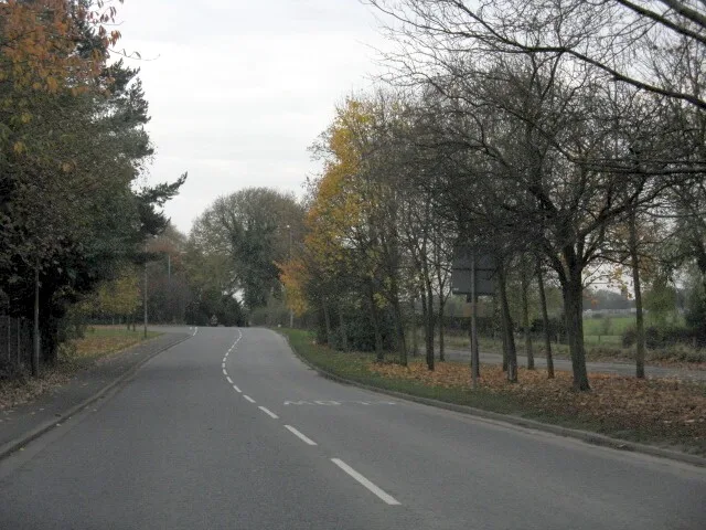
Wilton Crescent in Cheshire East, Alderley Edge is an asphalted, lit residential street. It runs in a north-south direction starting from Eaton Drive and crosses Aldford Place and ends at Eaton Drive.
- Road Type
- residential street
- Route
- north-south
Image
Dentist
Stations
Post offices
Fast food restaurants
Bus stops
Charity shops
Restaurants
Delicatessens
Car repair shops
Kitchen showrooms
Convenience stores
Bakeries
Roads nearby
Aldford Place100 m
Oakhurst Chase200 m
Brook LaneThe Oakwood, Alderley Edge, Brook Lane / Hole Farm
250 m
Fairfield Gardens300 m
Sutton Road300 m
Hurst Lea CourtAlderley Edge, Brook Lane / Woodleigh Court
300 m
Eaton Drive300 m
Woodleigh Court300 m
Meadow Brow300 m
Haddon Close350 m
Church LaneAlderley Edge, Church Lane / Alderley Edge Primary
350 m
Meadscroft Drive350 m
Kensington Gardens400 m
Davey LaneHighams, Yu, Aldeli
400 m
Lynton Lane400 m
Lynton Mews400 m
Horseshoe Lane450 m
Sunninghey Court450 m
Elkington Way500 m
Wilmslow RoadAlderley Edge, Piccolino, Medispa Cheshire, Alderley Edge, Wilmslow Road / Tower Garage, Harden Park, Wilmslow Road / Harden Park
500 m
Ryleys Lane550 m
Grasmere Road550 m
Thirlmere Close550 m
Windermere Drive600 m
Redesmere Drive600 m
Harden Park650 m
Melrose Way700 m
Whitehall Bridge Roundabout850 m
Welton Close850 m
Apartment buildings nearby
1-12 Lynton Court450 m
13-18 Lynton Court450 m
19-24 Lynton Court450 m
Buildings nearby
Tower Garage400 m
Bridgefords600 m
Golf courses nearby
Alderley Edge Golf Club600 m
Hairdresser's nearby
Pascha600 m
Office buildings nearby
Bridgford House550 m
Parks nearby
Alderley Edge Park550 m
Places of worship nearby
St. Philip's Church350 m
Pubs nearby
The Oakwood600 m
The Merlin750 m
Railway stations nearby
Alderley Edge500 m
Recreation grounds nearby
Alderley Edge School for Girls Netball and Tennis Courts500 m
The Ryleys Games Field500 m
Residential buildings nearby
Oak Bank300 m
Restaurants nearby
Peppery ROSE600 m
Sports shops nearby
Running Bear600 m
Streams nearby
Whitehall Brook600 m
Supermarkets nearby
Waitrose550 m
 Public transport map Alderley Edge Legend
| Railway | |
| Bus | |
| Tram |
 Cycling map Alderley Edge Legend
| Cycle path | |
| Cycle lane on road | |
| Cycling on bus lane | |
| Bicycle street | |
| Cyclists allowed | |
| Cyclists allowed, good surface | |
| No cycling | |
| Cobblestones |
| Long-distance cycle route | (depending on scale) | |
| Long-distance cycle route |
 Walking map Alderley Edge Legend
| Path |
| Long-distance hiking trail | (depending on scale) | |
| Long-distance hiking trail | ||
| No pedestrians |