
Progress Way in Grantham
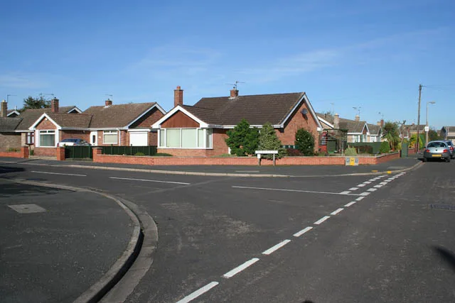
Progress Way in Grantham in South Kesteven is a service road and runs in an east-west direction and ends at Manthorpe Road, while the other end is a cul-de-sac.
- Road Type
- service road
- Route
- east-west
Image
Hotels
Bus stops
Tourist information offices
Social facility
Artwork
Cafés
Roads nearby
Rushcliffe RoadThe Priory Ruskin Academy
100 m
Manthorpe RoadHospital, Slate Mill Place
150 m
Langford Gardens150 m
Hawksdale Close250 m
Westerdale Road300 m
Sandcliffe RoadRushcliffe Road, Darley Dale Crescent
350 m
Redcliffe Road350 m
Highcliffe Road400 m
Darley Dale Crescent400 m
Cottesmore Close400 m
Belton LaneIsaacs Apple, Hill Avenue, Harrowby Lane, The Royal Queen PH, Tyson Close, Royal Queen
450 m
Lodge Way500 m
Harrowby LaneMethodist Church, Byron Avenue, Tennyson Avenue, New Beacon Road, Beacon Fish Bar
500 m
Welby GardensGregory House
550 m
Sidney Street550 m
Manners StreetEden House Hotel
600 m
Belton Gardens600 m
Slate Mill Place600 m
Alford Street600 m
Gonerby RoadOrchard Close, Cliffe Avenue, Playing Fields, Moy Park
600 m
Park Road650 m
North ParadeSerendipitys Day Nursery, Grantham North Junction, Tennis Courts, New Street, Red House Guest House
650 m
Prospect Place650 m
Chambers Street700 m
Gladstone Terrace700 m
Red Cross StreetQuick Bite
700 m
Albion Road700 m
New Street750 m
Albion StreetAlbion House Day Nursery, Belvoir House Care Home
750 m
Brook StreetThe King's School, Five Bells, Gerard Hairdressing
750 m
Albion Place750 m
Brownlow Street800 m
Broad StreetPremier Court
800 m
Bicycle hires nearby
Cliff Edge Cycle Hire650 m
Buildings nearby
Hill Avenue, Grantham600 m
Newton Block800 m
Convenience stores nearby
Manthorpe Convenience Store250 m
Spar700 m
Parks nearby
Wyndham Park600 m
Petrol stations nearby
Grantham Service Station700 m
Railway lines nearby
East Coast Main Line600 m
Rivers nearby
River Witham300 m
School buildings nearby
Brook Street and Castlegate Block750 m
Tower Block800 m
Sixth Form Centre800 m
Old School800 m
Social facilities nearby
Spire View750 m
Sports centres nearby
Grantham Tennis Club550 m
Tourist information offices nearby
Wyndham Park Visitor Centre650 m
Public transport map Grantham Legend
| Railway | |
| Bus | |
| Tram |
Cycling map Grantham Legend
| Cycle path | |
| Cycle lane on road | |
| Cycling on bus lane | |
| Bicycle street | |
| Cyclists allowed | |
| Cyclists allowed, good surface | |
| No cycling | |
| Cobblestones |
| Long-distance cycle route | (depending on scale) | |
| Long-distance cycle route |
Walking map Grantham Legend
| Path |
| Long-distance hiking trail | (depending on scale) | |
| Long-distance hiking trail | ||
| No pedestrians |