
Elizabeth Line in London Borough of Camden
Elizabeth Line in London Borough of Camden is a railway line (Transport for London, line number XRC, 1435 mm, overhead line, main line). The train route Elizabeth runs along this road. It passes through a tunnel. Elizabeth Line is also known as Crossrail. Elizabeth Line also exists in City of Westminster, Royal Borough of Kensington and Chelsea, City of London, London Borough of Tower Hamlets and London Borough of Islington. Ⓦ.
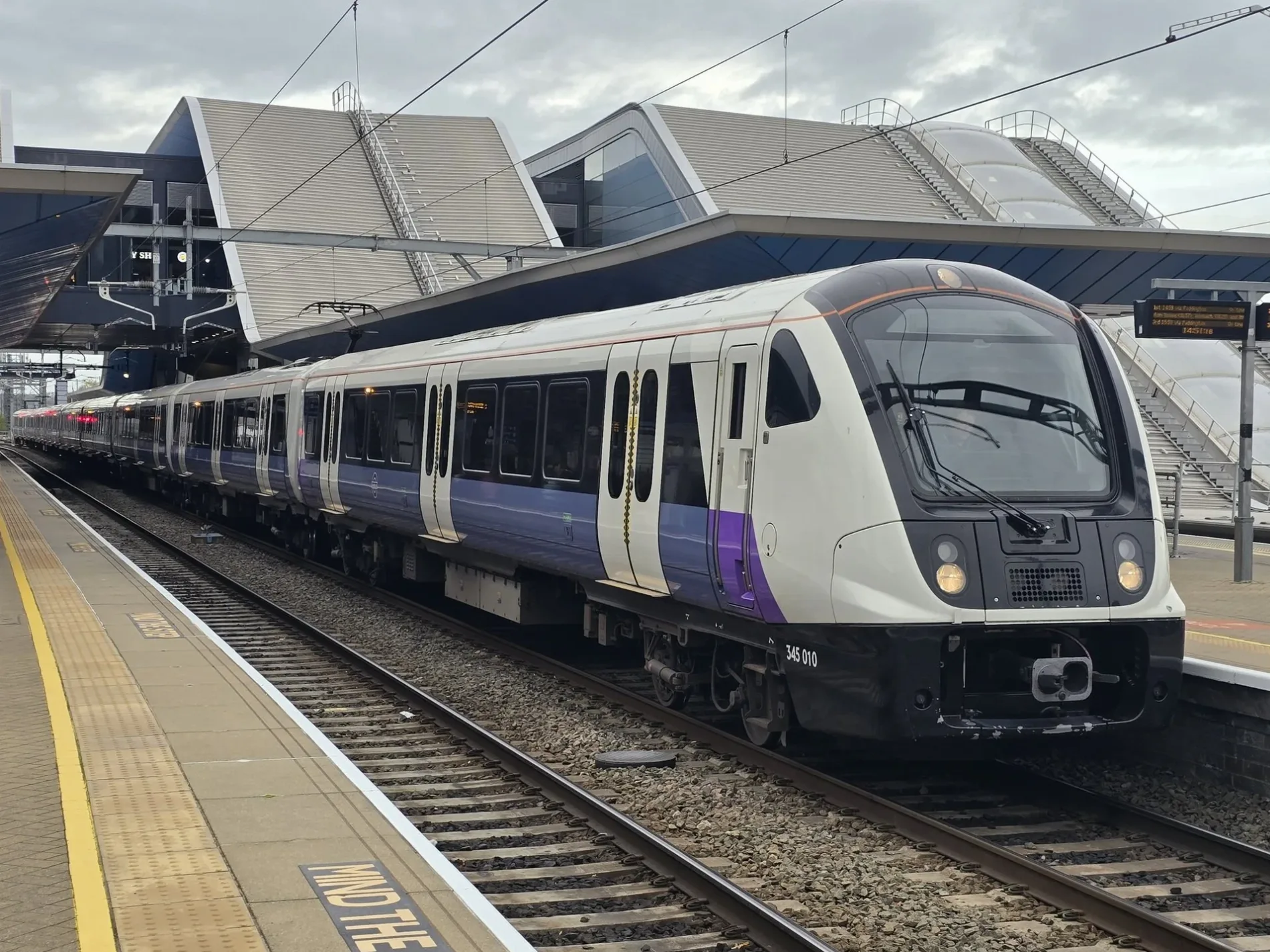
- Alternative Name
- Crossrail
- Speed Limit
- 50 mph
- Operator
- Transport for London
Jewellers
Cafés
Dentist
Clothing shops
Bank
Watch shops
Convenience stores
Doctor's office
Bicycle hires
Bus stops
Roads nearby
Ely Court150 m
Ely Place150 m
Greville StreetSolitaire Jewellery, J&A, Jules Diamonds, The Argyle, Elite Jewellery, SB Jewellery, La Forchetta, A.R. Ullman, Numan
150 m
Charterhouse StreetClub Reina, Charterhouse Street, Holborn Circus
200 m
Hatton GardenManyhill Ltd, Tobi Gem Setting, WW Gallery, The Heart of Hatton Garden, Krystle, Classic Jewellery, Bernstones, Gems, Fine Jewels, E Katz & Co. Ltd, John Lawrence, Hatton Garden Pawnbrokers, The Garden Workshop, Jay's Jewellers & Diamond Merchants, Boutique 36, Cafe Mano, Tuffo's Place, 54 hatton garden, ivan dvorak, R&R Wholesale Jewellers, Hatton Wall, Hatton Garden Car Park, Hatton Garden, VoyaHire LTD, Barclays, Abrahams, Diamonds, Hamiltons, Justine, Alexander Craig, Rennie & Co, Eternity, Dynasty, Beverley Hills London, holts, The Wedding Ring Shop, Channings, John m reynolds, Pronuptia, Jewellry & Watch Exchange, Hatton Garden Dental Practice
200 m
Holborn Circus200 m
HolbornBoots, Holborn Circus, Bounce Farringdon, Sainsbury's Local, Holborn Circus / Fetter Lane, JAAQ Coffee
200 m
St Andrew StreetLloyds Bank, Cortina Sandwich Bar, St Andrew Street
250 m
Waterhouse Square250 m
Thavies InnPizzaExpress, Nosh Cafe
300 m
Dyer's Buildings300 m
Bartlett's Passage350 m
Robin Hood CourtCaffè Nero
350 m
New Fetter LaneGuido's, Hotori, Honi Poke, New Fetter Lane
350 m
Fetter LaneBrewDog, Fetter Barbers, Clifford's, Cliffords Inn Residential Flats, John Wilkes
350 m
Bartlett Court350 m
Plough PlaceNusa Kitchen
350 m
Great New StreetBirley Sandwiches, Old Spike, Garbanzos, WHSmith, Positive Eating, Townhouse
350 m
Norwich Street350 m
Apartment buildings nearby
Vesage Court150 m
Banks nearby
Lloyds Bank250 m
Buildings nearby
St Andrew's Vicarage250 m
Buchanan House250 m
St Andrew's Courthouse250 m
Barnards Inn Hall300 m
Fetter Yard350 m
Edenica400 m
Cafés nearby
Du:kan150 m
WatchHouse350 m
Commercial buildings nearby
Sainsbury's Head Office250 m
Sterling House300 m
Bird & Bird350 m
Jeweller's nearby
A&S Jewellers100 m
Val D'or & Imperial Pearl Co.100 m
Madison100 m
Carlo Jewellers100 m
Hatton Diamonds100 m
The Luxury Hut Pawnbrokers London150 m
Arlington & Co150 m
Bassange150 m
Davril150 m
Bellore Rashbel150 m
Premier Jewellers150 m
Parks nearby
Gray's Inn Gardens250 m
Places of worship nearby
St Etheldreda's100 m
Saint Andrew250 m
Pubs nearby
Ye Olde Mitre150 m
Residential buildings nearby
Pink Mews350 m
Service buildings nearby
Kingsway Telephone Exchange350 m
Subway lines nearby
Central Line - Eastbound300 m
| Named after | Elizabeth II |
|---|---|
| Opening | 2022 |
| Country | United Kingdom |
| Transport network | Elizabeth line network |
| Website | https://tfl.gov.uk/modes/elizabeth-line/ |
| Significant event | Crossrail |
| Has part | Elizabeth line: Reading - Abbey Wood, Elizabeth line: Maidenhead - Abbey Wood, Elizabeth line: Heathrow Airport - Abbey Wood, Elizabeth line: Heathrow Airport - Shenfield, Elizabeth line: Paddington - Shenfield |
| Part of | TfL |
Public transport map London Borough of Camden Legend
| Railway | |
| Bus | |
| Tram |
Cycling map London Borough of Camden Legend
| Cycle path | |
| Cycle lane on road | |
| Cycling on bus lane | |
| Bicycle street | |
| Cyclists allowed | |
| Cyclists allowed, good surface | |
| No cycling | |
| Cobblestones |
| Long-distance cycle route | (depending on scale) | |
| Long-distance cycle route |
Walking map London Borough of Camden Legend
| Path |
| Long-distance hiking trail | (depending on scale) | |
| Long-distance hiking trail | ||
| No pedestrians |