
Elizabeth Line in London Borough of Islington
Elizabeth Line in London Borough of Islington is a railway line (Transport for London, line number XRC, 1435 mm, overhead line, main line). The train route Elizabeth runs along this road. It passes through a tunnel. Elizabeth Line is also known as Crossrail. Elizabeth Line also exists in City of Westminster, Royal Borough of Kensington and Chelsea, City of London, London Borough of Tower Hamlets and Royal Borough of Greenwich. Ⓦ.
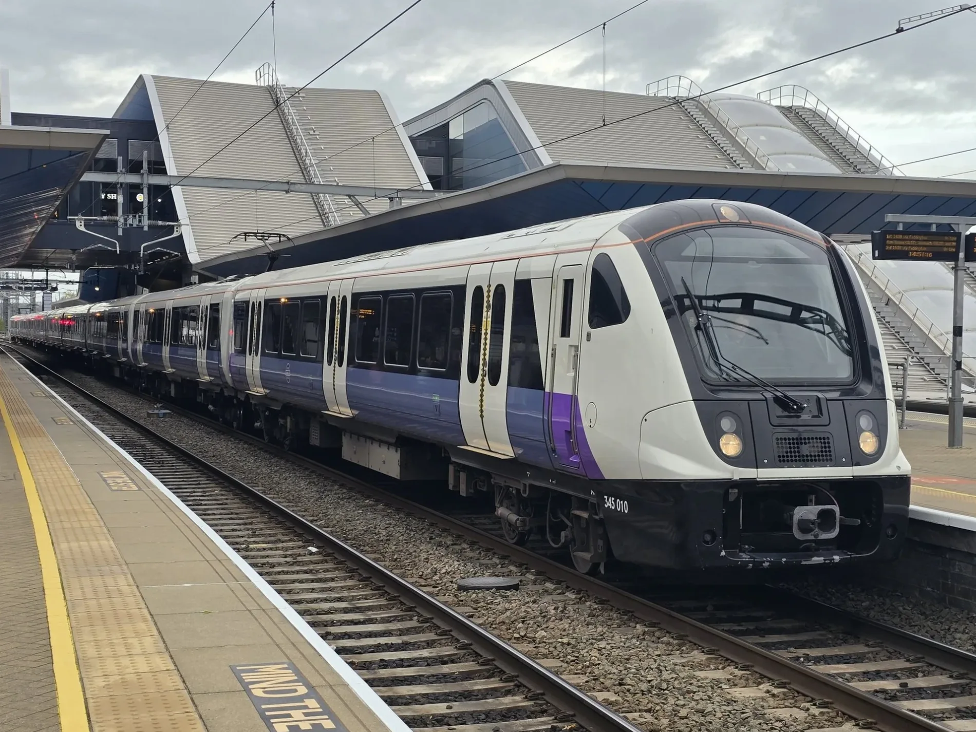
- Alternative Name
- Crossrail
- Speed Limit
- 44 mph
- Operator
- Transport for London
Cafés
Bar
Platforms
- train routes Elizabeth
Public bookcases
Research institutes
Watch shops
Restaurants
Pubs
Clinic
Post offices
Convenience stores
Tea shops
Museum
Fast food restaurants
Nightclubs
Hairdressers
Stations
- train routes Elizabeth
Roads nearby
St. John Streetcafe La Forchetta, Tinseltown, Friend Street / Sadler's Wells Theatre, Rosebery Avenue / Sadler's Wells Theatre, St. John Street, St John Street / Goswell Road, The Hummingbird Bakery, Bibigo, Pret A Manger, The Shoap, Spencer Street / City University, Islington Museum, Aylesbury Street, St John Street / Clerkenwell Road, Percival Street, Franco & Co, Summer Dumpling, Vinoteca Farringdon
200 m
Passing Alley250 m
Hat and Mitre Court250 m
Clerkenwell RoadTimTim Takeaway, J. Adams & Co, Pret A Manger, Farringdon Road, M. le Duck, Clerkenwell Green, Roni's Cafe, Knockbox Coffee, Clerkenwell Road / St John Street, La Vietnamese Kitchen, Antique Watch Co. Ltd., Berry Street, The Barts Cancer Institute, Newby, Kebabs Made Good, EC1 Coffee House, St John Street, Kings Of Clerkenwell, BrewDog, St Bartholomew's and the Royal London School of Medicine and Dentistry, Goswell Road, The Arts Catalyst, Medivet, The Zetter, Dominic, ØRN Furniture
300 m
Leo YardSonder St. John's Garden
300 m
Sutton Lane350 m
Great Sutton StreetMetro Imaging, City of London Car Service, Breese Little, Flokk, Conran and Partners, Shaw Contract
350 m
Shops nearby
Currell Residential350 m
50-54 Clerkenwell Road350 m
Gleave & Co350 m
Havwoods350 m
Boen350 m
Art galleries nearby
Stuart R Stevenson300 m
Bars nearby
The 1920 Bar350 m
Bathroom furnishing shops nearby
west one bathrooms300 m
Buildings nearby
The Marketing Agency150 m
NASUWT150 m
Staverton200 m
Forbo200 m
Beavis Morgan and BM2020250 m
St John Ambulance250 m
KEO Films250 m
N. Sethia House300 m
Moreton Smith300 m
UNICEF350 m
Yewdale350 m
Ryno350 m
H.F.& G.W.Smith350 m
Domus350 m
The Gallery350 m
Kinleigh Folkard & Hayward350 m
Metro Imaging400 m
Cafés nearby
Workshop Coffee Co.250 m
Clothing shops nearby
Sublime350 m
Commercial buildings nearby
Blake Lapthorn150 m
Furniture shops nearby
Tarkett150 m
Elite250 m
ferm300 m
Kohler350 m
Modus350 m
Duravit350 m
Hairdresser's nearby
Hair Salon Brazilian Hairstylist200 m
Interior decorators nearby
Panaz300 m
Pubs nearby
The Slaughtered Lamb350 m
Restaurants nearby
Make Friends With Food200 m
Pho250 m
Luca250 m
The Rasoi350 m
Katsuma350 m
Stationery shops nearby
Wyvern Bindery350 m
| Named after | Elizabeth II |
|---|---|
| Opening | 2022 |
| Country | United Kingdom |
| Transport network | Elizabeth line network |
| Website | https://tfl.gov.uk/modes/elizabeth-line/ |
| Significant event | Crossrail |
| Has part | Elizabeth line: Reading - Abbey Wood, Elizabeth line: Maidenhead - Abbey Wood, Elizabeth line: Heathrow Airport - Abbey Wood, Elizabeth line: Heathrow Airport - Shenfield, Elizabeth line: Paddington - Shenfield |
| Part of | TfL |
Public transport map London Borough of Islington Legend
| Railway | |
| Bus | |
| Tram |
Cycling map London Borough of Islington Legend
| Cycle path | |
| Cycle lane on road | |
| Cycling on bus lane | |
| Bicycle street | |
| Cyclists allowed | |
| Cyclists allowed, good surface | |
| No cycling | |
| Cobblestones |
| Long-distance cycle route | (depending on scale) | |
| Long-distance cycle route |
Walking map London Borough of Islington Legend
| Path |
| Long-distance hiking trail | (depending on scale) | |
| Long-distance hiking trail | ||
| No pedestrians |