
Elizabeth Line in Royal Borough of Greenwich
Elizabeth Line in Royal Borough of Greenwich is a railway line (Transport for London, line number XRS, 1435 mm, overhead line, main line). The train route Elizabeth runs along this road. It passes through a tunnel. Elizabeth Line is also known as Crossrail. Elizabeth Line also exists in City of Westminster, Royal Borough of Kensington and Chelsea, City of London, London Borough of Tower Hamlets and London Borough of Islington. Ⓦ.
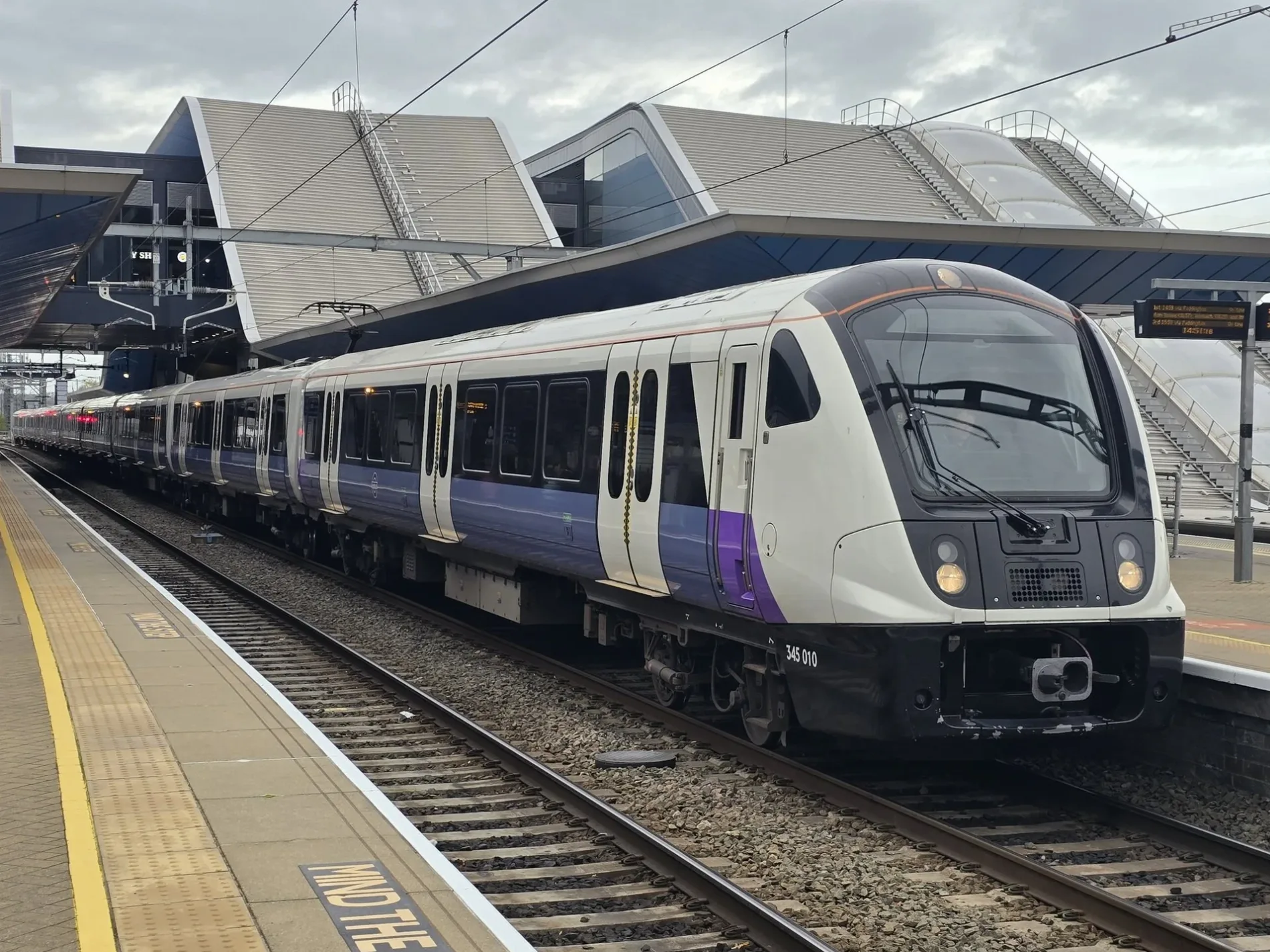
- Alternative Name
- Crossrail
- Speed Limit
- 62 mph
- Operator
- Transport for London
Bus stops
Restaurants
Beauty salons
Convenience stores
Hairdressers
Pubs
Tattoo studios
Car washes
Fast food restaurants
Stations
- train routes Elizabeth
Tourist information offices
Jewellers
Artwork
Roads nearby
Swingbridge Close300 m
Woolwich Foot Tunnel350 m
Bell Water GateEngland Coast Path — Thames Path
350 m
Pier RoadNurtureVille Nursery, North Woolwich Ferry, Woolwich Ferry North Pier, Pier Masala, Taz Hair & Beauty, Pier Parade Post Office, Up 1 News, Kings
350 m
Ferry PlaceKlipaz LK Ldn, Tonia Hair, Pinkey's Crown Jewel, Destiny Cut
350 m
Warren Lane350 m
Glass Yard400 m
Beresford StreetBeresford Street, Beresford Square / Woolwich Arsenal Station, Rime Tuition, The Guard House, Beresford Street / Macbean Street
400 m
Woolwich High StreetWoolwich High Street, Osiris Lounge, Woolwich Ferry, Coopers Arms, Papa John's, Furlongs, First Choice Cafe, Bagel Boss
400 m
Ferry ApproachWoolwich Ferry South Pier
450 m
Bunton Street450 m
Myrtle AlleyCallis Yard, Sports Direct, Boots, Hare Street
450 m
Duke of Wellington AvenueRoyal Arsenal Dentists
500 m
Woolwich Church StreetKingsman Street, Warspite Road, Prospect Vale, Woolwich Ferry, Frances Street, McDonald's, Mimi's Lounge & Bar, Rosario Munch, Mimi's Kitchen, TJ's, Le Wouri
500 m
New Warren LaneBeefeater
500 m
Creton Street500 m
Hare StreetHare Street, The Better Beds Store, Primark, Noir Menswear, Salah Superstore, Cezar's Best Romnian Shop, Scope, Cash Converters, British Heart Foundation, @VR, Vida & Sons Shop, Star Banqueting, Charles Dance Jewellers and Pawnbrokers, Seventh Sun, Pizza Chicken Hot 4 You
500 m
Mortgramit SquarePrince Albert Rose's
500 m
Parsons Hill500 m
Macbean StreetO2
500 m
Powis StreetTravelodge London Woolwich, Creams, TK Maxx, TFC, Powis Street, The Castle Tavern, Soneva, Medivet, Ammas Fayre, Greggs, NatWest, Boots Opticians, JenningsBet, Admiral, British Heart Foundation, Halifax, Superdrug, Mimi, Lloyds Bank, Simons, Square Bubbles, Warren James, Vodafone, Silk City, EE, Aqua, EVA, Three., Shaba Hair & Cosmetics, Santander, DIVA, Specsavers, Popeyes, JD Sports, Nando's, St James Pharmacy, Virtue Specs, McDonald's, Taco Bell, Pyramid Pharmacy, Poundland, Savers, HomeSense, Deichmann, Woolwich Fish Market, Iceland, Herbal Inn, Holland & Barrett, AFS Halal Foods, Card Factory, The Works, CeX, Shoe Zone, MK Mix London, XPOSED, Luxor Home Furniture, Age UK, Subway
550 m
Barnard Close550 m
Thunderer WalkThalía, Minotaur house, Amphion
550 m
St Mary Street600 m
Clara PlaceArgos
600 m
Kingsman Street650 m
Calderwood StreetCalderwood Street, Sainsbury's Main Lifts, Kaabo Lounge
650 m
Monk StreetMonk Street / Calderwood Street, Monk Street / Clara Place
650 m
John Wilson StreetJohn Wilson Street / Powis Street
650 m
Apartment buildings nearby
Woolwich Reach300 m
Norton House300 m
Judde House350 m
Buildings nearby
North Woolwich Old Station Museum (Closed)300 m
SET Woolwich400 m
Concierge500 m
Macbean Centre650 m
Car dealerships nearby
Hyper Autos400 m
Clinics nearby
Ferryview Health Centre600 m
Grass nearby
Pavillion Square500 m
Hotels nearby
Premier Inn London Woolwich500 m
Railway lines nearby
North Kent Line - Woolwich Branch650 m
Residential buildings nearby
The Sidings300 m
Retail buildings nearby
Woolwich Supermarket450 m
Shoe shops nearby
Clarks600 m
Sports centres nearby
Waterfront Leisure Centre350 m
Supermarkets nearby
Lidl500 m
Transport buildings nearby
Southern Entrance to Woolwich Foot Tunnel350 m
Northern Entrance to Woolwich Foot Tunnel350 m
Other nearby
Woolwich Free Ferry100 m
| Named after | Elizabeth II |
|---|---|
| Opening | 2022 |
| Country | United Kingdom |
| Transport network | Elizabeth line network |
| Website | https://tfl.gov.uk/modes/elizabeth-line/ |
| Significant event | Crossrail |
| Has part | Elizabeth line: Reading - Abbey Wood, Elizabeth line: Maidenhead - Abbey Wood, Elizabeth line: Heathrow Airport - Abbey Wood, Elizabeth line: Heathrow Airport - Shenfield, Elizabeth line: Paddington - Shenfield |
| Part of | TfL |
Public transport map Royal Borough of Greenwich Legend
| Railway | |
| Bus | |
| Tram |
Cycling map Royal Borough of Greenwich Legend
| Cycle path | |
| Cycle lane on road | |
| Cycling on bus lane | |
| Bicycle street | |
| Cyclists allowed | |
| Cyclists allowed, good surface | |
| No cycling | |
| Cobblestones |
| Long-distance cycle route | (depending on scale) | |
| Long-distance cycle route |
Walking map Royal Borough of Greenwich Legend
| Path |
| Long-distance hiking trail | (depending on scale) | |
| Long-distance hiking trail | ||
| No pedestrians |